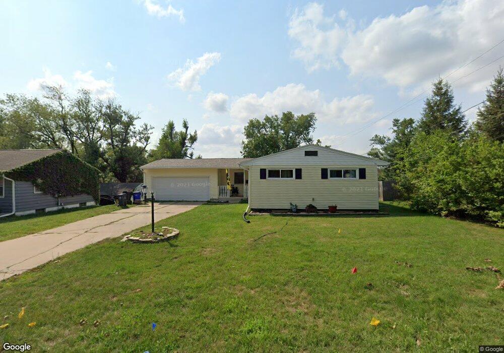
1215 30th St SE Cedar Rapids, IA 52403
Estimated Value: $186,829 - $227,000
3
Beds
2
Baths
1,740
Sq Ft
$115/Sq Ft
Est. Value
About This Home
This home is located at 1215 30th St SE, Cedar Rapids, IA 52403 and is currently estimated at $200,957, approximately $115 per square foot. 1215 30th St SE is a home located in Linn County with nearby schools including Grant Wood Elementary School, Summit Elementary School, and McKinley STEAM Academy.
Ownership History
Date
Name
Owned For
Owner Type
Purchase Details
Closed on
Feb 26, 2011
Sold by
Pieper Rhonda L and Pieper Jay
Bought by
Viggers Kenneth N and The Kenneth N Viggers Revocable Trust
Current Estimated Value
Home Financials for this Owner
Home Financials are based on the most recent Mortgage that was taken out on this home.
Original Mortgage
$82,000
Outstanding Balance
$45,974
Interest Rate
4.78%
Mortgage Type
Future Advance Clause Open End Mortgage
Estimated Equity
$154,983
Purchase Details
Closed on
Jun 20, 2002
Sold by
Beckman Kimberly J and Beckman David L
Bought by
Knaack Rhonda L
Home Financials for this Owner
Home Financials are based on the most recent Mortgage that was taken out on this home.
Original Mortgage
$100,700
Interest Rate
6.93%
Create a Home Valuation Report for This Property
The Home Valuation Report is an in-depth analysis detailing your home's value as well as a comparison with similar homes in the area
Home Values in the Area
Average Home Value in this Area
Purchase History
| Date | Buyer | Sale Price | Title Company |
|---|---|---|---|
| Viggers Kenneth N | $116,500 | None Available | |
| Knaack Rhonda L | $105,500 | -- |
Source: Public Records
Mortgage History
| Date | Status | Borrower | Loan Amount |
|---|---|---|---|
| Open | Viggers Kenneth N | $82,000 | |
| Previous Owner | Knaack Rhonda L | $100,700 |
Source: Public Records
Tax History Compared to Growth
Tax History
| Year | Tax Paid | Tax Assessment Tax Assessment Total Assessment is a certain percentage of the fair market value that is determined by local assessors to be the total taxable value of land and additions on the property. | Land | Improvement |
|---|---|---|---|---|
| 2025 | $2,888 | $180,100 | $35,100 | $145,000 |
| 2024 | $3,094 | $176,700 | $35,100 | $141,600 |
| 2023 | $3,094 | $163,200 | $31,900 | $131,300 |
| 2022 | $2,914 | $146,700 | $28,700 | $118,000 |
| 2021 | $2,916 | $140,700 | $28,700 | $112,000 |
| 2020 | $2,916 | $132,200 | $22,300 | $109,900 |
| 2019 | $2,728 | $126,600 | $22,300 | $104,300 |
| 2018 | $2,534 | $126,600 | $22,300 | $104,300 |
| 2017 | $2,506 | $115,100 | $22,300 | $92,800 |
| 2016 | $2,404 | $113,100 | $22,300 | $90,800 |
| 2015 | $2,502 | $117,586 | $22,315 | $95,271 |
| 2014 | $2,502 | $117,586 | $22,315 | $95,271 |
| 2013 | $2,448 | $117,586 | $22,315 | $95,271 |
Source: Public Records
Map
Nearby Homes
- 1135 Crestview Dr SE
- 1158 28th St SE
- 1117 Crestview Dr SE
- 2861 Seely Ave SE
- 2700 Mount Vernon Rd SE
- 1521 Oak Ridge Ln SE Unit 3
- 1331 34th St SE
- 1013 36th St SE
- 700 Memorial Dr SE
- 639 32nd St SE
- 3223 Mound Ave SE
- 3200 Mound Ave SE
- 651 34th St SE
- 2600 Mount Vernon Rd SE
- 3510 Pioneer Ave SE
- 705 Grant Wood Dr SE
- 1401 Harold Dr SE
- 914 25th St SE
- 654 34th St SE
- 3600 Bel Air Dr SE
- 1221 30th St SE
- 1203 30th St SE
- 2860 13th Ave SE
- 1100 Crestview Dr SE
- 2854 13th Ave SE
- 3001 12th Ave SE
- 1102 Crestview Dr SE
- 1235 30th St SE
- 1216 30th St SE
- 2846 13th Ave SE
- 3011 12th Ave SE
- 1224 30th St SE
- 2863 13th Ave SE
- 1123 30th St SE
- 1104 Crestview Dr SE
- 2857 13th Ave SE
- 1241 30th St SE
- 1232 30th St SE
- 110 Crestview Dr SE
- 3017 12th Ave SE