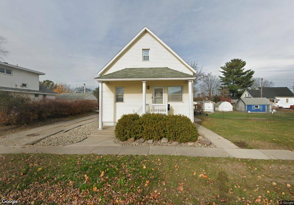
1215 Beard St Port Huron, MI 48060
Estimated Value: $130,245 - $156,000
3
Beds
1
Bath
1,279
Sq Ft
$114/Sq Ft
Est. Value
About This Home
This home is located at 1215 Beard St, Port Huron, MI 48060 and is currently estimated at $145,811, approximately $114 per square foot. 1215 Beard St is a home located in St. Clair County with nearby schools including Michigamme Elementary School, Central Middle School, and Port Huron High School.
Ownership History
Date
Name
Owned For
Owner Type
Purchase Details
Closed on
Feb 29, 2012
Sold by
Walton Thomas F and Davidson Richard R
Bought by
Ribble Trace and Duenaz Joy
Current Estimated Value
Home Financials for this Owner
Home Financials are based on the most recent Mortgage that was taken out on this home.
Original Mortgage
$29,239
Outstanding Balance
$3,829
Interest Rate
4.25%
Mortgage Type
FHA
Estimated Equity
$141,982
Create a Home Valuation Report for This Property
The Home Valuation Report is an in-depth analysis detailing your home's value as well as a comparison with similar homes in the area
Home Values in the Area
Average Home Value in this Area
Purchase History
| Date | Buyer | Sale Price | Title Company |
|---|---|---|---|
| Ribble Trace | $30,000 | Mortgage Center Title Llc |
Source: Public Records
Mortgage History
| Date | Status | Borrower | Loan Amount |
|---|---|---|---|
| Open | Ribble Trace | $29,239 |
Source: Public Records
Tax History Compared to Growth
Tax History
| Year | Tax Paid | Tax Assessment Tax Assessment Total Assessment is a certain percentage of the fair market value that is determined by local assessors to be the total taxable value of land and additions on the property. | Land | Improvement |
|---|---|---|---|---|
| 2025 | $1,320 | $55,100 | $0 | $0 |
| 2024 | $1,073 | $52,100 | $0 | $0 |
| 2023 | $1,013 | $46,600 | $0 | $0 |
| 2022 | $1,005 | $38,900 | $0 | $0 |
| 2021 | $954 | $33,400 | $0 | $0 |
| 2020 | $965 | $29,300 | $29,300 | $0 |
| 2019 | $948 | $20,800 | $0 | $0 |
| 2018 | $927 | $20,800 | $0 | $0 |
| 2017 | $829 | $19,500 | $0 | $0 |
| 2016 | $699 | $19,500 | $0 | $0 |
| 2015 | $731 | $19,500 | $19,500 | $0 |
| 2014 | $731 | $20,400 | $20,400 | $0 |
| 2013 | -- | $22,400 | $0 | $0 |
Source: Public Records
Map
Nearby Homes
- 1414 Beard St
- 2411 10th St
- 1403 Catherine McAuley Dr
- 2710 Electric Ave
- 2718 Electric Ave
- 823 Beard St
- 913 Tunnel St
- 1112 Minnie St
- 2704 Military St
- 2444 Military St
- 2430 Military St Unit 2434
- 1127 Minnie St
- 2724 Military St
- 1319 Minnie St
- 2815 Military St
- 730 Jenkinson St
- 1322 Division St
- 1309 Division St
- 831 Bancroft St
- 1325 Division St