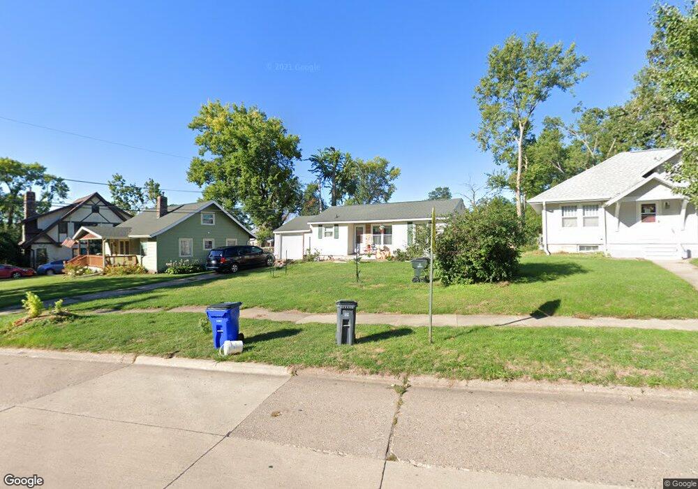
1215 Elmhurst Dr NE Cedar Rapids, IA 52402
Mound View NeighborhoodEstimated Value: $129,000 - $145,463
2
Beds
1
Bath
814
Sq Ft
$169/Sq Ft
Est. Value
About This Home
This home is located at 1215 Elmhurst Dr NE, Cedar Rapids, IA 52402 and is currently estimated at $137,616, approximately $169 per square foot. 1215 Elmhurst Dr NE is a home located in Linn County with nearby schools including Garfield Elementary School, Franklin Middle School, and George Washington High School.
Ownership History
Date
Name
Owned For
Owner Type
Purchase Details
Closed on
Sep 25, 2009
Sold by
Thurston Carol M
Bought by
Sobotka Christopher A and Sobotka Myndi J
Current Estimated Value
Home Financials for this Owner
Home Financials are based on the most recent Mortgage that was taken out on this home.
Original Mortgage
$75,270
Outstanding Balance
$49,425
Interest Rate
5.19%
Mortgage Type
FHA
Estimated Equity
$88,191
Purchase Details
Closed on
Mar 13, 2007
Sold by
Smith John and Smith Patricia S
Bought by
Thurston Carol M
Home Financials for this Owner
Home Financials are based on the most recent Mortgage that was taken out on this home.
Original Mortgage
$72,207
Interest Rate
6.31%
Mortgage Type
Purchase Money Mortgage
Create a Home Valuation Report for This Property
The Home Valuation Report is an in-depth analysis detailing your home's value as well as a comparison with similar homes in the area
Home Values in the Area
Average Home Value in this Area
Purchase History
| Date | Buyer | Sale Price | Title Company |
|---|---|---|---|
| Sobotka Christopher A | $77,500 | None Available | |
| Thurston Carol M | $75,500 | None Available | |
| Smith Patricia S | $69,500 | None Available |
Source: Public Records
Mortgage History
| Date | Status | Borrower | Loan Amount |
|---|---|---|---|
| Open | Sobotka Christopher A | $75,270 | |
| Previous Owner | Smith Patricia S | $72,207 |
Source: Public Records
Tax History Compared to Growth
Tax History
| Year | Tax Paid | Tax Assessment Tax Assessment Total Assessment is a certain percentage of the fair market value that is determined by local assessors to be the total taxable value of land and additions on the property. | Land | Improvement |
|---|---|---|---|---|
| 2025 | $2,162 | $152,400 | $38,800 | $113,600 |
| 2024 | $2,512 | $132,600 | $35,200 | $97,400 |
| 2023 | $2,512 | $132,600 | $35,200 | $97,400 |
| 2022 | $2,140 | $128,000 | $35,200 | $92,800 |
| 2021 | $2,014 | $112,300 | $35,200 | $77,100 |
| 2020 | $2,014 | $99,900 | $28,200 | $71,700 |
| 2019 | $1,970 | $99,900 | $28,200 | $71,700 |
| 2018 | $1,832 | $99,900 | $28,200 | $71,700 |
| 2017 | $1,832 | $94,800 | $28,200 | $66,600 |
| 2016 | $1,983 | $93,300 | $29,900 | $63,400 |
| 2015 | $2,005 | $94,202 | $35,227 | $58,975 |
| 2014 | $1,820 | $97,888 | $35,227 | $62,661 |
| 2013 | $1,852 | $97,888 | $35,227 | $62,661 |
Source: Public Records
Map
Nearby Homes
- 1204 Elmhurst Dr NE
- 1060 17th St NE
- 1839 K Ave NE
- 910 Maplewood Dr NE
- 1115 27th St NE
- 1815 E Ave NE
- 1857 E Ave NE
- 517 18th St NE
- 1047 27th St NE
- 1046 12th St NE
- 2019 G Ave NE
- 2906 Oakland Rd NE
- 2935 Wildwood Ct NE
- 832 Daniels St NE
- 1735 C Ave NE
- 420 16th St NE
- 1230 30th St NE
- 826 Daniels St NE
- 1746 B Ave NE
- 1551 C Ave NE
- 1225 Elmhurst Dr NE
- 1209 Elmhurst Dr NE
- 1614 K Ave NE
- 1231 Elmhurst Dr NE
- 1203 Elmhurst Dr NE
- 1612 K Ave NE
- 1235 Elmhurst Dr NE
- 1606 K Ave NE
- 1226 Elmhurst Dr NE
- 1243 Elmhurst Dr NE
- 1240 Elmhurst Dr NE
- 1516 K Ave NE
- 1245 Elmhurst Dr NE
- 1629 K Ave NE
- 1127 Elmhurst Dr NE
- 1220 Maplewood Dr NE
- 1212 Maplewood Dr NE
- 1619 K Ave NE
- 1246 Elmhurst Dr NE
- 1625 K Ave NE