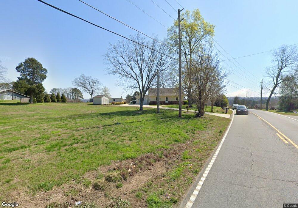
1215 Highway 95 Rock Spring, GA 30739
Rock Spring NeighborhoodEstimated Value: $178,528 - $277,000
--
Bed
1
Bath
1,504
Sq Ft
$157/Sq Ft
Est. Value
About This Home
This home is located at 1215 Highway 95, Rock Spring, GA 30739 and is currently estimated at $235,632, approximately $156 per square foot. 1215 Highway 95 is a home located in Walker County with nearby schools including Rock Spring Elementary School, Lafayette High School, and Alice M Daley Adventist School.
Ownership History
Date
Name
Owned For
Owner Type
Purchase Details
Closed on
Nov 22, 2013
Sold by
Wadsworth Phyllis A
Bought by
Lankford Phyllis A and Lankford Anthony Tod
Current Estimated Value
Purchase Details
Closed on
Oct 14, 2010
Sold by
Wadsworth James H
Bought by
Wadsworth Phyllia A
Purchase Details
Closed on
Dec 1, 2008
Sold by
Farr Elizabeth
Bought by
Wadsworth James H and Wadsworth Phyllis A
Home Financials for this Owner
Home Financials are based on the most recent Mortgage that was taken out on this home.
Original Mortgage
$50,000
Interest Rate
6.38%
Mortgage Type
New Conventional
Purchase Details
Closed on
Oct 20, 2007
Sold by
Not Provided
Bought by
Wadsworth Phyllia A
Purchase Details
Closed on
Mar 30, 2004
Sold by
Gilbreath John J and Gilbreath Sarah
Bought by
Farr Matthew and Farr Elizabeth
Purchase Details
Closed on
Mar 3, 1997
Bought by
Gilbreath John J and Gilbreath Sarah
Create a Home Valuation Report for This Property
The Home Valuation Report is an in-depth analysis detailing your home's value as well as a comparison with similar homes in the area
Home Values in the Area
Average Home Value in this Area
Purchase History
| Date | Buyer | Sale Price | Title Company |
|---|---|---|---|
| Lankford Phyllis A | -- | -- | |
| Wadsworth Phyllia A | -- | -- | |
| Wadsworth James H | $86,000 | -- | |
| Wadsworth Phyllia A | -- | -- | |
| Farr Matthew | $68,800 | -- | |
| Gilbreath John J | -- | -- |
Source: Public Records
Mortgage History
| Date | Status | Borrower | Loan Amount |
|---|---|---|---|
| Previous Owner | Wadsworth James H | $50,000 |
Source: Public Records
Tax History Compared to Growth
Tax History
| Year | Tax Paid | Tax Assessment Tax Assessment Total Assessment is a certain percentage of the fair market value that is determined by local assessors to be the total taxable value of land and additions on the property. | Land | Improvement |
|---|---|---|---|---|
| 2024 | $1,300 | $55,600 | $9,089 | $46,511 |
| 2023 | $1,235 | $51,436 | $7,213 | $44,223 |
| 2022 | $1,135 | $44,377 | $5,984 | $38,393 |
| 2021 | $1,055 | $37,205 | $5,984 | $31,221 |
| 2020 | $973 | $32,841 | $5,984 | $26,857 |
| 2019 | $990 | $32,841 | $5,984 | $26,857 |
| 2018 | $869 | $32,841 | $5,984 | $26,857 |
| 2017 | $1,081 | $32,841 | $5,984 | $26,857 |
| 2016 | $885 | $32,841 | $5,984 | $26,857 |
| 2015 | $997 | $35,294 | $11,240 | $24,054 |
| 2014 | $905 | $35,294 | $11,240 | $24,054 |
| 2013 | -- | $35,294 | $11,240 | $24,054 |
Source: Public Records
Map
Nearby Homes
- 5602 Georgia 95
- 00 Georgia 95
- 10180 Us Highway 27
- 1003 Highway N Old 27
- 1370 Old Highway 27
- 0 Cheshire Crossing Dr Unit 1387793
- 701 Bicentennial Trail
- 23 Willow Cir
- 16 Willow Cir
- 11 Willow Cir
- The Pearson Plan at Laurel Ridge
- The Benson II Plan at Laurel Ridge
- The Langford Plan at Laurel Ridge
- The Lawson Plan at Laurel Ridge
- The Coleman Plan at Laurel Ridge
- The McGinnis Plan at Laurel Ridge
- The Caldwell Plan at Laurel Ridge
- 1902 Long Hollow Rd
- 195 Honeysuckle Dr
- 36 Pheonix Cir
- 1212 Highway 95
- 1145 Highway 95
- 1145 Georgia 95
- 1212 Georgia 95
- 1289 Georgia 95
- 1289 Highway 95
- 1286 Highway 95
- 1140 Georgia 95
- 1140 Highway 95
- 0 Moon Beam Cir Unit 8270725
- 0 Moon Beam Cir Unit 1375386
- 0 Moon Beam Cir Unit 942766
- 0 Moon Beam Cir Unit 1271496
- 0 Moon Beam Cir Unit 1149977
- 1099 Highway 95
- 1296 Highway 95
- 50 Moon Beam Cir
- 185 Hurt Dr
- 30 Evergreen Meadows Ln
- 30 Evergreen Meadows