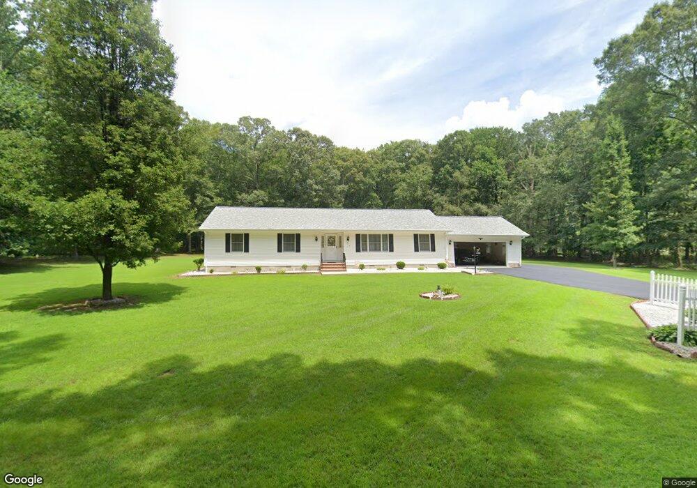
1215 John Brown Rd Queenstown, MD 21658
Estimated Value: $415,000 - $480,000
--
Bed
2
Baths
1,680
Sq Ft
$265/Sq Ft
Est. Value
About This Home
This home is located at 1215 John Brown Rd, Queenstown, MD 21658 and is currently estimated at $444,474, approximately $264 per square foot. 1215 John Brown Rd is a home located in Queen Anne's County with nearby schools including Centreville Elementary School, Kennard Elementary School, and Centreville Middle School.
Ownership History
Date
Name
Owned For
Owner Type
Purchase Details
Closed on
Jun 7, 1984
Sold by
Sheubrooks Carlton Milton O
Bought by
Middleton Robert E and Middleton Roberta L
Current Estimated Value
Home Financials for this Owner
Home Financials are based on the most recent Mortgage that was taken out on this home.
Original Mortgage
$10,000
Interest Rate
14.29%
Create a Home Valuation Report for This Property
The Home Valuation Report is an in-depth analysis detailing your home's value as well as a comparison with similar homes in the area
Home Values in the Area
Average Home Value in this Area
Purchase History
| Date | Buyer | Sale Price | Title Company |
|---|---|---|---|
| Middleton Robert E | $13,000 | -- |
Source: Public Records
Mortgage History
| Date | Status | Borrower | Loan Amount |
|---|---|---|---|
| Closed | Middleton Robert E | $10,000 |
Source: Public Records
Tax History Compared to Growth
Tax History
| Year | Tax Paid | Tax Assessment Tax Assessment Total Assessment is a certain percentage of the fair market value that is determined by local assessors to be the total taxable value of land and additions on the property. | Land | Improvement |
|---|---|---|---|---|
| 2025 | $3,389 | $357,467 | $0 | $0 |
| 2024 | $3,226 | $336,100 | $146,000 | $190,100 |
| 2023 | $3,098 | $322,500 | $0 | $0 |
| 2022 | $2,970 | $308,900 | $0 | $0 |
| 2021 | $2,892 | $295,300 | $121,000 | $174,300 |
| 2020 | $2,892 | $295,300 | $121,000 | $174,300 |
| 2019 | $2,892 | $295,300 | $121,000 | $174,300 |
| 2018 | $2,907 | $296,800 | $106,000 | $190,800 |
| 2017 | $2,802 | $285,867 | $0 | $0 |
| 2016 | -- | $274,933 | $0 | $0 |
| 2015 | $2,431 | $264,000 | $0 | $0 |
| 2014 | $2,431 | $264,000 | $0 | $0 |
Source: Public Records
Map
Nearby Homes
- 518 Bryce Rd
- 103 Trevors Ct
- 142 Harmony Way
- 107 Overture Way
- 250 Concerto Ave
- 214 Orchestra Place
- 714 Harmony Way
- 243 Orchestra Place
- 807 Harmony Way
- 315 Nottingham Ln
- 364 Overture Way
- 371 Overture Way
- 111 Mt Mills Ln
- 6107 Ocean Gateway
- 154 Mckenney Ln
- 224 Wye Knot Ct
- 235 Wye Knot Ct
- 114 Bristol Ln
- 407 S Commerce St
- 401 Dulin Clark Rd
- 1211 John Brown Rd
- 1218 John Brown Rd
- 1214 John Brown Rd
- 1207 John Brown Rd
- 1202 John Brown Rd
- 1302 John Brown Rd
- 1310 John Brown Rd
- 1201 John Brown Rd
- 201 Darray Ln
- 1401 John Brown Rd
- 1318 John Brown Rd
- 2017 Bloomingdale Rd
- 1405 John Brown Rd
- 1406 John Brown Rd
- 175 Darray Ln
- 2001 Bloomingdale Rd
- 2113 Bloomingdale Rd
- 1410 John Brown Rd
- 1413 John Brown Rd
- 124 Bryce Rd