Estimated Value: $230,000 - $249,000
3
Beds
2
Baths
1,000
Sq Ft
$237/Sq Ft
Est. Value
About This Home
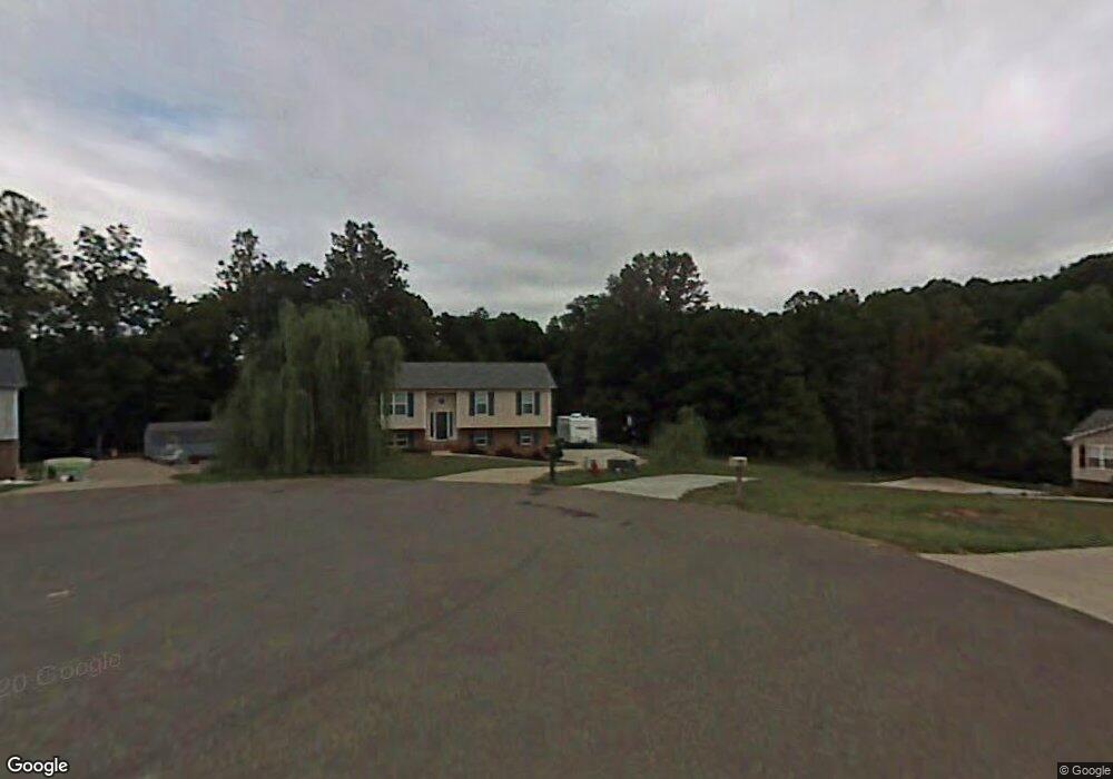
This home is located at 1215 Laurel Crest Rd, King, NC 27021 and is currently estimated at $237,233, approximately $237 per square foot. 1215 Laurel Crest Rd is a home located in Stokes County with nearby schools including Poplar Springs Elementary School, Chestnut Grove Middle, and West Stokes High.
Ownership History
Date
Name
Owned For
Owner Type
Purchase Details
Closed on
Jul 20, 2018
Sold by
Vance Victor C and Vance Janet S
Bought by
Frazier Jackie S and Frazier Randy S
Current Estimated Value
Home Financials for this Owner
Home Financials are based on the most recent Mortgage that was taken out on this home.
Original Mortgage
$107,600
Outstanding Balance
$93,251
Interest Rate
4.5%
Mortgage Type
New Conventional
Estimated Equity
$143,982
Create a Home Valuation Report for This Property
The Home Valuation Report is an in-depth analysis detailing your home's value as well as a comparison with similar homes in the area
Home Values in the Area
Average Home Value in this Area
Purchase History
| Date | Buyer | Sale Price | Title Company |
|---|---|---|---|
| Frazier Jackie S | $134,500 | None Available |
Source: Public Records
Mortgage History
| Date | Status | Borrower | Loan Amount |
|---|---|---|---|
| Open | Frazier Jackie S | $107,600 |
Source: Public Records
Tax History
| Year | Tax Paid | Tax Assessment Tax Assessment Total Assessment is a certain percentage of the fair market value that is determined by local assessors to be the total taxable value of land and additions on the property. | Land | Improvement |
|---|---|---|---|---|
| 2025 | $1,466 | $205,000 | $45,500 | $159,500 |
| 2024 | $1,466 | $135,400 | $28,000 | $107,400 |
| 2023 | $1,097 | $135,400 | $28,000 | $107,400 |
| 2022 | $1,002 | $135,400 | $28,000 | $107,400 |
| 2021 | $1,002 | $135,400 | $28,000 | $107,400 |
| 2020 | $868 | $117,300 | $25,000 | $92,300 |
| 2019 | $868 | $117,300 | $25,000 | $92,300 |
| 2018 | $813 | $109,900 | $25,000 | $84,900 |
| 2017 | $808 | $109,900 | $25,000 | $84,900 |
| 2016 | $780 | $106,100 | $25,000 | $81,100 |
| 2015 | $775 | $106,100 | $25,000 | $81,100 |
| 2014 | $818 | $106,100 | $25,000 | $81,100 |
Source: Public Records
Map
Nearby Homes
- 100 Ridgecrest Dr
- 101 Ravenwood Ct
- 113 Ravenwood Ct
- 1110 Foxtrot Ct
- 103 Jasper Ct
- 1255 Mountain View Rd
- 1739 Denny Rd
- 310 Cedardale Ln
- Lot 19 Glen Brooke Ln
- Lot 18 Glen Brooke Ln
- 117 Rocky Maple Dr
- 4.45acres Gib Ferguson Rd
- 109 Glen Brooke Ln
- 1034 Kentland Dr
- 125 Rocky Maple Dr
- 1129 Kentland Dr
- 157 Leeds Ln
- 218 Maverick Trail Dr
- 104 Palomino Dr
- 0 Mountain View Rd Unit 1173137
- 1195 Laurel Crest Rd
- 1210 Laurel Crest Rd
- 1200 Laurel Crest Rd
- 1185 Laurel Crest Rd
- 1190 Laurel Crest Rd
- 1175 Laurel Crest Rd
- 1180 Laurel Crest Rd
- 1165 Laurel Crest Rd
- 1170 Laurel Crest Rd
- 1155 Laurel Crest Rd
- 1160 Laurel Crest Rd
- 1270 Traffic Ln
- 1145 Laurel Crest Rd
- 1150 Laurel Crest Rd
- 7633 Nc 66 Hwy S
- 7727 Nc 66 Hwy S
- 7701 Nc 66 Hwy S
- 7677 Nc 66 Hwy S
- 7655 Nc 66 Hwy S
- 7741 Nc 66 Hwy S
Your Personal Tour Guide
Ask me questions while you tour the home.