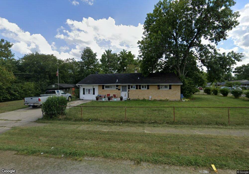
1215 Madeleine Cir Cincinnati, OH 45231
Finneytown NeighborhoodEstimated Value: $157,000 - $192,000
3
Beds
1
Bath
1,350
Sq Ft
$128/Sq Ft
Est. Value
About This Home
This home is located at 1215 Madeleine Cir, Cincinnati, OH 45231 and is currently estimated at $173,131, approximately $128 per square foot. 1215 Madeleine Cir is a home located in Hamilton County with nearby schools including Mt Healthy High School, John Paul II Catholic School, and Central Baptist Academy.
Ownership History
Date
Name
Owned For
Owner Type
Purchase Details
Closed on
Jan 8, 2002
Sold by
Ishida Yoshio G and Ishida Aiko
Bought by
Storer Kent B and Storer Stephanie E
Current Estimated Value
Home Financials for this Owner
Home Financials are based on the most recent Mortgage that was taken out on this home.
Original Mortgage
$46,800
Interest Rate
7.16%
Purchase Details
Closed on
Feb 27, 1995
Sold by
Ishida Yoshio G and Ishida Aiko
Bought by
Storer Kent E and Storer Stephanie E
Create a Home Valuation Report for This Property
The Home Valuation Report is an in-depth analysis detailing your home's value as well as a comparison with similar homes in the area
Home Values in the Area
Average Home Value in this Area
Purchase History
| Date | Buyer | Sale Price | Title Company |
|---|---|---|---|
| Storer Kent B | $48,500 | -- | |
| Storer Kent E | $48,500 | -- |
Source: Public Records
Mortgage History
| Date | Status | Borrower | Loan Amount |
|---|---|---|---|
| Closed | Storer Kent B | $46,800 |
Source: Public Records
Tax History Compared to Growth
Tax History
| Year | Tax Paid | Tax Assessment Tax Assessment Total Assessment is a certain percentage of the fair market value that is determined by local assessors to be the total taxable value of land and additions on the property. | Land | Improvement |
|---|---|---|---|---|
| 2024 | $2,119 | $36,778 | $5,845 | $30,933 |
| 2023 | $2,013 | $36,778 | $5,845 | $30,933 |
| 2022 | $1,284 | $16,857 | $5,786 | $11,071 |
| 2021 | $1,250 | $16,857 | $5,786 | $11,071 |
| 2020 | $1,269 | $16,857 | $5,786 | $11,071 |
| 2019 | $1,256 | $15,611 | $5,359 | $10,252 |
| 2018 | $1,263 | $15,611 | $5,359 | $10,252 |
| 2017 | $1,198 | $15,611 | $5,359 | $10,252 |
| 2016 | $1,609 | $20,689 | $5,786 | $14,903 |
| 2015 | $1,621 | $20,689 | $5,786 | $14,903 |
| 2014 | $1,614 | $20,689 | $5,786 | $14,903 |
| 2013 | $1,663 | $21,777 | $6,090 | $15,687 |
Source: Public Records
Map
Nearby Homes
- 8831 Daly Rd
- 8840 Grenada Dr
- 8950 Daly Rd
- 8772 Balboa Dr
- 8925 Monsanto Dr
- 1190 Sugartree Ct
- 8734 Grenada Dr
- 1100 Gracewind Ct
- 1151 Hempstead Dr
- 8681 Desoto Dr
- 8627 Mockingbird Ln
- 8622 Mockingbird Ln
- 1277 Prospect Place
- 8491 Daly Rd
- 1013 Vacationland Dr
- 1458 Van Fleet Ave
- 1029 Bluejay Dr
- 958 Hollytree Dr
- 954 Hollytree Dr
- 1478 Foxwood Dr
- 8860 Balboa Dr
- 8859 Daly Rd
- 8852 Balboa Dr
- 8847 Daly Rd
- 8874 Balboa Dr
- 1208 Madeleine Cir
- 1229 Madeleine Cir
- 8857 Balboa Dr
- 8841 Daly Rd
- 8883 Daly Rd
- 8844 Balboa Dr
- 1228 Madeleine Cir
- 8849 Balboa Dr
- 8880 Balboa Dr
- 8895 Daly Rd
- 8836 Balboa Dr
- 8877 Balboa Dr
- 8841 Balboa Dr
- 1239 Madeleine Cir
- 8823 Daly Rd