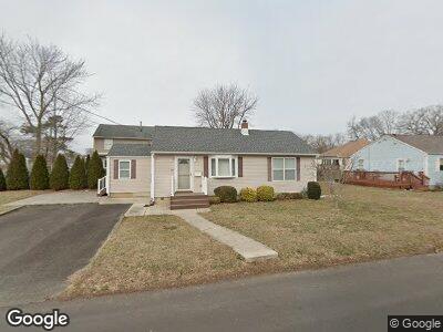
1215 Sherman Ave Point Pleasant Boro, NJ 08742
Estimated Value: $521,000 - $533,000
1
Bed
1
Bath
1,142
Sq Ft
$461/Sq Ft
Est. Value
About This Home
This home is located at 1215 Sherman Ave, Point Pleasant Boro, NJ 08742 and is currently estimated at $525,902, approximately $460 per square foot. 1215 Sherman Ave is a home located in Ocean County with nearby schools including Point Pleasant High School and St. Peter School.
Ownership History
Date
Name
Owned For
Owner Type
Purchase Details
Closed on
May 21, 2009
Sold by
Leonhard Keith
Bought by
Salyga Joseph R and Salyga Sandra K
Current Estimated Value
Purchase Details
Closed on
Jun 16, 2004
Sold by
Stavac Gary and Stavac Deborah
Bought by
Leonhard Keith
Home Financials for this Owner
Home Financials are based on the most recent Mortgage that was taken out on this home.
Original Mortgage
$237,500
Interest Rate
6.32%
Mortgage Type
Stand Alone First
Create a Home Valuation Report for This Property
The Home Valuation Report is an in-depth analysis detailing your home's value as well as a comparison with similar homes in the area
Home Values in the Area
Average Home Value in this Area
Purchase History
| Date | Buyer | Sale Price | Title Company |
|---|---|---|---|
| Salyga Joseph R | $253,000 | Fidelity Natl Title Ins Co | |
| Leonhard Keith | $250,000 | Stewart Title Guaranty Co |
Source: Public Records
Mortgage History
| Date | Status | Borrower | Loan Amount |
|---|---|---|---|
| Previous Owner | Leonhard Keith | $40,000 | |
| Previous Owner | Leonhard Keith | $237,500 |
Source: Public Records
Tax History Compared to Growth
Tax History
| Year | Tax Paid | Tax Assessment Tax Assessment Total Assessment is a certain percentage of the fair market value that is determined by local assessors to be the total taxable value of land and additions on the property. | Land | Improvement |
|---|---|---|---|---|
| 2024 | $5,388 | $263,200 | $183,100 | $80,100 |
| 2023 | $5,278 | $246,500 | $183,100 | $63,400 |
| 2022 | $5,278 | $246,500 | $183,100 | $63,400 |
| 2021 | $5,196 | $246,500 | $183,100 | $63,400 |
| 2020 | $5,142 | $246,500 | $183,100 | $63,400 |
| 2019 | $5,073 | $246,500 | $183,100 | $63,400 |
| 2018 | $4,923 | $246,500 | $183,100 | $63,400 |
| 2017 | $4,814 | $246,500 | $183,100 | $63,400 |
| 2016 | $4,777 | $246,500 | $183,100 | $63,400 |
| 2015 | $4,720 | $246,500 | $183,100 | $63,400 |
| 2014 | $4,612 | $246,500 | $183,100 | $63,400 |
Source: Public Records
Map
Nearby Homes
- 1409 Buckner St
- 1320 Charles St
- 1416 George St
- 1030 Ocean Rd
- 1215 Johnson Ave
- 22 Cedar Dr
- 284 Osborne Ave
- 1125 Arnold Ave Unit 2
- 1320 Bay Ave
- 827 Rosewood Ave
- 1501 Hulse Rd Unit 18
- 916 Arnold Ave
- 820 Trenton Ave
- 815 Sinclair Rd
- 1115 Hollywood Blvd
- 1117 Bradford Dr
- 2113 River Rd
- 842 Arnold Ave Unit 2
- 842 Arnold Ave Unit 1
- 842 Arnold Ave Unit 5
- 1215 Sherman Ave
- 903 Catherine St
- 903 Catherine St
- 1218 Sherman Ave
- 1216 Sherman Ave
- 1211 Sherman Ave
- 1222 Sherman Ave
- 905 Catherine St
- 1214 Sherman Ave
- 1208A Rue Ave
- 1210 Sherman Ave
- 1225 Sherman Ave
- 1207 Sherman Ave
- 1226 Sherman Ave
- 1226 George St
- 1217 Fleming Ave Unit 19
- 1227 Sherman Ave
- 1208 Sherman Ave
- 1216 Rue Ave
- 1221 Fleming Ave