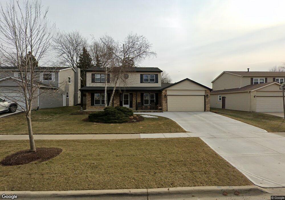
1215 W Dovington Dr Hoffman Estates, IL 60169
South Hoffman Estates NeighborhoodEstimated Value: $516,448 - $553,000
4
Beds
3
Baths
2,036
Sq Ft
$261/Sq Ft
Est. Value
About This Home
This home is located at 1215 W Dovington Dr, Hoffman Estates, IL 60169 and is currently estimated at $531,612, approximately $261 per square foot. 1215 W Dovington Dr is a home located in Cook County with nearby schools including Hoover Math And Science Academy, Dwight D Eisenhower Junior High School, and Hoffman Estates High School.
Ownership History
Date
Name
Owned For
Owner Type
Purchase Details
Closed on
Jan 8, 2010
Sold by
Grudzinski Donald A and Grudzinski Karen L
Bought by
Grudzinski Donald A and Grudzinski Karen L
Current Estimated Value
Create a Home Valuation Report for This Property
The Home Valuation Report is an in-depth analysis detailing your home's value as well as a comparison with similar homes in the area
Home Values in the Area
Average Home Value in this Area
Purchase History
| Date | Buyer | Sale Price | Title Company |
|---|---|---|---|
| Grudzinski Donald A | -- | None Available |
Source: Public Records
Tax History
| Year | Tax Paid | Tax Assessment Tax Assessment Total Assessment is a certain percentage of the fair market value that is determined by local assessors to be the total taxable value of land and additions on the property. | Land | Improvement |
|---|---|---|---|---|
| 2025 | $10,337 | $48,000 | $9,324 | $38,676 |
| 2024 | $10,337 | $37,000 | $7,770 | $29,230 |
| 2023 | $9,973 | $37,000 | $7,770 | $29,230 |
| 2022 | $9,973 | $37,000 | $7,770 | $29,230 |
| 2021 | $9,594 | $31,966 | $5,439 | $26,527 |
| 2020 | $9,372 | $31,966 | $5,439 | $26,527 |
| 2019 | $9,394 | $35,518 | $5,439 | $30,079 |
| 2018 | $9,372 | $32,177 | $4,662 | $27,515 |
| 2017 | $9,224 | $32,177 | $4,662 | $27,515 |
| 2016 | $8,842 | $32,177 | $4,662 | $27,515 |
| 2015 | $7,985 | $27,485 | $4,079 | $23,406 |
| 2014 | $7,861 | $27,485 | $4,079 | $23,406 |
| 2013 | $7,642 | $27,485 | $4,079 | $23,406 |
Source: Public Records
Map
Nearby Homes
- 1300 Chatsworth Ln
- 712 Scarbrough Cir Unit 126
- 658 Claridge Cir Unit 99
- 426 Argyll Ln
- 1365 Newcastle Ln
- 845 Harmon Blvd
- 1335 Blair Ln
- 670 Lakeview Ln
- 1085 Higgins Quarters Dr Unit 104
- 630 Bode Rd
- 1975 Leiter Way Unit 12002
- 1982 Leiter Way Unit 13004
- 1985 Leiter Way Unit 1102
- 1988 Leiter Way Unit 13001
- 1979 Leiter Way Unit 12004
- 1981 Leiter Way Unit 12005
- 1994 Leiter Way Unit 14003
- 1977 Leiter Way Unit 12003
- 1986 Leiter Way Unit 13002
- 1989 Leiter Way Unit 11004
- 1225 W Dovington Dr
- 1205 W Dovington Dr
- 1235 W Dovington Dr
- 1195 W Dovington Dr
- 831 N Dovington Ct
- 1245 W Dovington Dr
- 1185 W Dovington Dr
- 667 Wainsford Dr
- 841 N Dovington Ct
- 665 Wainsford Dr
- 1255 W Dovington Dr
- 792 Randi Ln
- 1175 W Dovington Dr
- 832 N Dovington Ct
- 790 Randi Ln
- 794 Randi Ln
- 851 N Dovington Ct
- 669 Wainsford Dr
- 842 N Dovington Ct
- 1265 W Dovington Dr
Your Personal Tour Guide
Ask me questions while you tour the home.