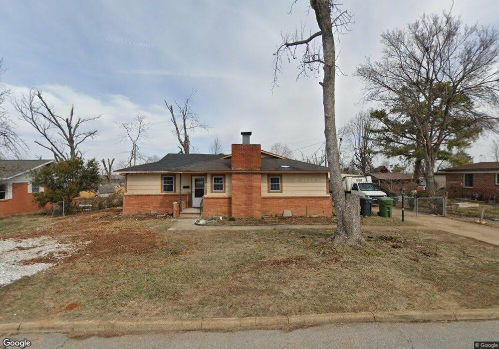
1215 W Pine St Rogers, AR 72756
Estimated Value: $255,122 - $325,000
3
Beds
2
Baths
1,570
Sq Ft
$187/Sq Ft
Est. Value
About This Home
This home is located at 1215 W Pine St, Rogers, AR 72756 and is currently estimated at $293,781, approximately $187 per square foot. 1215 W Pine St is a home located in Benton County with nearby schools including Frank Tillery Elementary School, Lingle Middle School, and Rogers Heritage High School.
Ownership History
Date
Name
Owned For
Owner Type
Purchase Details
Closed on
Jan 30, 2017
Sold by
Larson Robert Lane
Bought by
Larson Robert Lane and Ormeno Alfredo Sven Larson
Current Estimated Value
Purchase Details
Closed on
Jul 27, 1999
Bought by
Larson
Purchase Details
Closed on
Feb 2, 1988
Bought by
Chambers
Purchase Details
Closed on
Mar 1, 1985
Bought by
Kirk
Purchase Details
Closed on
Sep 21, 1983
Bought by
Kirk
Purchase Details
Closed on
Nov 2, 1982
Bought by
Holliday
Create a Home Valuation Report for This Property
The Home Valuation Report is an in-depth analysis detailing your home's value as well as a comparison with similar homes in the area
Home Values in the Area
Average Home Value in this Area
Purchase History
| Date | Buyer | Sale Price | Title Company |
|---|---|---|---|
| Larson Robert Lane | -- | None Available | |
| Larson | $71,000 | -- | |
| Chambers | $44,000 | -- | |
| Kirk | -- | -- | |
| Kirk | $48,000 | -- | |
| Holliday | $45,000 | -- |
Source: Public Records
Tax History Compared to Growth
Tax History
| Year | Tax Paid | Tax Assessment Tax Assessment Total Assessment is a certain percentage of the fair market value that is determined by local assessors to be the total taxable value of land and additions on the property. | Land | Improvement |
|---|---|---|---|---|
| 2025 | $1,621 | $49,780 | $19,000 | $30,780 |
| 2024 | $1,449 | $46,702 | $19,000 | $27,702 |
| 2023 | $1,318 | $30,970 | $8,000 | $22,970 |
| 2022 | $1,264 | $30,970 | $8,000 | $22,970 |
| 2021 | $1,156 | $30,970 | $8,000 | $22,970 |
| 2020 | $1,051 | $19,150 | $2,400 | $16,750 |
| 2019 | $1,051 | $19,150 | $2,400 | $16,750 |
| 2018 | $1,051 | $19,150 | $2,400 | $16,750 |
| 2017 | $965 | $19,150 | $2,400 | $16,750 |
| 2016 | $965 | $19,150 | $2,400 | $16,750 |
| 2015 | $892 | $16,860 | $3,400 | $13,460 |
| 2014 | $892 | $16,860 | $3,400 | $13,460 |
Source: Public Records
Map
Nearby Homes
- 501 S 12th St
- 1120 W Cypress St
- 1208 W Cherry St
- 1310 W Pecan St
- 1112 W Poplar St
- 1020 W Cypress St Unit 3
- 1406 W Pine St
- 1126 S 13th St
- 1202 S 13th St
- 600 S Scott Cir
- 930 S 14th St
- 917 S 15th St
- 1603 W Poplar St
- 906 W Holly St
- 1217 W Countrywood Cir
- 910 S 16th St
- 501 S 7th St
- 707 S 7th St
- 630 W Poplar St
- 902 S 17th St