Estimated Value: $235,000 - $247,623
3
Beds
3
Baths
1,378
Sq Ft
$176/Sq Ft
Est. Value
About This Home
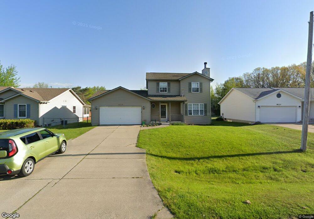
This home is located at 1215 Windsor St, Flint, MI 48507 and is currently estimated at $242,656, approximately $176 per square foot. 1215 Windsor St is a home located in Genesee County with nearby schools including Anderson Elementary School, McGrath Elementary School, and Grand Blanc West Middle School.
Ownership History
Date
Name
Owned For
Owner Type
Purchase Details
Closed on
Mar 14, 2008
Sold by
Big Sky Development Inc
Bought by
Dobbs Cynthia D
Current Estimated Value
Purchase Details
Closed on
Jun 21, 2007
Sold by
Moody Aaron and Moody Christena G
Bought by
Big Sky Development Inc
Purchase Details
Closed on
Jun 30, 2004
Sold by
Doak Eric and Doak Jill
Bought by
Moody Aaron and Moody Christina G
Purchase Details
Closed on
May 30, 2002
Sold by
Doak Eric
Bought by
Doak Eric and Doak Jill
Purchase Details
Closed on
Mar 5, 2001
Sold by
Schaar Steve J and Schaar Merrie
Bought by
Doak Eric
Create a Home Valuation Report for This Property
The Home Valuation Report is an in-depth analysis detailing your home's value as well as a comparison with similar homes in the area
Home Values in the Area
Average Home Value in this Area
Purchase History
| Date | Buyer | Sale Price | Title Company |
|---|---|---|---|
| Dobbs Cynthia D | $153,300 | Metropolitan Title Company | |
| Big Sky Development Inc | $174,000 | Metropolitan Title Company | |
| Moody Aaron | $160,000 | Metropolitan Title Company | |
| Doak Eric | -- | Title Giant | |
| Doak Eric | $151,000 | Guaranty Title Company |
Source: Public Records
Tax History Compared to Growth
Tax History
| Year | Tax Paid | Tax Assessment Tax Assessment Total Assessment is a certain percentage of the fair market value that is determined by local assessors to be the total taxable value of land and additions on the property. | Land | Improvement |
|---|---|---|---|---|
| 2025 | $2,782 | $104,800 | $0 | $0 |
| 2024 | $1,600 | $101,900 | $0 | $0 |
| 2023 | $1,527 | $92,600 | $0 | $0 |
| 2022 | $2,503 | $82,100 | $0 | $0 |
| 2021 | $2,444 | $76,000 | $0 | $0 |
| 2020 | $1,408 | $71,600 | $0 | $0 |
| 2019 | $1,387 | $64,600 | $0 | $0 |
| 2018 | $2,232 | $60,000 | $0 | $0 |
| 2017 | $2,137 | $58,500 | $0 | $0 |
| 2016 | $2,114 | $51,900 | $0 | $0 |
| 2015 | $2,018 | $51,700 | $0 | $0 |
| 2012 | -- | $50,900 | $50,900 | $0 |
Source: Public Records
Map
Nearby Homes
- 1142 Linus St
- 00 Mckinley Blvd
- 000 Mckinley Blvd
- 1329 Rollins St
- 1226 Harding Dr
- 5146 Sandalwood Cir
- 0 Harding Dr Unit 20251056693
- 0000 Coolidge Dr
- 5152 Sandalwood Cir
- 5148 Sandalwood Cir
- 0000 Mckinley Blvd
- 1096 Harding Dr
- 00 Coolidge Dr
- 000 Coolidge Dr
- 5160 Sandalwood Dr
- 1045 Leisure Dr Unit 7
- 5045 Sandalwood Dr Unit 5K
- 5400 Ali Dr
- 1044 W Rowland St
- 5076 Spring Well Ln
- 1221 Windsor St
- 1207 Windsor St
- 1227 Windsor St
- 1201 Windsor St
- 1233 Windsor St
- 1195 Windsor St
- 1239 Windsor St
- 1189 Windsor St
- 1214 Linus St
- 1204 Linus St
- 1183 Windsor St
- 1226 Linus St
- 1214 Windsor St
- 1220 Windsor St
- 1208 Windsor St
- 1194 Linus St
- 1238 Linus St
- 1226 Windsor St
- 1200 Windsor St
- 1177 Windsor St