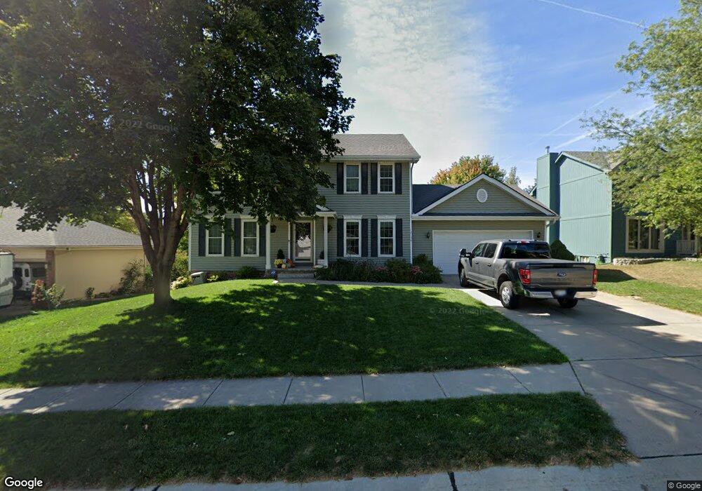
12156 S 217th Ave Gretna, NE 68028
Estimated Value: $385,973 - $439,000
4
Beds
6
Baths
2,500
Sq Ft
$162/Sq Ft
Est. Value
About This Home
This home is located at 12156 S 217th Ave, Gretna, NE 68028 and is currently estimated at $403,993, approximately $161 per square foot. 12156 S 217th Ave is a home located in Sarpy County with nearby schools including Gretna Elementary School, Gretna Middle School, and Gretna High School.
Ownership History
Date
Name
Owned For
Owner Type
Purchase Details
Closed on
May 12, 2000
Sold by
Michl Robert W and Mellen Kimberly
Bought by
Carlson Eric R and Carlson Julie A
Current Estimated Value
Home Financials for this Owner
Home Financials are based on the most recent Mortgage that was taken out on this home.
Original Mortgage
$136,000
Outstanding Balance
$47,085
Interest Rate
8.17%
Estimated Equity
$356,908
Create a Home Valuation Report for This Property
The Home Valuation Report is an in-depth analysis detailing your home's value as well as a comparison with similar homes in the area
Home Values in the Area
Average Home Value in this Area
Purchase History
| Date | Buyer | Sale Price | Title Company |
|---|---|---|---|
| Carlson Eric R | $189,000 | -- |
Source: Public Records
Mortgage History
| Date | Status | Borrower | Loan Amount |
|---|---|---|---|
| Open | Carlson Eric R | $136,000 |
Source: Public Records
Tax History Compared to Growth
Tax History
| Year | Tax Paid | Tax Assessment Tax Assessment Total Assessment is a certain percentage of the fair market value that is determined by local assessors to be the total taxable value of land and additions on the property. | Land | Improvement |
|---|---|---|---|---|
| 2025 | $5,919 | $338,329 | $51,000 | $287,329 |
| 2024 | $6,485 | $330,633 | $51,000 | $279,633 |
| 2023 | $6,485 | $301,711 | $43,000 | $258,711 |
| 2022 | $5,884 | $257,831 | $38,000 | $219,831 |
| 2021 | $5,513 | $244,327 | $38,000 | $206,327 |
| 2020 | $5,230 | $233,136 | $34,000 | $199,136 |
| 2019 | $5,214 | $232,706 | $34,000 | $198,706 |
| 2018 | $5,179 | $232,177 | $30,000 | $202,177 |
| 2017 | $4,913 | $219,971 | $30,000 | $189,971 |
| 2016 | $4,613 | $207,089 | $27,000 | $180,089 |
| 2015 | $4,503 | $203,891 | $27,000 | $176,891 |
| 2014 | $4,433 | $202,423 | $27,000 | $175,423 |
| 2012 | -- | $195,517 | $27,000 | $168,517 |
Source: Public Records
Map
Nearby Homes
- 12015 S 219th Ave
- 21810 Westridge Dr
- 22712 Copper Ridge Rd
- 22704 Copper Ridge Rd
- 22618 Copper Ridge Rd
- 22610 Copper Ridge Rd
- 22524 Copper Ridge Rd
- 22611 Copper Ridge Rd
- 12416 S 218th Ave
- 21327 Quarry Ln
- 11829 S 217th St
- 10705 S 219th St
- 12526 S 218th Ave
- 12610 S 218th St
- 11808 S 213th St
- 21205 Stonehaven Ct
- 21113 Flagstone Cir
- 21115 Castlerock Ln
- 12261 Bobwhite Rd
- Lot 43 Lincoln Ridge
- 12146 S 217th Ave
- 12168 S 217th Ave
- 12149 S 218th St
- 12125 S 218th St
- 12126 S 217th Ave
- 12174 S 217th Ave
- 12161 S 218th St
- 12169 S 217th Ave
- 12149 S 217th Ave
- 12119 S 218th St
- 12139 S 217th Ave
- 12173 S 217th Ave
- 12173 S 218th St
- 12116 S 217th Ave
- 12180 S 217th Ave
- 12119 S 217th Ave
- 12179 S 217th Ave
- 12101 S 218th St
- 12183 S 218th St
- 12109 S 217th Ave