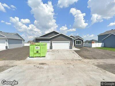
1216 22nd Ave W West Fargo, ND 58078
Brooks Harbor NeighborhoodEstimated Value: $450,000 - $471,915
4
Beds
3
Baths
2,636
Sq Ft
$175/Sq Ft
Est. Value
About This Home
This home is located at 1216 22nd Ave W, West Fargo, ND 58078 and is currently estimated at $460,958, approximately $174 per square foot. 1216 22nd Ave W is a home located in Cass County with nearby schools including Brooks Harbor Elementary School, Liberty Middle School, and West Fargo Sheyenne High School.
Ownership History
Date
Name
Owned For
Owner Type
Purchase Details
Closed on
Jul 16, 2021
Sold by
Thomsen Homes Llc
Bought by
Sarbaum Kyle John and Sarbaum Katie Necole
Current Estimated Value
Home Financials for this Owner
Home Financials are based on the most recent Mortgage that was taken out on this home.
Original Mortgage
$355,302
Outstanding Balance
$325,855
Interest Rate
2.9%
Mortgage Type
New Conventional
Estimated Equity
$135,103
Create a Home Valuation Report for This Property
The Home Valuation Report is an in-depth analysis detailing your home's value as well as a comparison with similar homes in the area
Home Values in the Area
Average Home Value in this Area
Purchase History
| Date | Buyer | Sale Price | Title Company |
|---|---|---|---|
| Sarbaum Kyle John | $394,780 | Fm Title |
Source: Public Records
Mortgage History
| Date | Status | Borrower | Loan Amount |
|---|---|---|---|
| Open | Sarbaum Kyle John | $355,302 | |
| Previous Owner | Thomsen Homes Llc | $237,377 | |
| Previous Owner | Thomsen Homes Llc | $240,000 |
Source: Public Records
Tax History Compared to Growth
Tax History
| Year | Tax Paid | Tax Assessment Tax Assessment Total Assessment is a certain percentage of the fair market value that is determined by local assessors to be the total taxable value of land and additions on the property. | Land | Improvement |
|---|---|---|---|---|
| 2024 | $5,487 | $221,100 | $40,800 | $180,300 |
| 2023 | $3,771 | $137,050 | $40,800 | $96,250 |
| 2022 | $3,336 | $119,550 | $40,800 | $78,750 |
| 2021 | $723 | $25,700 | $25,700 | $0 |
| 2020 | $5,086 | $25,700 | $25,700 | $0 |
| 2019 | $5,195 | $25,700 | $25,700 | $0 |
| 2018 | $5,274 | $25,700 | $25,700 | $0 |
| 2017 | $5,276 | $25,700 | $25,700 | $0 |
| 2016 | $3,906 | $25,700 | $25,700 | $0 |
| 2015 | $626 | $1,100 | $1,100 | $0 |
Source: Public Records
Map
Nearby Homes
- 1216 22nd Ave W
- 1210 22nd Ave W
- 2123 14th St W
- 2117 14th St W
- 1204 22nd Ave W
- 1306 22nd Ave W
- 1217 22nd Ave W
- 2111 14th St W
- 2135 14th St W
- 1312 22nd Ave W
- 1205 22nd Ave W
- 1307 22nd Ave W
- 1313 22nd Ave W
- 2120 12th St W
- 1218 Commander Dr W
- 2139 12th St W
- 1212 Commander Dr W
- 1224 Commander Dr W
- 1133 22nd Ave W
- 1206 Commander Dr W