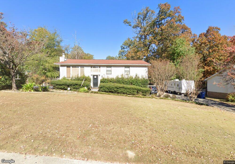
1216 6th Ave NW Unit 4 Alabaster, AL 35007
Estimated Value: $248,000 - $282,000
4
Beds
2
Baths
1,658
Sq Ft
$162/Sq Ft
Est. Value
About This Home
This home is located at 1216 6th Ave NW Unit 4, Alabaster, AL 35007 and is currently estimated at $269,346, approximately $162 per square foot. 1216 6th Ave NW Unit 4 is a home located in Shelby County with nearby schools including Thompson Intermediate School, Thompson Middle School, and Thompson High School.
Ownership History
Date
Name
Owned For
Owner Type
Purchase Details
Closed on
Nov 18, 2011
Sold by
Robison Gunn Robyn
Bought by
Robison Gunn Robyn
Current Estimated Value
Home Financials for this Owner
Home Financials are based on the most recent Mortgage that was taken out on this home.
Original Mortgage
$112,683
Interest Rate
4.06%
Mortgage Type
New Conventional
Purchase Details
Closed on
Mar 15, 2010
Sold by
Gunn Wilson L
Bought by
Robinson Gunn Robyn
Purchase Details
Closed on
Mar 29, 2002
Sold by
Armstrong Matthew R and Armstrong Shawn W
Bought by
Gunn Wilson L and Gunn Robyn R
Home Financials for this Owner
Home Financials are based on the most recent Mortgage that was taken out on this home.
Original Mortgage
$97,240
Interest Rate
6.8%
Create a Home Valuation Report for This Property
The Home Valuation Report is an in-depth analysis detailing your home's value as well as a comparison with similar homes in the area
Home Values in the Area
Average Home Value in this Area
Purchase History
| Date | Buyer | Sale Price | Title Company |
|---|---|---|---|
| Robison Gunn Robyn | $10,000 | None Available | |
| Robinson Gunn Robyn | -- | None Available | |
| Gunn Wilson L | $111,500 | Magic City Title Company Inc |
Source: Public Records
Mortgage History
| Date | Status | Borrower | Loan Amount |
|---|---|---|---|
| Closed | Robison Gunn Robyn | $112,683 | |
| Closed | Gunn Wilson L | $97,240 |
Source: Public Records
Tax History Compared to Growth
Tax History
| Year | Tax Paid | Tax Assessment Tax Assessment Total Assessment is a certain percentage of the fair market value that is determined by local assessors to be the total taxable value of land and additions on the property. | Land | Improvement |
|---|---|---|---|---|
| 2024 | $1,072 | $19,860 | $0 | $0 |
| 2023 | $959 | $18,520 | $0 | $0 |
| 2022 | $891 | $17,260 | $0 | $0 |
| 2021 | $788 | $15,360 | $0 | $0 |
| 2020 | $684 | $13,420 | $0 | $0 |
| 2019 | $660 | $12,980 | $0 | $0 |
| 2017 | $639 | $12,600 | $0 | $0 |
| 2015 | $623 | $12,300 | $0 | $0 |
| 2014 | $609 | $12,040 | $0 | $0 |
Source: Public Records
Map
Nearby Homes
- 513 Bennett Dr
- 540 11th St NW
- 640 11th St NW
- 834 Burning Tree Trail
- 905 Navajo Trail
- 1216 1st Ave W
- 641 Olde Towne Ln
- 220 Navajo Pines Dr
- 1805 Mohawk Dr
- 1807 Apache Way
- 95 9th St NW
- 240 Greenfield Ln
- 0001 9th St NW
- 000 9th St NW
- 112 Kingsley Ct
- 2014 1st Ave W
- 202 Stoney Trail
- 1445 Navajo Trail
- 412 10th St SW
- 925 5th Ave SW
- 1216 6th Ave NW
- 1210 6th Ave NW
- 1222 6th Ave NW
- 1235 Bennett Dr
- 1245 Bennett Dr
- 1228 6th Ave NW
- 1204 6th Ave NW
- 1219 6th Ave NW
- 1225 Bennett Dr
- 1207 6th Ave NW
- 1225 6th Ave NW
- 1201 6th Ave NW
- 1255 Bennett Dr
- 1234 6th Ave NW
- 633 12th St NW
- 625 12th St NW
- 1265 Bennett Dr
- 1214 Bennett Cir
- 1208 Bennett Cir
- 1220 Bennett Cir