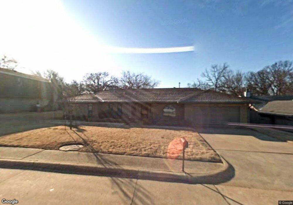
1216 Mockingbird Ln Edmond, OK 73034
Fleetwood Terrace NeighborhoodEstimated Value: $284,111 - $324,000
3
Beds
2
Baths
1,925
Sq Ft
$155/Sq Ft
Est. Value
About This Home
This home is located at 1216 Mockingbird Ln, Edmond, OK 73034 and is currently estimated at $298,778, approximately $155 per square foot. 1216 Mockingbird Ln is a home located in Oklahoma County with nearby schools including Will Rogers Elementary School, Central Middle School, and Memorial High School.
Ownership History
Date
Name
Owned For
Owner Type
Purchase Details
Closed on
Jul 11, 2013
Sold by
Banta Mark C
Bought by
Banta Sharon L
Current Estimated Value
Purchase Details
Closed on
Sep 8, 2005
Sold by
Lyles Larry A and Lyles Emily J
Bought by
Banta Mark C and Banta Sharon L
Home Financials for this Owner
Home Financials are based on the most recent Mortgage that was taken out on this home.
Original Mortgage
$124,800
Outstanding Balance
$65,239
Interest Rate
5.88%
Mortgage Type
Fannie Mae Freddie Mac
Estimated Equity
$233,539
Create a Home Valuation Report for This Property
The Home Valuation Report is an in-depth analysis detailing your home's value as well as a comparison with similar homes in the area
Home Values in the Area
Average Home Value in this Area
Purchase History
| Date | Buyer | Sale Price | Title Company |
|---|---|---|---|
| Banta Sharon L | -- | The Oklahoma City Abs & Tit | |
| Banta Mark C | $156,000 | Capitol Abstract & Title |
Source: Public Records
Mortgage History
| Date | Status | Borrower | Loan Amount |
|---|---|---|---|
| Open | Banta Mark C | $124,800 |
Source: Public Records
Tax History
| Year | Tax Paid | Tax Assessment Tax Assessment Total Assessment is a certain percentage of the fair market value that is determined by local assessors to be the total taxable value of land and additions on the property. | Land | Improvement |
|---|---|---|---|---|
| 2025 | $2,640 | $26,389 | $4,216 | $22,173 |
| 2024 | $2,495 | $25,132 | $4,261 | $20,871 |
| 2023 | $2,495 | $23,935 | $4,197 | $19,738 |
| 2022 | $2,385 | $22,796 | $4,577 | $18,219 |
| 2021 | $2,261 | $21,710 | $4,555 | $17,155 |
| 2020 | $2,180 | $20,677 | $4,481 | $16,196 |
| 2019 | $2,086 | $19,692 | $4,570 | $15,122 |
| 2018 | $1,998 | $18,755 | $0 | $0 |
| 2017 | $2,030 | $19,139 | $3,632 | $15,507 |
| 2016 | $1,967 | $18,589 | $3,632 | $14,957 |
| 2015 | $1,901 | $18,981 | $3,476 | $15,505 |
| 2014 | $1,840 | $18,428 | $3,518 | $14,910 |
Source: Public Records
Map
Nearby Homes
- 1221 Briarwood Dr
- 1301 Mockingbird Ln
- 1216 Devonshire Ct
- 917 E 11th St
- 1208 Pine Ridge Cir
- 1404 Mary Lee Ln
- 1641 S Bryant Ave
- 807 Willment Place
- 1900 Cedar Ridge Rd
- 1805 Chaparral Ln
- 1601 Hazelhurst
- 1800 Michael Dr
- 325 Tullahoma Dr
- 2201 Colchester Terrace
- 725 E Clegern Place Ct
- 1212 Ridgecrest Rd
- 2005 Woodland Rd
- 1817 Edgewood Dr
- 219 Tullahoma Dr
- 652 Reynolds Rd
- 1220 Mockingbird Ln
- 1212 Mockingbird Ln
- 1217 Briarwood Dr
- 1300 Mockingbird Ln
- 1208 Briarwood Place
- 1217 Mockingbird Ln
- 1215 Briarwood Dr
- 1213 Mockingbird Ln
- 1301 Briarwood Dr
- 1304 Mockingbird Ln
- 1221 Mockingbird Ln
- 1209 Mockingbird Ln
- 1209 Briarwood Dr
- 1305 Briarwood Dr
- 1205 Mockingbird Ln
- 1308 Mockingbird Ln
- 1305 Mockingbird Ln
- 1216 Briarwood Dr
- 1220 Briarwood Dr
- 1209 Briarwood Place
Your Personal Tour Guide
Ask me questions while you tour the home.