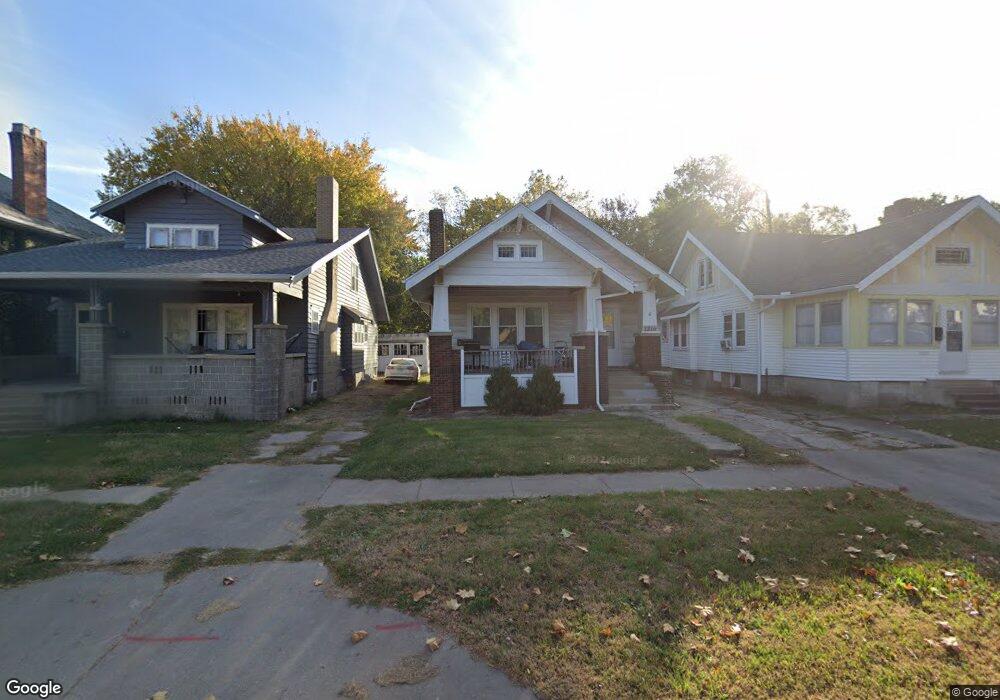
1216 N University St Peoria, IL 61606
West Bluff NeighborhoodEstimated Value: $64,000 - $84,000
2
Beds
1
Bath
1,112
Sq Ft
$64/Sq Ft
Est. Value
About This Home
This home is located at 1216 N University St, Peoria, IL 61606 and is currently estimated at $71,396, approximately $64 per square foot. 1216 N University St is a home located in Peoria County with nearby schools including Franklin Primary School, Harold B. Dawson Jr. Middle School, and Peoria High School.
Ownership History
Date
Name
Owned For
Owner Type
Purchase Details
Closed on
Mar 29, 2019
Sold by
Maricle Dyrke S and Maricle Sarah E
Bought by
Plan A Prop Llc 1216 N Unvi St
Current Estimated Value
Purchase Details
Closed on
Mar 11, 2019
Sold by
Maricle Dyrke S and Maricle Sarah E
Bought by
Plan A Prop Llc 1216 N Unvi St
Purchase Details
Closed on
Sep 15, 2011
Bought by
Wilken Adam
Create a Home Valuation Report for This Property
The Home Valuation Report is an in-depth analysis detailing your home's value as well as a comparison with similar homes in the area
Home Values in the Area
Average Home Value in this Area
Purchase History
| Date | Buyer | Sale Price | Title Company |
|---|---|---|---|
| Plan A Prop Llc 1216 N Unvi St | -- | Attorney Only | |
| Plan A Prop Llc 1216 N Unvi St | -- | Attorney Only | |
| Wilken Adam | $43,000 | -- |
Source: Public Records
Tax History Compared to Growth
Tax History
| Year | Tax Paid | Tax Assessment Tax Assessment Total Assessment is a certain percentage of the fair market value that is determined by local assessors to be the total taxable value of land and additions on the property. | Land | Improvement |
|---|---|---|---|---|
| 2024 | $1,588 | $17,560 | $3,540 | $14,020 |
| 2023 | $1,516 | $16,110 | $3,250 | $12,860 |
| 2022 | $1,394 | $14,450 | $2,950 | $11,500 |
| 2021 | $1,368 | $13,760 | $2,810 | $10,950 |
| 2020 | $1,365 | $13,620 | $2,780 | $10,840 |
| 2019 | $1,385 | $13,900 | $2,840 | $11,060 |
| 2018 | $1,364 | $14,010 | $2,840 | $11,170 |
| 2017 | $1,364 | $14,150 | $2,870 | $11,280 |
| 2016 | $1,326 | $14,150 | $2,870 | $11,280 |
| 2015 | $1,040 | $13,870 | $2,810 | $11,060 |
| 2014 | $1,040 | $11,300 | $2,800 | $8,500 |
| 2013 | -- | $11,430 | $2,830 | $8,600 |
Source: Public Records
Map
Nearby Homes
- 1213 N University St
- 1403 W Main St
- 1009 W Armstrong Ave
- 911 W Russell St
- 1509 W Main St
- 1614 W Columbia Terrace
- 1402 N Broadway St
- 1027 N Maplewood Ave
- 816 W Columbia Terrace
- 1104 N Orange St
- 710 W Armstrong Ave
- 1224 N Douglas St
- 1420 N Douglas St
- 915 W Moss Ave
- 919 W Moss Ave
- 1412 N Sheridan Rd
- 609 W Armstrong Ave
- 1104 W Rice St
- 1503 W Callender Ave
- 1917 N Broadway St
- 1220 N University St
- 1222 N University St
- 1208 N University St
- 1218 W Columbia Terrace
- 1212 W Columbia Terrace
- 1217 N Underhill St
- 1206 N University St
- 1221 N Underhill St
- 1215 N Underhill St
- 1223 N Underhill St
- 1211 N Underhill St
- 1202 N University St
- 1215 N University St
- 1202 W Columbia Terrace
- 1207 N Underhill St
- 1209 N Underhill St
- 1200 N University St
- 1217 W Columbia Terrace
- 1213 W Columbia Terrace
- 1300 N University St