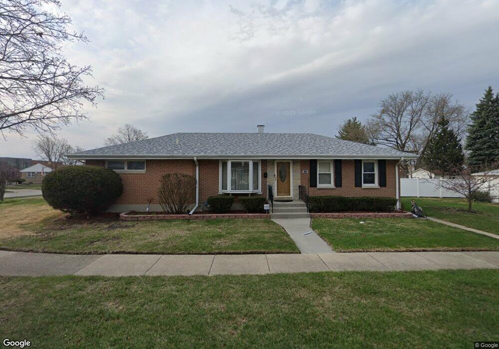
1216 Sunnyside Dr Berkeley, IL 60163
Estimated Value: $265,000 - $327,000
3
Beds
1
Bath
1,325
Sq Ft
$225/Sq Ft
Est. Value
About This Home
This home is located at 1216 Sunnyside Dr, Berkeley, IL 60163 and is currently estimated at $297,819, approximately $224 per square foot. 1216 Sunnyside Dr is a home located in Cook County with nearby schools including Macarthur Intermediate School, Sunnyside Elementary School, and Proviso West High School.
Ownership History
Date
Name
Owned For
Owner Type
Purchase Details
Closed on
Aug 15, 1997
Sold by
Spencer Paul and Spencer Debra
Bought by
Poe Edward P
Current Estimated Value
Home Financials for this Owner
Home Financials are based on the most recent Mortgage that was taken out on this home.
Original Mortgage
$131,100
Outstanding Balance
$17,384
Interest Rate
7.63%
Estimated Equity
$280,435
Create a Home Valuation Report for This Property
The Home Valuation Report is an in-depth analysis detailing your home's value as well as a comparison with similar homes in the area
Home Values in the Area
Average Home Value in this Area
Purchase History
| Date | Buyer | Sale Price | Title Company |
|---|---|---|---|
| Poe Edward P | $92,000 | -- |
Source: Public Records
Mortgage History
| Date | Status | Borrower | Loan Amount |
|---|---|---|---|
| Open | Poe Edward P | $131,100 |
Source: Public Records
Tax History
| Year | Tax Paid | Tax Assessment Tax Assessment Total Assessment is a certain percentage of the fair market value that is determined by local assessors to be the total taxable value of land and additions on the property. | Land | Improvement |
|---|---|---|---|---|
| 2025 | $6,382 | $23,192 | $3,819 | $19,373 |
| 2024 | $6,382 | $23,192 | $3,819 | $19,373 |
| 2023 | $5,343 | $23,192 | $3,819 | $19,373 |
| 2022 | $5,343 | $18,320 | $2,604 | $15,716 |
| 2021 | $5,397 | $18,319 | $2,603 | $15,716 |
| 2020 | $5,259 | $18,319 | $2,603 | $15,716 |
| 2019 | $3,949 | $15,490 | $2,430 | $13,060 |
| 2018 | $4,190 | $16,266 | $2,430 | $13,836 |
| 2017 | $3,780 | $16,266 | $2,430 | $13,836 |
| 2016 | $3,667 | $13,341 | $2,256 | $11,085 |
| 2015 | $3,570 | $13,341 | $2,256 | $11,085 |
| 2014 | $3,542 | $13,341 | $2,256 | $11,085 |
| 2013 | $4,185 | $15,939 | $2,256 | $13,683 |
Source: Public Records
Map
Nearby Homes
- 5700 Saint Charles Rd
- 5706 Saint Charles Rd
- 5509 Bohlander Ave
- 1426 N Rohde Ave
- 1529 N Hillside Ave
- 1428 1/2 N Ashbel Ave
- 4929 W Randolph St
- 1038 Arthur Ave
- 5920 Chicago Ave
- 4938 W Randolph St
- 51 50th Ave
- 33 49th Ave
- 129 49th Ave
- 319 50th Ave
- 630 E End Ave
- 241 48th Ave
- 5936 W Maple Ave
- 605 N Wolf Rd Unit B9
- 600 N Irving Ave
- 31 46th Ave
- 1220 Sunnyside Dr
- 1224 Sunnyside Dr
- 1217 N Lind Ave
- 1221 N Lind Ave
- 1228 Sunnyside Dr
- 1207 Sunnyside Dr
- 1209 Sunnyside Dr
- 1205 Sunnyside Dr
- 1225 N Lind Ave
- 1203 Sunnyside Dr
- 1211 Sunnyside Dr
- 1213 Sunnyside Dr
- 1232 Sunnyside Dr
- 1229 N Lind Ave
- 1221 Sunnyside Dr
- 1201 Sunnyside Dr
- 1217 Sunnyside Dr
- 1225 Sunnyside Dr
- 1233 N Lind Ave
- 1236 Sunnyside Dr