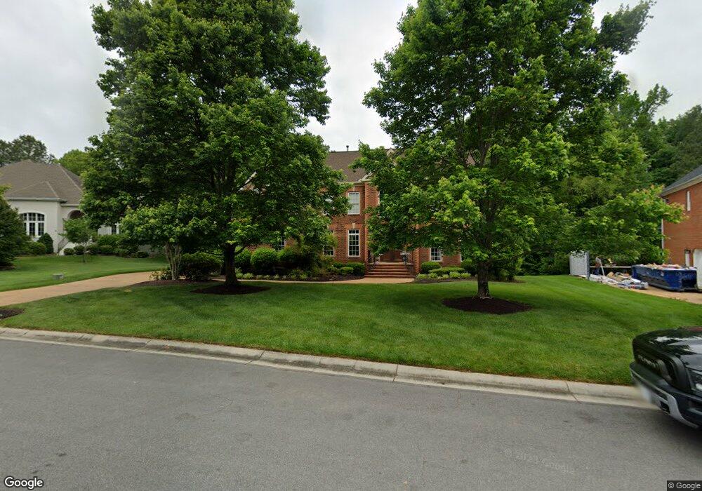
12164 Morestead Ct Glen Allen, VA 23059
Estimated Value: $1,157,000 - $1,346,119
5
Beds
6
Baths
6,740
Sq Ft
$185/Sq Ft
Est. Value
About This Home
This home is located at 12164 Morestead Ct, Glen Allen, VA 23059 and is currently estimated at $1,247,530, approximately $185 per square foot. 12164 Morestead Ct is a home located in Henrico County with nearby schools including Shady Grove Elementary School, Short Pump Middle School, and Deep Run High School.
Ownership History
Date
Name
Owned For
Owner Type
Purchase Details
Closed on
Aug 26, 2008
Sold by
Neal Harvey W
Bought by
Miller David A
Current Estimated Value
Home Financials for this Owner
Home Financials are based on the most recent Mortgage that was taken out on this home.
Original Mortgage
$528,750
Outstanding Balance
$347,797
Interest Rate
6.29%
Mortgage Type
New Conventional
Estimated Equity
$899,733
Purchase Details
Closed on
Oct 15, 2001
Sold by
Oak Ridge Inc
Bought by
Neale Harvey W and Neale Kelly A
Create a Home Valuation Report for This Property
The Home Valuation Report is an in-depth analysis detailing your home's value as well as a comparison with similar homes in the area
Home Values in the Area
Average Home Value in this Area
Purchase History
| Date | Buyer | Sale Price | Title Company |
|---|---|---|---|
| Miller David A | $1,250,000 | -- | |
| Neale Harvey W | $693,713 | -- |
Source: Public Records
Mortgage History
| Date | Status | Borrower | Loan Amount |
|---|---|---|---|
| Open | Miller David A | $528,750 |
Source: Public Records
Tax History Compared to Growth
Tax History
| Year | Tax Paid | Tax Assessment Tax Assessment Total Assessment is a certain percentage of the fair market value that is determined by local assessors to be the total taxable value of land and additions on the property. | Land | Improvement |
|---|---|---|---|---|
| 2025 | $9,656 | $1,082,900 | $232,000 | $850,900 |
| 2024 | $9,656 | $1,082,900 | $232,000 | $850,900 |
| 2023 | $9,205 | $1,082,900 | $232,000 | $850,900 |
| 2022 | $8,481 | $997,800 | $232,000 | $765,800 |
| 2021 | $7,544 | $864,100 | $231,000 | $633,100 |
| 2020 | $7,518 | $864,100 | $231,000 | $633,100 |
| 2019 | $7,574 | $870,600 | $231,000 | $639,600 |
| 2018 | $7,574 | $870,600 | $231,000 | $639,600 |
| 2017 | $7,517 | $864,000 | $231,000 | $633,000 |
| 2016 | $7,517 | $864,000 | $231,000 | $633,000 |
| 2015 | $7,742 | $889,900 | $231,000 | $658,900 |
| 2014 | $7,742 | $889,900 | $231,000 | $658,900 |
Source: Public Records
Map
Nearby Homes
- 12100 Manor Park Dr
- 6233 Kershaw Dr
- 12504 Collinstone Ct
- 5900 Maybrook Dr
- 12012 Layton Dr
- 6009 Chestnut Hill Dr
- 12410 Creek Mill Ct
- 14357 Western Riders Ln
- 11824 Park Forest Way
- 6573 Glenshaw Dr
- 5410 Ridgedale Dr
- 5408 Fuller Dr
- 5400 Fuller Dr
- 5604 Ashton Park Ct
- 12309 Hardwick Ct
- 10813 Cherry Hill Dr
- 10801 Cherry Hill Dr
- 7025 Benhall Cir
- 5525 Barnsley Terrace
- 12313 Haybrook Ln
- 12160 Morestead Ct
- 12168 Morestead Ct
- 12156 Morestead Ct
- 12165 Morestead Ct
- 12172 Morestead Ct
- 12161 Morestead Ct
- 12169 Morestead Ct
- 12152 Morestead Ct
- 12157 Morestead Ct
- 0 Morestead Ct
- 12204 Loxton Way
- 12173 Morestead Ct
- 12148 Morestead Ct
- 12208 Loxton Way
- 12180 Morestead Ct
- 12200 Loxton Way
- 12149 Morestead Ct
- 12144 Morestead Ct
- 12116 Loxton Ct
- 12145 Morestead Ct