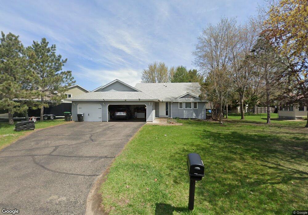
12167 Quinn St NW Coon Rapids, MN 55448
Estimated Value: $376,939 - $409,000
4
Beds
2
Baths
1,114
Sq Ft
$353/Sq Ft
Est. Value
About This Home
This home is located at 12167 Quinn St NW, Coon Rapids, MN 55448 and is currently estimated at $392,735, approximately $352 per square foot. 12167 Quinn St NW is a home located in Anoka County with nearby schools including Lucile Bruner Elementary School, Hoover Elementary School, and Laughlin Junior/Senior High School.
Ownership History
Date
Name
Owned For
Owner Type
Purchase Details
Closed on
Apr 28, 2006
Sold by
Xayaosa Phongsy and Buckhalton Brandon J
Bought by
Taiwo Akinola
Current Estimated Value
Purchase Details
Closed on
Aug 22, 2003
Sold by
Paige Marlin and Paige Catherine
Bought by
Xayaosa Phongsy and Buckhatton Brandon
Create a Home Valuation Report for This Property
The Home Valuation Report is an in-depth analysis detailing your home's value as well as a comparison with similar homes in the area
Home Values in the Area
Average Home Value in this Area
Purchase History
| Date | Buyer | Sale Price | Title Company |
|---|---|---|---|
| Taiwo Akinola | $239,500 | -- | |
| Xayaosa Phongsy | $210,000 | -- |
Source: Public Records
Tax History Compared to Growth
Tax History
| Year | Tax Paid | Tax Assessment Tax Assessment Total Assessment is a certain percentage of the fair market value that is determined by local assessors to be the total taxable value of land and additions on the property. | Land | Improvement |
|---|---|---|---|---|
| 2025 | $3,719 | $323,900 | $86,000 | $237,900 |
| 2024 | $3,719 | $331,700 | $95,000 | $236,700 |
| 2023 | $3,140 | $323,500 | $82,000 | $241,500 |
| 2022 | $2,799 | $322,300 | $70,000 | $252,300 |
| 2021 | $2,805 | $258,900 | $59,000 | $199,900 |
| 2020 | $3,024 | $253,600 | $63,000 | $190,600 |
| 2019 | $2,720 | $251,000 | $67,000 | $184,000 |
| 2018 | $2,536 | $230,500 | $0 | $0 |
| 2017 | $2,791 | $210,300 | $0 | $0 |
| 2016 | $2,521 | $183,500 | $0 | $0 |
| 2015 | -- | $183,500 | $51,000 | $132,500 |
| 2014 | -- | $166,900 | $50,300 | $116,600 |
Source: Public Records
Map
Nearby Homes
- 2068 124th Ln NW
- 2147 125th Ln NW
- 1727 121st Ln NW
- 12365 Jay St NW
- 12019 Zion St NW
- 12760 Raven St NW
- 1930 127th Cir NW
- 12010 Eagle St NW
- 12554 Grouse St NW
- 12463 Drake St NW
- 2675 128th Ave NW
- 11444 Hanson Blvd NW
- 11749 Crooked Lake Blvd NW
- 1660 Northdale Blvd NW
- 11424 Hanson Blvd NW
- 1449 119th Ln NW
- 1593 126th Ln NW
- 11409 Quinn St NW
- 12888 Nightingale St NW
- 11361 Jay St NW
- 12173 Quinn St NW
- 12161 Quinn St NW
- 12168 Partridge St NW
- 12179 Quinn St NW
- 12155 Quinn St NW
- 12176 Partridge St NW
- 12166 Quinn St NW
- 12170 Quinn St NW
- 12185 Quinn St NW
- 12158 Quinn St NW
- 12184 Partridge St NW
- 12172 Quinn St NW
- 12154 Quinn St NW
- 12178 Quinn St NW
- 12191 Quinn St NW
- 12180 Quinn St NW
- 12186 Quinn St NW
- 12196 Partridge St NW
- 12159 Partridge St NW
- 12155 Partridge St NW