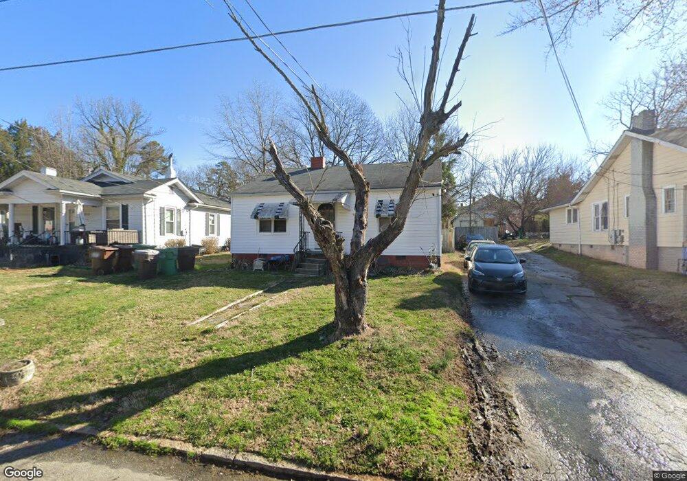
1217 Carter St High Point, NC 27260
Greater High Point NeighborhoodEstimated Value: $102,322 - $148,000
2
Beds
1
Bath
1,152
Sq Ft
$111/Sq Ft
Est. Value
About This Home
This home is located at 1217 Carter St, High Point, NC 27260 and is currently estimated at $127,331, approximately $110 per square foot. 1217 Carter St is a home located in Guilford County with nearby schools including Fairview Elementary School, Ferndale Middle School, and High Point Central High School.
Ownership History
Date
Name
Owned For
Owner Type
Purchase Details
Closed on
Jan 28, 2022
Sold by
Justus Jr Bobby R
Bought by
Justus B & C Properties Llc
Current Estimated Value
Purchase Details
Closed on
May 23, 2005
Sold by
Va
Bought by
Cash W Brandon
Purchase Details
Closed on
Aug 24, 2004
Sold by
Ortiz Jesus M and Ortiz Dianne B
Bought by
Va
Purchase Details
Closed on
Jan 8, 1998
Sold by
Ortiz Dianne B
Bought by
Ortiz Jesus M
Create a Home Valuation Report for This Property
The Home Valuation Report is an in-depth analysis detailing your home's value as well as a comparison with similar homes in the area
Home Values in the Area
Average Home Value in this Area
Purchase History
| Date | Buyer | Sale Price | Title Company |
|---|---|---|---|
| Justus B & C Properties Llc | -- | Mark L Mcguire Pa | |
| Cash W Brandon | -- | -- | |
| Va | $28,642 | -- | |
| Ortiz Jesus M | -- | -- |
Source: Public Records
Tax History
| Year | Tax Paid | Tax Assessment Tax Assessment Total Assessment is a certain percentage of the fair market value that is determined by local assessors to be the total taxable value of land and additions on the property. | Land | Improvement |
|---|---|---|---|---|
| 2025 | $557 | $40,400 | $7,000 | $33,400 |
| 2024 | $557 | $40,400 | $7,000 | $33,400 |
| 2023 | $557 | $40,400 | $7,000 | $33,400 |
| 2022 | $545 | $40,400 | $7,000 | $33,400 |
| 2021 | $371 | $26,900 | $6,000 | $20,900 |
| 2020 | $371 | $26,900 | $6,000 | $20,900 |
| 2019 | $371 | $26,900 | $0 | $0 |
| 2018 | $369 | $26,900 | $0 | $0 |
| 2017 | $371 | $26,900 | $0 | $0 |
| 2016 | $408 | $29,100 | $0 | $0 |
| 2015 | $410 | $29,100 | $0 | $0 |
| 2014 | $417 | $29,100 | $0 | $0 |
Source: Public Records
Map
Nearby Homes
- 1110 Worth St
- 640 Wesley Dr
- 1601 E Green Dr
- 650 Wesley Dr
- 1111 Winslow St
- 1806 Franklin Ave
- 511 Hines St
- 1809 Franklin Ave
- 1314 Franklin Ave
- 1309 Pershing St
- 1423 E Commerce Ave
- 811 Worth St
- 2317 Purdy Ave
- 1908 Leonard Ave
- 430 New St
- 812 E Russell Ave
- 1103 Jefferson St
- 1012 Jefferson St
- 1303 Leonard Ave
- 1010 Grace St
Your Personal Tour Guide
Ask me questions while you tour the home.