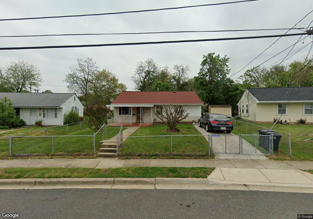
1217 Devonshire Dr Oxon Hill, MD 20745
Estimated Value: $293,000 - $346,000
--
Bed
1
Bath
910
Sq Ft
$356/Sq Ft
Est. Value
About This Home
This home is located at 1217 Devonshire Dr, Oxon Hill, MD 20745 and is currently estimated at $324,006, approximately $356 per square foot. 1217 Devonshire Dr is a home located in Prince George's County with nearby schools including Flintstone Elementary School, Oxon Hill Middle School, and Oxon Hill High School.
Ownership History
Date
Name
Owned For
Owner Type
Purchase Details
Closed on
Mar 22, 2010
Sold by
Myles Shelly C
Bought by
Myles Shelly C and The Myles Living Trust
Current Estimated Value
Purchase Details
Closed on
Oct 24, 2002
Sold by
Snead Hampton L
Bought by
Myles Shelly C
Purchase Details
Closed on
Feb 15, 1980
Sold by
Moorehead Thomas
Bought by
Snead Hampton L and Snead Debra A
Create a Home Valuation Report for This Property
The Home Valuation Report is an in-depth analysis detailing your home's value as well as a comparison with similar homes in the area
Home Values in the Area
Average Home Value in this Area
Purchase History
| Date | Buyer | Sale Price | Title Company |
|---|---|---|---|
| Myles Shelly C | -- | None Available | |
| Myles Shelly C | $115,000 | -- | |
| Snead Hampton L | $51,000 | -- |
Source: Public Records
Tax History Compared to Growth
Tax History
| Year | Tax Paid | Tax Assessment Tax Assessment Total Assessment is a certain percentage of the fair market value that is determined by local assessors to be the total taxable value of land and additions on the property. | Land | Improvement |
|---|---|---|---|---|
| 2025 | $3,053 | $248,467 | -- | -- |
| 2024 | $3,053 | $234,300 | $75,400 | $158,900 |
| 2023 | $2,954 | $223,233 | $0 | $0 |
| 2022 | $2,830 | $212,167 | $0 | $0 |
| 2021 | $2,710 | $201,100 | $75,200 | $125,900 |
| 2020 | $2,657 | $192,933 | $0 | $0 |
| 2019 | $2,565 | $184,767 | $0 | $0 |
| 2018 | $2,453 | $176,600 | $75,200 | $101,400 |
| 2017 | $2,355 | $158,433 | $0 | $0 |
| 2016 | -- | $140,267 | $0 | $0 |
| 2015 | $2,272 | $122,100 | $0 | $0 |
| 2014 | $2,272 | $122,100 | $0 | $0 |
Source: Public Records
Map
Nearby Homes
- 1125 Devonshire Dr
- 6900 Stirling St
- 0 Livingston Rd
- 7100 Southlawn Dr
- 7009 Shagbark Ct
- 1910 Belfast Dr
- 6903 Bock Rd
- 735 Shelby Dr
- 710 Leyte Place
- 6225 Dimrill Ct
- 6211 Caryhurst Dr
- 6111A 1 Livingston Rd
- 2105 Calhoun St
- 2107 High Timber Rd
- 554 Wilson Bridge Dr Unit 6755 B-1
- 554 Wilson Bridge Dr Unit 6755A( A2)
- 2206 Wolf St
- 6510 Trowbridge Place
- 534 Wilson Bridge Dr Unit C-1
- 6120 Brandyhall Ct
- 1219 Devonshire Dr
- 1215 Devonshire Dr
- 1221 Devonshire Dr
- 1213 Devonshire Dr
- 1216 Devonshire Dr
- 6809 Livingston Rd
- 1301 Wentworth Dr
- 1220 Devonshire Dr
- 1211 Devonshire Dr
- 6807 Livingston Rd
- 1210 Devonshire Dr
- 6805 Livingston Rd
- 6901 Livingston Rd
- 1209 Wentworth Dr
- 1206 Devonshire Dr
- 1207 Devonshire Dr
- 6801 Livingston Rd
- 1217 Westfield Dr
- 1207 Wentworth Dr
- 1218 Westfield Dr