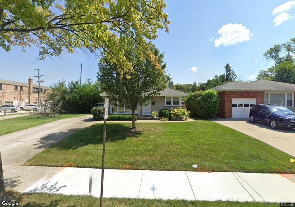
1217 S Cumberland Ave Park Ridge, IL 60068
O'Hare NeighborhoodEstimated Value: $467,000 - $515,285
3
Beds
2
Baths
1,224
Sq Ft
$402/Sq Ft
Est. Value
About This Home
This home is located at 1217 S Cumberland Ave, Park Ridge, IL 60068 and is currently estimated at $491,821, approximately $401 per square foot. 1217 S Cumberland Ave is a home located in Cook County with nearby schools including Theodore Roosevelt Elementary School, Lincoln Middle School, and Maine South High School.
Ownership History
Date
Name
Owned For
Owner Type
Purchase Details
Closed on
Jul 13, 2021
Sold by
Hoff Carolyn and Arlene Bickler Trust
Bought by
Grace K Touhy Family Trust
Current Estimated Value
Home Financials for this Owner
Home Financials are based on the most recent Mortgage that was taken out on this home.
Original Mortgage
$252,000
Outstanding Balance
$234,508
Interest Rate
4.75%
Mortgage Type
New Conventional
Estimated Equity
$257,313
Purchase Details
Closed on
Apr 1, 2020
Sold by
Hoff Carolyn and Hoff Carolyn
Bought by
Arlene Bickler Trust
Purchase Details
Closed on
Jan 9, 2019
Sold by
Bickler Arlene
Bought by
The Arlene Bickler Trust
Purchase Details
Closed on
Apr 17, 2002
Sold by
Bickler Paul and Bickler Arlene L
Bought by
Bickler Paul and The Paul Bickler Trust
Create a Home Valuation Report for This Property
The Home Valuation Report is an in-depth analysis detailing your home's value as well as a comparison with similar homes in the area
Home Values in the Area
Average Home Value in this Area
Purchase History
| Date | Buyer | Sale Price | Title Company |
|---|---|---|---|
| Grace K Touhy Family Trust | $315,000 | Chicago Title | |
| Arlene Bickler Trust | -- | Attorney | |
| The Arlene Bickler Trust | -- | Attorney | |
| Bickler Paul | -- | -- |
Source: Public Records
Mortgage History
| Date | Status | Borrower | Loan Amount |
|---|---|---|---|
| Open | Grace K Touhy Family Trust | $252,000 |
Source: Public Records
Tax History Compared to Growth
Tax History
| Year | Tax Paid | Tax Assessment Tax Assessment Total Assessment is a certain percentage of the fair market value that is determined by local assessors to be the total taxable value of land and additions on the property. | Land | Improvement |
|---|---|---|---|---|
| 2024 | $3,637 | $13,513 | $5,215 | $8,298 |
| 2023 | $3,486 | $13,513 | $5,215 | $8,298 |
| 2022 | $3,486 | $13,513 | $5,215 | $8,298 |
| 2021 | $2,712 | $11,389 | $3,911 | $7,478 |
| 2020 | $2,668 | $11,389 | $3,911 | $7,478 |
| 2019 | $2,627 | $12,581 | $3,911 | $8,670 |
| 2018 | $701 | $11,418 | $3,259 | $8,159 |
| 2017 | $683 | $11,418 | $3,259 | $8,159 |
| 2016 | $2,630 | $11,418 | $3,259 | $8,159 |
| 2015 | $2,494 | $9,982 | $2,793 | $7,189 |
| 2014 | $2,456 | $9,982 | $2,793 | $7,189 |
| 2013 | $2,314 | $9,982 | $2,793 | $7,189 |
Source: Public Records
Map
Nearby Homes
- 901 S Cumberland Ave
- 1116 S Cumberland Ave
- 820 W Talcott Rd
- 1015 Arthur St
- 1016 Arthur St
- 819 Albion Ave
- 1220 Courtland Ave
- 1014 S Chester Ave
- 919 S Chester Ave
- 1425 Brophy Ave
- 425 W Talcott Rd
- 1634 S Cumberland Ave
- 1219 S Western Ave
- 1610 S Greenwood Ave
- 1705 S Prospect Ave
- 623 S Prospect Ave
- 1715 S Greenwood Ave
- 929 S Aldine Ave
- 1632 S Vine Ave
- 600 S Greenwood Ave
- 1217 S Cumberland Ave
- 1221 S Cumberland Ave
- 1221 S Cumberland Ave
- 1225 S Cumberland Ave
- 1225 S Cumberland Ave
- 819 Devon Ave
- 1218 Brophy Ave
- 1212 Brophy Ave
- 1220 Brophy Ave
- 1229 S Cumberland Ave
- 811 Devon Ave Unit 207
- 811 Devon Ave
- 811 Devon Ave Unit 206
- 1226 Brophy Ave
- 807-817 Devon Ave
- 807 Devon Ave Unit 202
- 807 Devon Ave
- 807 Devon Ave
- 807 Devon Ave Unit 201
- 807 Devon Ave Unit 206