Estimated Value: $36,000 - $68,000
--
Bed
2
Baths
--
Sq Ft
3.31
Acres
About This Home
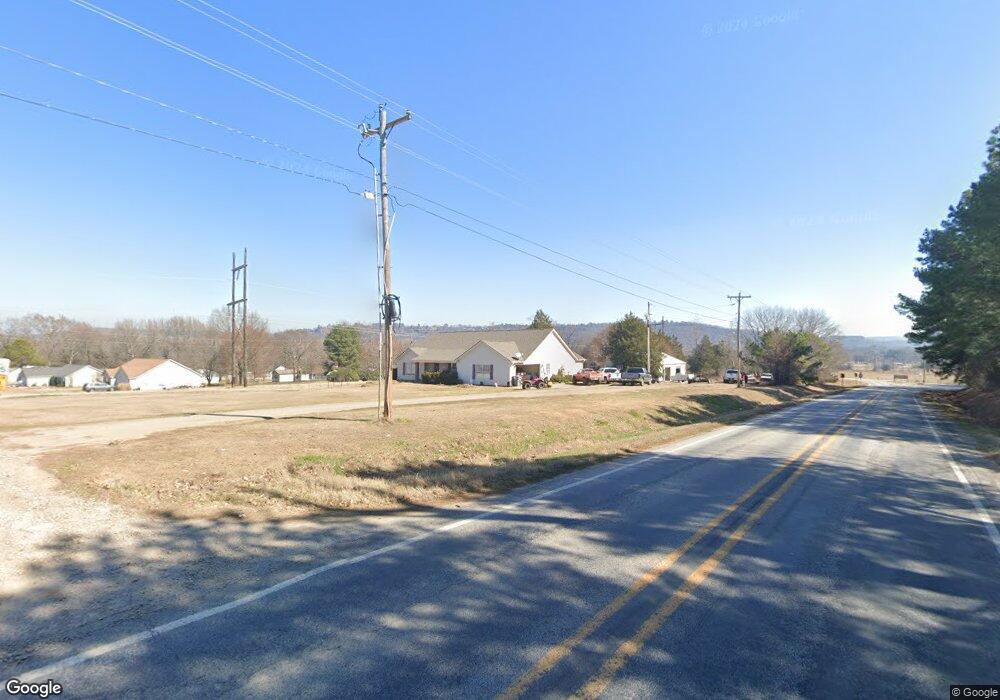
This home is located at 1217 S Taylor Rd, Ozark, AR 72949 and is currently estimated at $52,000. 1217 S Taylor Rd is a home located in Franklin County with nearby schools including Ozark Kindergarten School, Elgin B. Milton Elementary School, and Ozark Upper Elementary School.
Ownership History
Date
Name
Owned For
Owner Type
Purchase Details
Closed on
Feb 20, 2007
Sold by
Brockett Bill
Bought by
Thompson Allie
Current Estimated Value
Home Financials for this Owner
Home Financials are based on the most recent Mortgage that was taken out on this home.
Original Mortgage
$55,000
Interest Rate
6.25%
Mortgage Type
Purchase Money Mortgage
Purchase Details
Closed on
Aug 11, 2003
Bought by
Hillbilly and Ciampoli
Purchase Details
Closed on
May 23, 2003
Bought by
Hillbilly and Brockett
Purchase Details
Closed on
Sep 13, 2002
Bought by
Fultz and Realty Co
Create a Home Valuation Report for This Property
The Home Valuation Report is an in-depth analysis detailing your home's value as well as a comparison with similar homes in the area
Home Values in the Area
Average Home Value in this Area
Purchase History
| Date | Buyer | Sale Price | Title Company |
|---|---|---|---|
| Thompson Allie | -- | -- | |
| Hillbilly | $90,000 | -- | |
| Hillbilly | -- | -- | |
| Fultz | $5,300 | -- |
Source: Public Records
Mortgage History
| Date | Status | Borrower | Loan Amount |
|---|---|---|---|
| Closed | Thompson Allie | $55,000 |
Source: Public Records
Tax History Compared to Growth
Tax History
| Year | Tax Paid | Tax Assessment Tax Assessment Total Assessment is a certain percentage of the fair market value that is determined by local assessors to be the total taxable value of land and additions on the property. | Land | Improvement |
|---|---|---|---|---|
| 2024 | $113 | $2,360 | $2,360 | $0 |
| 2023 | $113 | $2,360 | $2,360 | $0 |
| 2022 | $113 | $2,360 | $2,360 | $0 |
| 2021 | $113 | $2,360 | $2,360 | $0 |
| 2020 | $113 | $2,360 | $2,360 | $0 |
| 2019 | $113 | $2,360 | $2,360 | $0 |
| 2018 | $113 | $2,360 | $2,360 | $0 |
| 2017 | $113 | $2,360 | $2,360 | $0 |
| 2016 | $113 | $2,360 | $2,360 | $0 |
| 2015 | $185 | $3,860 | $3,860 | $0 |
| 2014 | -- | $3,860 | $3,860 | $0 |
| 2013 | -- | $3,860 | $3,860 | $0 |
Source: Public Records
Map
Nearby Homes
- 1128 Santa fe Trail
- 1210 S Highway 23
- 1410 S Highway 23
- 905 Harris Rd
- 1311 S Highway 23
- 209 W River St
- 110 E Main St
- 2631 S Highway 309
- 506 W River St
- 100 E Commercial St
- 3775 E Highway 64
- 312 Alston St
- 809 W Gibson St
- 110 E Walker St
- 604 W Carver St
- 1105 W Gibson St
- 409 N 9th St
- 306 W Nickell St
- 217 Cloos Circle Dr
- 205 Cloos Circle Dr
- 1235 S Taylor Rd
- 1211 S Taylor Rd
- 1127 Terrah Ln
- 1114 S Highway 309
- 1200 S Taylor Rd
- 1119 S Highway 309
- 1137 Terrah Ln
- 1203 S Taylor Rd
- 1134 S Taylor Rd
- 1147 Terrah Ln
- 1135 S Taylor Rd
- 1238 Santa fe Trail
- 1037 S Highway 309
- 1124 S Taylor Rd
- 1218 Santa fe Trail
- 1102 Santa fe Ln
- 1055 Terrah Ln
- 1123 S Taylor Rd
- 1100 Santa fe Trail
- TBD Arkansas 309