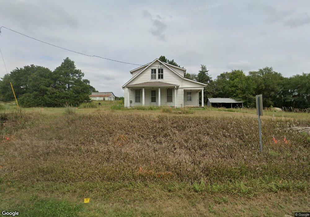
12175 Military Trail Rd Saint George, KS 66535
Estimated Value: $244,000 - $523,000
4
Beds
1
Bath
1,669
Sq Ft
$223/Sq Ft
Est. Value
About This Home
This home is located at 12175 Military Trail Rd, Saint George, KS 66535 and is currently estimated at $372,335, approximately $223 per square foot. 12175 Military Trail Rd is a home located in Pottawatomie County with nearby schools including Rock Creek Junior/Senior High School.
Ownership History
Date
Name
Owned For
Owner Type
Purchase Details
Closed on
Mar 26, 2024
Sold by
Joseph W Johns And Sharon L Johns Trust and Johns Joseph W
Bought by
Johns Clinton J and Wenger Samantha J
Current Estimated Value
Purchase Details
Closed on
Dec 21, 2023
Sold by
Joseph W Johns And Sharon L Johns Trust
Bought by
Johns Clinton J and Wenger Samantha J
Create a Home Valuation Report for This Property
The Home Valuation Report is an in-depth analysis detailing your home's value as well as a comparison with similar homes in the area
Home Values in the Area
Average Home Value in this Area
Purchase History
| Date | Buyer | Sale Price | Title Company |
|---|---|---|---|
| Johns Clinton J | -- | None Listed On Document | |
| Johns Clinton J | -- | None Listed On Document | |
| Johns Clinton J | -- | None Listed On Document | |
| Joseph W Johns And Sharon L Johns Trust | -- | None Listed On Document | |
| Joseph W Johns And Sharon L Johns Trust | -- | None Listed On Document |
Source: Public Records
Tax History Compared to Growth
Tax History
| Year | Tax Paid | Tax Assessment Tax Assessment Total Assessment is a certain percentage of the fair market value that is determined by local assessors to be the total taxable value of land and additions on the property. | Land | Improvement |
|---|---|---|---|---|
| 2025 | $176 | $1,836 | $1,836 | $0 |
| 2024 | $2 | $22,680 | $5,758 | $16,922 |
| 2023 | $2,126 | $22,297 | $5,810 | $16,487 |
| 2022 | $1,769 | $19,816 | $5,687 | $14,129 |
| 2021 | $1,769 | $18,435 | $5,216 | $13,219 |
| 2020 | $1,769 | $18,265 | $5,120 | $13,145 |
| 2019 | $1,731 | $17,661 | $4,766 | $12,895 |
| 2018 | $1,626 | $16,125 | $3,823 | $12,302 |
| 2017 | $1,374 | $15,507 | $3,586 | $11,921 |
| 2016 | $1,285 | $15,048 | $3,296 | $11,752 |
| 2015 | -- | $14,789 | $3,197 | $11,592 |
| 2014 | -- | $14,725 | $2,597 | $12,128 |
Source: Public Records
Map
Nearby Homes
- 13140 Anthony Dr
- 306 Snyder Dr
- 107 Quail Ct
- 00000 Countryside Ln Unit Lot 6
- 00000 Countryside Ln Unit Lot 20
- 00000 Countryside Ln Unit Lot 7
- 00000 Countryside Ln Unit Lot 16
- 00000 Countryside Ln Unit Lot 14
- 00000 Countryside Ln Unit Lot 9
- 00000 Countryside Ln Unit Lot 10
- 00000 Countryside Ln Unit Lot 24
- 00000 Countryside Ln Unit Lot 19
- 00000 Countryside Ln Unit Lot 4
- 00000 Countryside Ln Unit Lot 17
- 00000 Countryside Ln Unit Lot 22
- 00000 Countryside Ln Unit Lot 3
- 00000 Countryside Ln Unit Lot 11
- 00000 Countryside Ln Unit Lot 8
- 00000 Countryside Ln Unit Lot 1
- 00000 Countryside Ln Unit Lot 15
- 12155 Military Trail Rd
- 12160 Military Trail Rd
- 110 Lockett Ln
- 108 Lockett Ln
- 112 Lockett Ln
- 106 Lockett Ln
- 114 Lockett Ln
- 104 Lockett Ln
- 116 Lockett Ln
- 109 Lockett Ln
- 200 Blackjack Rd
- 102 Lockett Ln
- 105 Lockett Ln
- 13178 Anthony Dr
- 13141 Anthony Dr
- 13103 Anthony Dr
- 13102 Anthony Dr
- 118 Lockett Ln
- 115 Lockett Ln
- 100 Lockett Ln