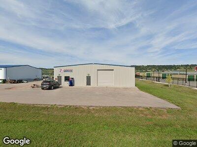
12176 Siouxland Rd Summerset, SD 57718
Estimated Value: $551,235
--
Bed
--
Bath
3,600
Sq Ft
$153/Sq Ft
Est. Value
About This Home
This home is located at 12176 Siouxland Rd, Summerset, SD 57718 and is currently estimated at $551,235, approximately $153 per square foot. 12176 Siouxland Rd is a home located in Meade County with nearby schools including Sturgis Brown High School - 01.
Ownership History
Date
Name
Owned For
Owner Type
Purchase Details
Closed on
Oct 20, 2020
Sold by
J & S Properties Llc
Bought by
Thomson Cody
Current Estimated Value
Home Financials for this Owner
Home Financials are based on the most recent Mortgage that was taken out on this home.
Original Mortgage
$320,000
Outstanding Balance
$288,625
Interest Rate
2.8%
Mortgage Type
New Conventional
Estimated Equity
$269,909
Purchase Details
Closed on
Jan 20, 2014
Sold by
Djoseland Justin
Bought by
J & S Properties Llc
Purchase Details
Closed on
Jan 14, 2013
Sold by
Stagebarn Partners Llc
Bought by
Jd'S Equipment Service Llc
Home Financials for this Owner
Home Financials are based on the most recent Mortgage that was taken out on this home.
Original Mortgage
$208,000
Interest Rate
3.31%
Create a Home Valuation Report for This Property
The Home Valuation Report is an in-depth analysis detailing your home's value as well as a comparison with similar homes in the area
Home Values in the Area
Average Home Value in this Area
Purchase History
| Date | Buyer | Sale Price | Title Company |
|---|---|---|---|
| Thomson Cody | $400,000 | Pennington Title | |
| J & S Properties Llc | -- | -- | |
| Jd'S Equipment Service Llc | -- | -- |
Source: Public Records
Mortgage History
| Date | Status | Borrower | Loan Amount |
|---|---|---|---|
| Open | Thomson Cody | $320,000 | |
| Previous Owner | Jd'S Equipment Services Llc | $208,000 |
Source: Public Records
Tax History Compared to Growth
Tax History
| Year | Tax Paid | Tax Assessment Tax Assessment Total Assessment is a certain percentage of the fair market value that is determined by local assessors to be the total taxable value of land and additions on the property. | Land | Improvement |
|---|---|---|---|---|
| 2024 | $4,576 | $297,278 | $52,708 | $244,570 |
| 2023 | $4,773 | $297,278 | $52,708 | $244,570 |
| 2022 | $5,141 | $297,278 | $52,708 | $244,570 |
| 2021 | $5,449 | $297,278 | $52,708 | $244,570 |
| 2020 | $3,883 | $297,278 | $52,708 | $244,570 |
| 2019 | $980 | $208,420 | $52,708 | $155,712 |
| 2018 | $721 | $208,420 | $52,708 | $155,712 |
| 2017 | $760 | $194,045 | $38,333 | $155,712 |
| 2016 | $0 | $194,045 | $0 | $0 |
| 2015 | $826 | $194,045 | $38,333 | $155,712 |
| 2013 | -- | $38,333 | $0 | $0 |
Source: Public Records
Map
Nearby Homes
- 8339 Stagestop Rd
- TBD Republic Rd Unit 7.602 AC
- TBD Republic Rd Unit 4.592 AC
- 13082 Kit Carson Trail
- 10945 Bellingham Dr
- 7234 Savannah Ln
- 10345 Remmington St
- 7380 Brighton St
- 10284 Remmington St
- 10273 Remmington St
- 10217 Remington St
- 10138 Ventura Ln
- 6725 Townsend St
- 10903 N High Meadows Dr
- 6850 Brighton St
- 7155 Mulberry Dr
- 8073 Foley Dr
- 6960 Emerald Heights Rd
- 6965 Mulberry Dr
- 9485 Astoria Ln
