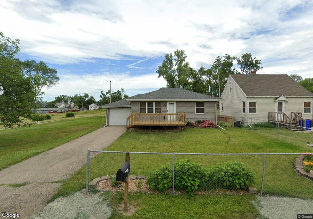
1218 22nd Ave SW Cedar Rapids, IA 52404
Southwest Area NeighborhoodEstimated Value: $137,000 - $153,000
2
Beds
2
Baths
742
Sq Ft
$195/Sq Ft
Est. Value
About This Home
This home is located at 1218 22nd Ave SW, Cedar Rapids, IA 52404 and is currently estimated at $144,383, approximately $194 per square foot. 1218 22nd Ave SW is a home located in Linn County with nearby schools including Junction City Elementary School, Grant Elementary School, and Bruce Hall Day Treatment Center.
Ownership History
Date
Name
Owned For
Owner Type
Purchase Details
Closed on
Oct 17, 2003
Sold by
Pazour Kenneth C and Pazour Virginia A
Bought by
Schminkey Sam C and Hogan Schminkey Sheri L
Current Estimated Value
Home Financials for this Owner
Home Financials are based on the most recent Mortgage that was taken out on this home.
Original Mortgage
$96,120
Outstanding Balance
$45,715
Interest Rate
6.49%
Mortgage Type
FHA
Estimated Equity
$98,668
Create a Home Valuation Report for This Property
The Home Valuation Report is an in-depth analysis detailing your home's value as well as a comparison with similar homes in the area
Home Values in the Area
Average Home Value in this Area
Purchase History
| Date | Buyer | Sale Price | Title Company |
|---|---|---|---|
| Schminkey Sam C | $96,500 | -- |
Source: Public Records
Mortgage History
| Date | Status | Borrower | Loan Amount |
|---|---|---|---|
| Open | Schminkey Sam C | $96,120 |
Source: Public Records
Tax History Compared to Growth
Tax History
| Year | Tax Paid | Tax Assessment Tax Assessment Total Assessment is a certain percentage of the fair market value that is determined by local assessors to be the total taxable value of land and additions on the property. | Land | Improvement |
|---|---|---|---|---|
| 2025 | $1,976 | $139,400 | $24,700 | $114,700 |
| 2024 | $2,202 | $129,100 | $22,400 | $106,700 |
| 2023 | $2,202 | $129,100 | $22,400 | $106,700 |
| 2022 | $1,716 | $113,300 | $20,200 | $93,100 |
| 2021 | $2,052 | $91,800 | $19,000 | $72,800 |
| 2020 | $2,052 | $101,600 | $16,800 | $84,800 |
| 2019 | $1,864 | $95,000 | $16,800 | $78,200 |
| 2018 | $1,808 | $95,000 | $16,800 | $78,200 |
| 2017 | $2,007 | $94,400 | $16,800 | $77,600 |
| 2016 | $2,007 | $94,400 | $16,800 | $77,600 |
| 2015 | $2,057 | $96,682 | $16,807 | $79,875 |
| 2014 | $1,872 | $96,682 | $16,807 | $79,875 |
| 2013 | $1,828 | $96,682 | $16,807 | $79,875 |
Source: Public Records
Map
Nearby Homes
- 1132 21st Ave SW
- 1227 19th Ave SW
- 1318 22nd Ave SW
- 1312 Wilson Ave SW
- 1332 Wilson Ave SW
- 826 21st Ave SW
- 1121 15th Ave SW
- 1621 9th St SW
- 1617 9th St SW
- 648 22nd Ave SW
- 1424 11th St SW
- 2150 Rockford Rd SW
- 1424 9th St SW
- 657 16th Ave SW
- 815 15th Ave SW
- 2025 18th St SW
- 1960 Rockford Rd SW Unit 45
- 1801 Shady Grove Rd SW
- 1806 Holly Meadow Ave SW
- 2105 Milligan Ct SW
- 1216 22nd Ave SW
- 1214 22nd Ave SW
- 1219 21st Ave SW
- 1215 21st Ave SW
- 1200 22nd Ave SW
- 1211 21st Ave SW
- 1222 Wilson Ave SW
- 1210 Wilson Ave SW
- 1228 Wilson Ave SW
- 1230 Wilson Ave SW
- 1211 22nd Ave SW
- 1207 21st Ave SW
- 1236 Wilson Ave SW
- 1204 Wilson Ave SW
- 0 12th St SW Unit 1801484
- 1243 22nd Ave SW
- 2210 12th St SW
- 1244 Wilson Ave SW
- 1148 22nd Ave SW
- 1254 22nd Ave SW