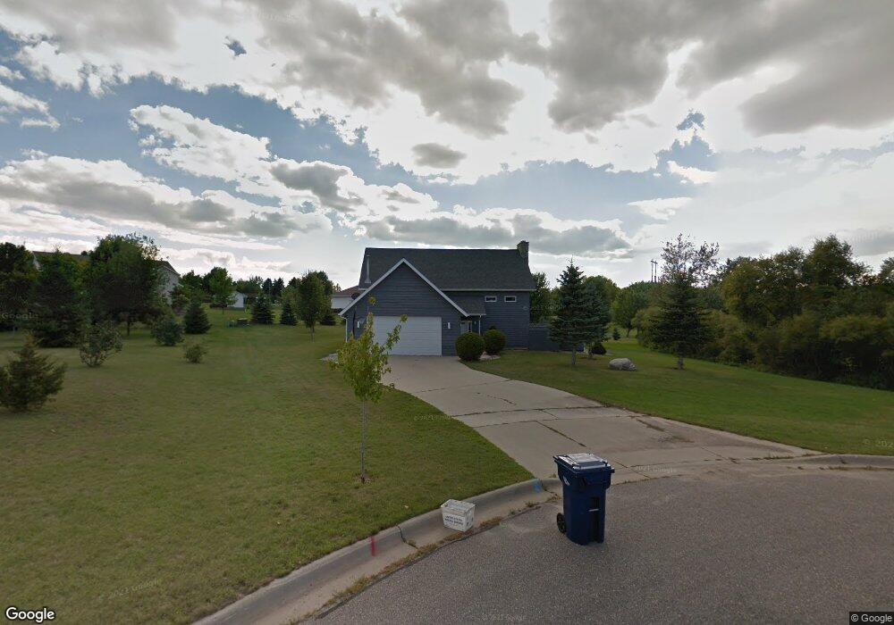
1218 Boulder Cir Fergus Falls, MN 56537
Estimated Value: $282,979 - $349,000
3
Beds
3
Baths
780
Sq Ft
$395/Sq Ft
Est. Value
About This Home
This home is located at 1218 Boulder Cir, Fergus Falls, MN 56537 and is currently estimated at $307,995, approximately $394 per square foot. 1218 Boulder Cir is a home located in Otter Tail County with nearby schools including McKinley Elementary School, Cleveland Elementary School, and Adams Elementary School.
Ownership History
Date
Name
Owned For
Owner Type
Purchase Details
Closed on
Jun 30, 2015
Sold by
Knutson Gary Gary
Bought by
Johnson Trever and Johnson Jayna
Current Estimated Value
Home Financials for this Owner
Home Financials are based on the most recent Mortgage that was taken out on this home.
Original Mortgage
$170,800
Outstanding Balance
$132,993
Interest Rate
3.82%
Estimated Equity
$175,002
Create a Home Valuation Report for This Property
The Home Valuation Report is an in-depth analysis detailing your home's value as well as a comparison with similar homes in the area
Home Values in the Area
Average Home Value in this Area
Purchase History
| Date | Buyer | Sale Price | Title Company |
|---|---|---|---|
| Johnson Trever | $174,000 | -- |
Source: Public Records
Mortgage History
| Date | Status | Borrower | Loan Amount |
|---|---|---|---|
| Open | Johnson Trever | $170,800 |
Source: Public Records
Tax History Compared to Growth
Tax History
| Year | Tax Paid | Tax Assessment Tax Assessment Total Assessment is a certain percentage of the fair market value that is determined by local assessors to be the total taxable value of land and additions on the property. | Land | Improvement |
|---|---|---|---|---|
| 2025 | $2,704 | $246,800 | $26,400 | $220,400 |
| 2024 | $2,826 | $239,000 | $26,400 | $212,600 |
| 2023 | $2,664 | $228,900 | $26,400 | $202,500 |
| 2022 | $2,516 | $266,400 | $0 | $0 |
| 2021 | $2,986 | $228,900 | $26,400 | $202,500 |
| 2020 | $2,906 | $230,900 | $24,200 | $206,700 |
| 2019 | $2,776 | $210,100 | $24,200 | $185,900 |
| 2018 | $2,530 | $210,100 | $24,200 | $185,900 |
| 2017 | $2,462 | $197,700 | $21,100 | $176,600 |
| 2016 | $2,286 | $182,400 | $21,100 | $161,300 |
| 2015 | $2,152 | $0 | $0 | $0 |
| 2014 | -- | $178,000 | $21,100 | $156,900 |
Source: Public Records
Map
Nearby Homes
- 1854 Buck Ridge Dr
- 1410 Ridgewood Dr
- 2046 Northwood Ln
- 1523 Ironwood Rd
- 1024 Circle Ln
- 1235 Mitchell Place
- 1502 Viking Ct
- 1110 Water Plant Rd
- 1604 Somerset Rd
- 1216 College St
- 1240 Northern Ave
- 1213 N Aurdal Ave
- 702 E Beech Ave
- 24135 County Highway 27
- 904 N Aurdal Ave
- 408 E Beech Ave
- 214 E Cherry Ave
- TBD Valley Dr
- 217 E Beech Ave
- 1446 Campus Dr
- 1226 Boulder Cir
- 1211 Stony Brook Rd
- 1215 Stony Brook Rd
- 1235 Boulder Cir
- 1234 Boulder Cir
- 1235 Stony Brook Rd
- 1949 Oakwood View
- 1951 Oakwood View
- 1210 Stony Brook Rd
- 1218 Stony Brook Rd
- 1953 Oakwood View
- 1204 Stony Brook Rd
- 1121 Stony Brook Rd
- Xxx Stony Brook Rd
- 1942 Oakwood View
- 1955 Oakwood View
- 1938 Oakwood View
- 1944 Oakwood View
- 1946 Oakwood View
- 1231 Oakwood View