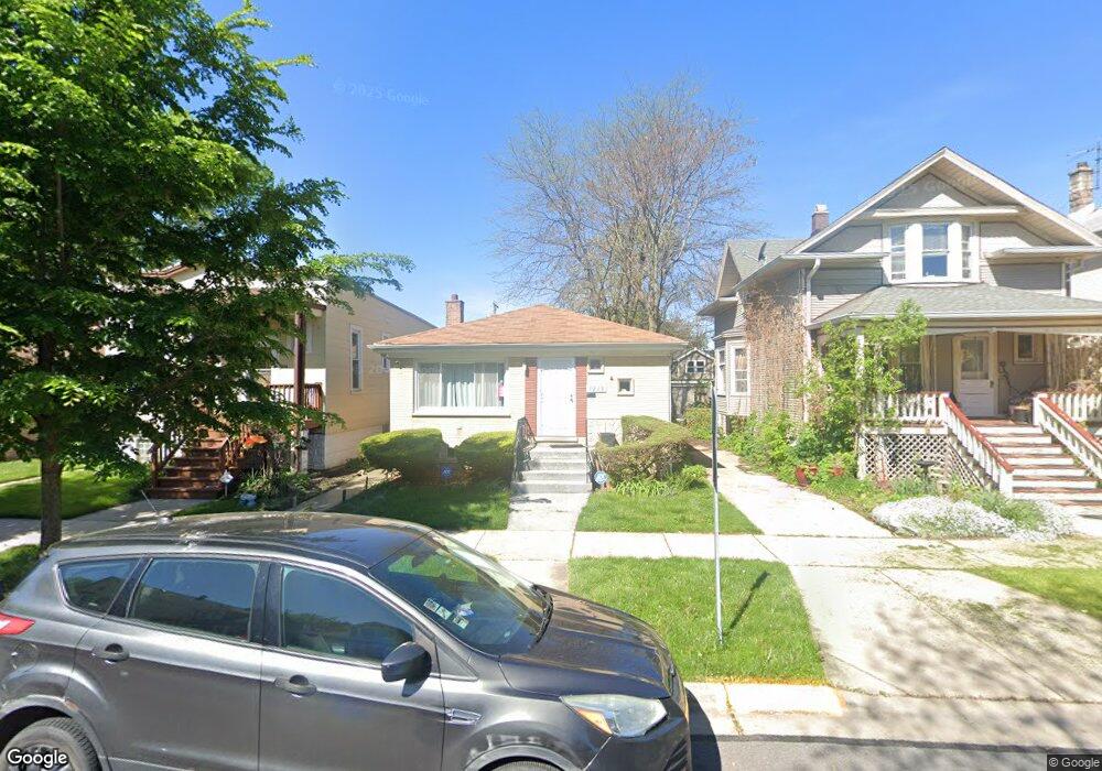
1218 Clarence Ave Berwyn, IL 60402
Estimated Value: $271,000 - $335,000
3
Beds
2
Baths
1,100
Sq Ft
$273/Sq Ft
Est. Value
About This Home
This home is located at 1218 Clarence Ave, Berwyn, IL 60402 and is currently estimated at $300,108, approximately $272 per square foot. 1218 Clarence Ave is a home located in Cook County with nearby schools including Prairie Oak School, Lincoln Middle School, and J. Sterling Morton High School West.
Ownership History
Date
Name
Owned For
Owner Type
Purchase Details
Closed on
May 24, 2024
Sold by
Scott Jemelah
Bought by
Franklin Tremist and Jones Reginald K
Current Estimated Value
Home Financials for this Owner
Home Financials are based on the most recent Mortgage that was taken out on this home.
Original Mortgage
$294,566
Outstanding Balance
$290,606
Interest Rate
7.1%
Mortgage Type
FHA
Estimated Equity
$9,502
Purchase Details
Closed on
Sep 11, 2015
Sold by
Tarakh Zinoviy
Bought by
Scott Jemelah
Home Financials for this Owner
Home Financials are based on the most recent Mortgage that was taken out on this home.
Original Mortgage
$118,750
Interest Rate
3.99%
Mortgage Type
New Conventional
Purchase Details
Closed on
Mar 30, 2006
Sold by
Zsk Properties Inc
Bought by
Tarakh Zinoviy
Home Financials for this Owner
Home Financials are based on the most recent Mortgage that was taken out on this home.
Original Mortgage
$183,400
Interest Rate
6.48%
Mortgage Type
Fannie Mae Freddie Mac
Purchase Details
Closed on
May 19, 2005
Sold by
Emc Mortgage Corp
Bought by
Zsk Properties Inc
Purchase Details
Closed on
Mar 31, 2005
Sold by
Comma Omar L
Bought by
Wells Fargo Bank Minnesota Na and Bear Stearns Asset Backed Securities Tru
Purchase Details
Closed on
May 2, 2001
Sold by
Labaguis Olivia L
Bought by
Comma Omar L
Home Financials for this Owner
Home Financials are based on the most recent Mortgage that was taken out on this home.
Original Mortgage
$160,050
Interest Rate
7.18%
Purchase Details
Closed on
Sep 16, 1999
Sold by
Gray Gary R and Gray Michaelene
Bought by
Labaguis Olivia U
Home Financials for this Owner
Home Financials are based on the most recent Mortgage that was taken out on this home.
Original Mortgage
$126,652
Interest Rate
7.87%
Mortgage Type
FHA
Create a Home Valuation Report for This Property
The Home Valuation Report is an in-depth analysis detailing your home's value as well as a comparison with similar homes in the area
Home Values in the Area
Average Home Value in this Area
Purchase History
| Date | Buyer | Sale Price | Title Company |
|---|---|---|---|
| Franklin Tremist | $300,000 | None Listed On Document | |
| Franklin Tremist | $300,000 | None Listed On Document | |
| Scott Jemelah | $125,000 | First American Title Ins Co | |
| Tarakh Zinoviy | $262,000 | Ticor Title Insurance Compan | |
| Zsk Properties Inc | $202,000 | Cti | |
| Wells Fargo Bank Minnesota Na | -- | -- | |
| Comma Omar L | $168,500 | Chicago Title Insurance Co | |
| Labaguis Olivia U | $127,500 | Professional National Title |
Source: Public Records
Mortgage History
| Date | Status | Borrower | Loan Amount |
|---|---|---|---|
| Open | Franklin Tremist | $294,566 | |
| Closed | Franklin Tremist | $294,566 | |
| Previous Owner | Scott Jemelah | $118,750 | |
| Previous Owner | Tarakh Zinoviy | $183,400 | |
| Previous Owner | Comma Omar L | $160,050 | |
| Previous Owner | Labaguis Olivia U | $126,652 |
Source: Public Records
Tax History Compared to Growth
Tax History
| Year | Tax Paid | Tax Assessment Tax Assessment Total Assessment is a certain percentage of the fair market value that is determined by local assessors to be the total taxable value of land and additions on the property. | Land | Improvement |
|---|---|---|---|---|
| 2024 | $5,560 | $21,001 | $4,253 | $16,748 |
| 2023 | $4,103 | $21,001 | $4,253 | $16,748 |
| 2022 | $4,103 | $13,660 | $3,686 | $9,974 |
| 2021 | $3,943 | $13,659 | $3,685 | $9,974 |
| 2020 | $3,924 | $13,659 | $3,685 | $9,974 |
| 2019 | $4,053 | $13,256 | $3,307 | $9,949 |
| 2018 | $3,891 | $13,256 | $3,307 | $9,949 |
| 2017 | $4,969 | $16,316 | $3,307 | $13,009 |
| 2016 | $4,685 | $13,573 | $2,740 | $10,833 |
| 2015 | $4,545 | $13,573 | $2,740 | $10,833 |
| 2014 | $4,440 | $13,573 | $2,740 | $10,833 |
| 2013 | $4,446 | $15,025 | $2,740 | $12,285 |
Source: Public Records
Map
Nearby Homes
- 1335 Wesley Ave
- 1321 East Ave
- 1183 S Scoville Ave
- 1156 Wesley Ave
- 1336 Grove Ave
- 1243 Elmwood Ave
- 1223 S Elmwood Ave Unit TWO
- 1341 Kenilworth Ave
- 1442 Oak Park Ave
- 1435 Gunderson Ave
- 1135 S Oak Park Ave
- 1510 Scoville Ave
- 1125 Gunderson Ave
- 1333 Clinton Ave
- 6337 Roosevelt Rd Unit 309
- 6337 Roosevelt Rd Unit 103
- 1336 Cuyler Ave
- 1324 Clinton Ave
- 1342 Clinton Ave
- 1133 S Ridgeland Ave
- 1220 Clarence Ave
- 1216 Clarence Ave
- 1222 Clarence Ave
- 1214 Clarence Ave
- 1226 Clarence Ave
- 1212 Clarence Ave
- 1230 Clarence Ave
- 1217 Wesley Ave
- 1215 Wesley Ave
- 1225 Wesley Ave
- 1225 Wesley Ave
- 1225 Wesley Ave Unit 1
- 1232 Clarence Ave
- 6625 Roosevelt Rd
- 6631 Roosevelt Rd
- 1211 Wesley Ave
- 1227 Wesley Ave
- 6633 Roosevelt Rd
- 1229 Wesley Ave
- 6627 Roosevelt Rd