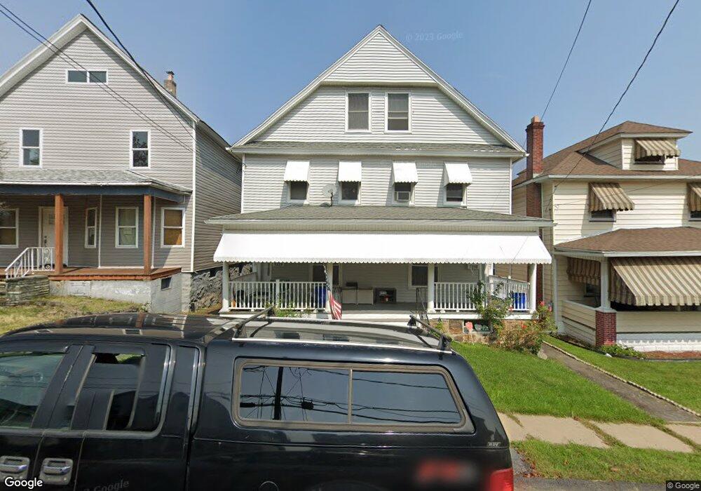
1218 Dartmouth St Unit 1220 Scranton, PA 18504
Hyde Park NeighborhoodEstimated Value: $229,000 - $245,000
--
Bed
--
Bath
--
Sq Ft
5,009
Sq Ft Lot
About This Home
This home is located at 1218 Dartmouth St Unit 1220, Scranton, PA 18504 and is currently estimated at $234,951. 1218 Dartmouth St Unit 1220 is a home located in Lackawanna County with nearby schools including Longan Elementary School, Adams Elementary School, and Frances Willard School.
Ownership History
Date
Name
Owned For
Owner Type
Purchase Details
Closed on
Sep 5, 2025
Sold by
Zackoski Peggy and Zackoski Jennifer
Bought by
Sanchez Lanny Ivette Tejed
Current Estimated Value
Home Financials for this Owner
Home Financials are based on the most recent Mortgage that was taken out on this home.
Original Mortgage
$218,500
Outstanding Balance
$218,500
Interest Rate
6.74%
Mortgage Type
New Conventional
Estimated Equity
$16,451
Purchase Details
Closed on
Aug 25, 2017
Sold by
Traino Joseph and Traino Michael
Bought by
Zackoski Peggy and Zackoski Jennifer
Home Financials for this Owner
Home Financials are based on the most recent Mortgage that was taken out on this home.
Original Mortgage
$80,514
Interest Rate
3.99%
Mortgage Type
FHA
Purchase Details
Closed on
Oct 26, 2011
Sold by
Traino Joseph
Bought by
Traino Michael
Create a Home Valuation Report for This Property
The Home Valuation Report is an in-depth analysis detailing your home's value as well as a comparison with similar homes in the area
Home Values in the Area
Average Home Value in this Area
Purchase History
| Date | Buyer | Sale Price | Title Company |
|---|---|---|---|
| Sanchez Lanny Ivette Tejed | $230,000 | None Listed On Document | |
| Zackoski Peggy | $82,000 | None Available | |
| Traino Michael | -- | None Available |
Source: Public Records
Mortgage History
| Date | Status | Borrower | Loan Amount |
|---|---|---|---|
| Open | Sanchez Lanny Ivette Tejed | $218,500 | |
| Previous Owner | Zackoski Peggy | $80,514 |
Source: Public Records
Tax History Compared to Growth
Tax History
| Year | Tax Paid | Tax Assessment Tax Assessment Total Assessment is a certain percentage of the fair market value that is determined by local assessors to be the total taxable value of land and additions on the property. | Land | Improvement |
|---|---|---|---|---|
| 2025 | $3,199 | $10,000 | $1,500 | $8,500 |
| 2024 | $2,923 | $10,000 | $1,500 | $8,500 |
| 2023 | $2,923 | $10,000 | $1,500 | $8,500 |
| 2022 | $2,858 | $10,000 | $1,500 | $8,500 |
| 2021 | $2,858 | $10,000 | $1,500 | $8,500 |
| 2020 | $2,804 | $10,000 | $1,500 | $8,500 |
| 2019 | $2,637 | $10,000 | $1,500 | $8,500 |
| 2018 | $2,637 | $10,000 | $1,500 | $8,500 |
| 2017 | $2,590 | $10,000 | $1,500 | $8,500 |
| 2016 | $0 | $10,000 | $1,500 | $8,500 |
| 2015 | $1,941 | $10,000 | $1,500 | $8,500 |
| 2014 | -- | $10,000 | $1,500 | $8,500 |
Source: Public Records
Map
Nearby Homes
- 1234 Bryn Mawr St Unit 11
- 924 S Main Ave
- 816 12th Ave
- 1215 Eynon St
- 1223 Eynon St
- 1157-59 Hampton St
- 901 Eynon St
- 730 W Locust St
- 1227-1229 Hampton St
- 1021 Fellows St
- 1301 Sloan St
- 1335 Sloan St
- 1009 1011 Acker Ave Unit L 109
- 610 Landis St
- 414 S 416 S Edwards Ct
- 1115 Watson St
- 625 Landis St
- 1203 Acker Ave
- 407-409 10th Ave
- 727 Fellows St
- 1218 Dartmouth St Unit L
- 1222 Dartmouth St
- 1214 Dartmouth St
- 1224 Dartmouth St
- 1212 Dartmouth St
- 1226 Dartmouth St
- 1204 Dartmouth St
- 1217 Dartmouth St
- 1129 W Locust St
- 1219 Dartmouth St
- 1125 W Locust St Unit 1125 1/2
- 1127 W Locust St Unit 1127 1/2
- 1125 W 1125 1 2 Locust St
- 1228 Dartmouth St
- 1202 Dartmouth St
- 1131 W Locust St
- 1133 1/2 W Locust St
- 1131 1131 1/2 W Locust St
- 1215 Dartmouth St Unit L5
- 1221 Dartmouth St