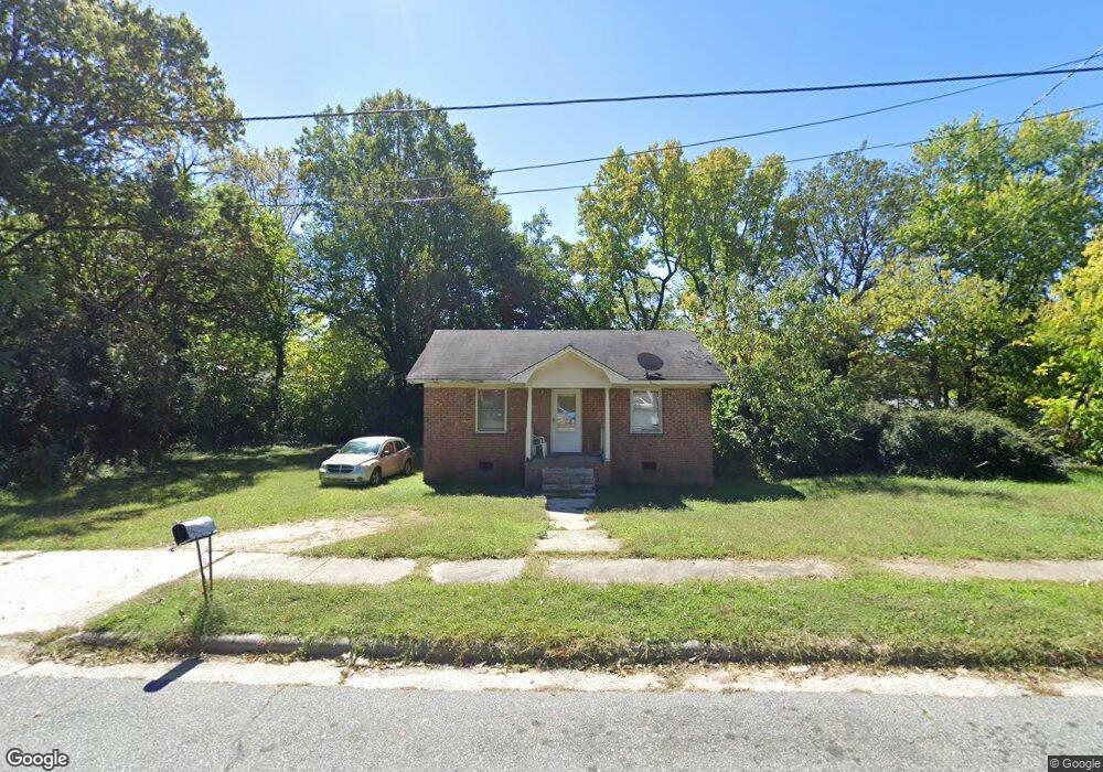
1218 Hoover Ave High Point, NC 27260
Greater High Point NeighborhoodEstimated Value: $102,773 - $185,000
2
Beds
1
Bath
840
Sq Ft
$163/Sq Ft
Est. Value
About This Home
This home is located at 1218 Hoover Ave, High Point, NC 27260 and is currently estimated at $137,193, approximately $163 per square foot. 1218 Hoover Ave is a home located in Guilford County with nearby schools including Parkview Village Elementary School, Southwest Guilford Middle School, and Southwest Guilford High School.
Ownership History
Date
Name
Owned For
Owner Type
Purchase Details
Closed on
Jan 3, 2020
Sold by
Vannguyen Nhan and Tran Nhung
Bought by
Tran Vu
Current Estimated Value
Purchase Details
Closed on
Mar 28, 2005
Sold by
Rhoney Lisa H and Rhoney Barry M
Bought by
Vannguyen Nhan
Home Financials for this Owner
Home Financials are based on the most recent Mortgage that was taken out on this home.
Original Mortgage
$5,000
Interest Rate
5.88%
Mortgage Type
Seller Take Back
Create a Home Valuation Report for This Property
The Home Valuation Report is an in-depth analysis detailing your home's value as well as a comparison with similar homes in the area
Home Values in the Area
Average Home Value in this Area
Purchase History
| Date | Buyer | Sale Price | Title Company |
|---|---|---|---|
| Tran Vu | $5,000 | None Available | |
| Vannguyen Nhan | $5,000 | -- |
Source: Public Records
Mortgage History
| Date | Status | Borrower | Loan Amount |
|---|---|---|---|
| Previous Owner | Vannguyen Nhan | $5,000 |
Source: Public Records
Tax History
| Year | Tax Paid | Tax Assessment Tax Assessment Total Assessment is a certain percentage of the fair market value that is determined by local assessors to be the total taxable value of land and additions on the property. | Land | Improvement |
|---|---|---|---|---|
| 2025 | $642 | $46,600 | $8,000 | $38,600 |
| 2024 | $642 | $46,600 | $8,000 | $38,600 |
| 2023 | $642 | $46,600 | $8,000 | $38,600 |
| 2022 | $628 | $46,600 | $8,000 | $38,600 |
| 2021 | $448 | $32,500 | $4,000 | $28,500 |
| 2020 | $448 | $32,500 | $4,000 | $28,500 |
| 2019 | $448 | $32,500 | $0 | $0 |
| 2018 | $446 | $32,500 | $0 | $0 |
| 2017 | $446 | $32,500 | $0 | $0 |
| 2016 | $348 | $24,800 | $0 | $0 |
| 2015 | $350 | $24,800 | $0 | $0 |
| 2014 | $356 | $24,800 | $0 | $0 |
Source: Public Records
Map
Nearby Homes
- 1224 S Downing St
- 1204 Pearson Place
- 1201 Pearson Place
- 230 Windley St
- 412 Meredith St
- 410 Meredith St
- 1504 East Ave
- 1506 East Ave
- 1423 E Commerce Ave
- 114 Eccles Place
- 1314 Franklin Ave
- 1614 Oneka Ave
- 505 Kent Ct
- 402 Walnut St
- 511 Hines St
- 518 Whiteoak St
- 205 Beach St
- 517 Walnut St
- 811 Worth St
- 526 White Oak St
- 1216 Hoover Ave
- 1220 Hoover Ave
- 1214 Hoover Ave
- 1217 Pearson Place
- 1215 Pearson Place
- 1219 Pearson Place
- 1213 Pearson Place
- 1221 Pearson Place
- 1219 Hoover Ave
- 1217 Hoover Ave
- 1211 Pearson Place
- 1221 Hoover Ave
- 1225 Pearson Place
- 1226 Hoover Ave
- 1215 Hoover Ave
- 1223 Hoover Ave
- 1209 Pearson Place
- 1227 Pearson Place
- 1206 Hoover Ave
- 1225 Hoover Ave
Your Personal Tour Guide
Ask me questions while you tour the home.