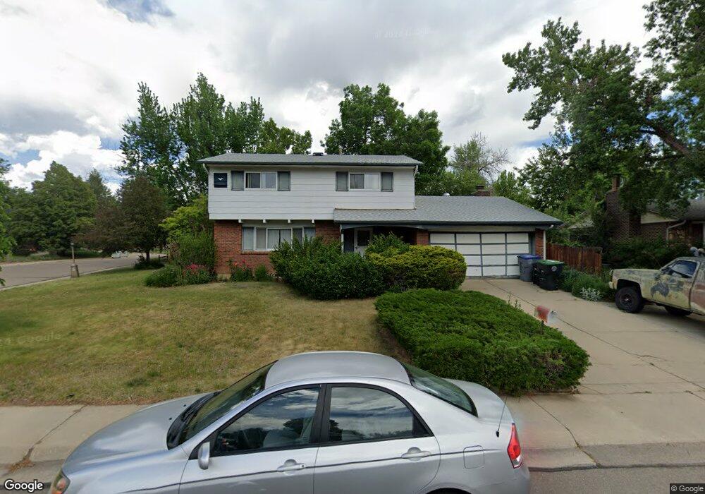
1218 Lefthand Dr Longmont, CO 80501
Southmoor NeighborhoodEstimated Value: $596,000 - $637,000
4
Beds
3
Baths
2,740
Sq Ft
$223/Sq Ft
Est. Value
About This Home
This home is located at 1218 Lefthand Dr, Longmont, CO 80501 and is currently estimated at $611,914, approximately $223 per square foot. 1218 Lefthand Dr is a home located in Boulder County with nearby schools including Indian Peaks Elementary School, Sunset Middle School, and Niwot High School.
Ownership History
Date
Name
Owned For
Owner Type
Purchase Details
Closed on
Jun 7, 1994
Sold by
Brinkel Margaret M
Bought by
Smythe Granville D
Current Estimated Value
Home Financials for this Owner
Home Financials are based on the most recent Mortgage that was taken out on this home.
Original Mortgage
$123,900
Interest Rate
8.49%
Purchase Details
Closed on
May 19, 1994
Sold by
Garilli Margaret M
Bought by
Brinkel Margaret M
Home Financials for this Owner
Home Financials are based on the most recent Mortgage that was taken out on this home.
Original Mortgage
$123,900
Interest Rate
8.49%
Purchase Details
Closed on
Jul 22, 1993
Bought by
Perez Anthony R and Perez Jitka
Purchase Details
Closed on
Apr 12, 1983
Bought by
Perez Anthony R and Perez Jitka
Create a Home Valuation Report for This Property
The Home Valuation Report is an in-depth analysis detailing your home's value as well as a comparison with similar homes in the area
Home Values in the Area
Average Home Value in this Area
Purchase History
| Date | Buyer | Sale Price | Title Company |
|---|---|---|---|
| Smythe Granville D | $134,900 | Security Title Guaranty Co | |
| Brinkel Margaret M | -- | -- | |
| Perez Anthony R | -- | -- | |
| Perez Anthony R | $90,000 | -- |
Source: Public Records
Mortgage History
| Date | Status | Borrower | Loan Amount |
|---|---|---|---|
| Closed | Smythe Granville D | $123,900 |
Source: Public Records
Tax History Compared to Growth
Tax History
| Year | Tax Paid | Tax Assessment Tax Assessment Total Assessment is a certain percentage of the fair market value that is determined by local assessors to be the total taxable value of land and additions on the property. | Land | Improvement |
|---|---|---|---|---|
| 2025 | $3,404 | $36,031 | $13,875 | $22,156 |
| 2024 | $3,404 | $36,031 | $13,875 | $22,156 |
| 2023 | $3,357 | $35,584 | $17,326 | $21,943 |
| 2022 | $2,962 | $29,934 | $12,239 | $17,695 |
| 2021 | $3,000 | $30,795 | $12,591 | $18,204 |
| 2020 | $2,744 | $28,243 | $10,153 | $18,090 |
| 2019 | $2,700 | $28,243 | $10,153 | $18,090 |
| 2018 | $2,305 | $24,271 | $7,056 | $17,215 |
| 2017 | $2,274 | $26,833 | $7,801 | $19,032 |
| 2016 | $2,042 | $21,365 | $7,005 | $14,360 |
| 2015 | $1,946 | $18,292 | $5,492 | $12,800 |
| 2014 | $1,709 | $18,292 | $5,492 | $12,800 |
Source: Public Records
Map
Nearby Homes
- 1350 S Lincoln St
- 1435 Ashcroft Dr
- 1435 Missouri Ave
- 1327 Brookfield Dr
- 1801 S Pratt Pkwy
- 919 S Sherman St
- 1527 S Vivian St
- 1456 Sepia Ave
- 1518 Sepia Ave
- 1028 Katy Ln
- 1072 Kane Dr
- 832 S Bowen St
- 1328 S Terry St
- 2030 Emerald Dr
- 1343 S Coffman St
- 9 Seattle Ln
- 2050 Emerald Dr
- 1208 S Coffman St
- 802 Neon Forest Cir
- 1321 Onyx Cir
- 1212 Lefthand Dr
- 1206 Lefthand Dr
- 1344 S Lincoln St
- 1359 S Lincoln St
- 1345 S Bowen St
- 1355 S Lincoln St
- 1301 Lefthand Dr
- 1213 Lefthand Dr
- 1351 S Lincoln St
- 1341 S Bowen St
- 1340 S Lincoln St
- 1347 S Lincoln St
- 1207 Lefthand Dr
- 1307 Lefthand Dr
- 1428 S Grant St
- 1420 S Grant St
- 1343 S Lincoln St
- 1336 S Lincoln St
- 1315 Lefthand Dr
- 1337 S Bowen St