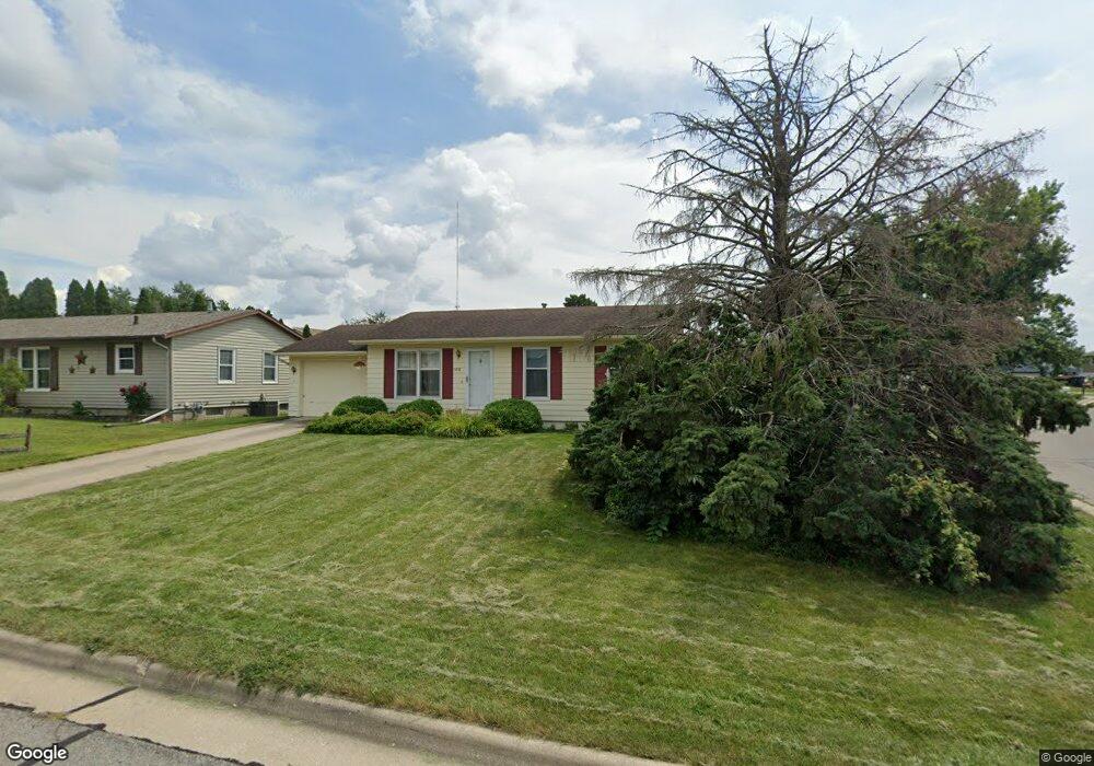
1218 Rolling Meadows Rd Marshalltown, IA 50158
Estimated Value: $168,071 - $194,000
3
Beds
1
Bath
884
Sq Ft
$207/Sq Ft
Est. Value
About This Home
This home is located at 1218 Rolling Meadows Rd, Marshalltown, IA 50158 and is currently estimated at $183,018, approximately $207 per square foot. 1218 Rolling Meadows Rd is a home located in Marshall County with nearby schools including Fisher Elementary School, B.R. Miller Middle School, and Marshalltown High School.
Ownership History
Date
Name
Owned For
Owner Type
Purchase Details
Closed on
Jan 9, 2008
Sold by
Stebniski Ronald D and Stebniski Sherri J
Bought by
Stoltenow Peter A
Current Estimated Value
Home Financials for this Owner
Home Financials are based on the most recent Mortgage that was taken out on this home.
Original Mortgage
$88,000
Interest Rate
6.13%
Mortgage Type
New Conventional
Purchase Details
Closed on
Sep 14, 2005
Sold by
Gethmann Investment Co
Bought by
Stebniski Ronald D and Stebniski Sherri J
Home Financials for this Owner
Home Financials are based on the most recent Mortgage that was taken out on this home.
Original Mortgage
$300,000
Interest Rate
5.93%
Mortgage Type
Construction
Create a Home Valuation Report for This Property
The Home Valuation Report is an in-depth analysis detailing your home's value as well as a comparison with similar homes in the area
Home Values in the Area
Average Home Value in this Area
Purchase History
| Date | Buyer | Sale Price | Title Company |
|---|---|---|---|
| Stoltenow Peter A | $110,000 | None Available | |
| Stebniski Ronald D | $45,000 | None Available |
Source: Public Records
Mortgage History
| Date | Status | Borrower | Loan Amount |
|---|---|---|---|
| Closed | Stoltenow Peter A | $88,000 | |
| Previous Owner | Stebniski Ronald D | $300,000 |
Source: Public Records
Tax History Compared to Growth
Tax History
| Year | Tax Paid | Tax Assessment Tax Assessment Total Assessment is a certain percentage of the fair market value that is determined by local assessors to be the total taxable value of land and additions on the property. | Land | Improvement |
|---|---|---|---|---|
| 2025 | $2,632 | $165,090 | $9,690 | $155,400 |
| 2024 | $2,632 | $146,510 | $9,690 | $136,820 |
| 2023 | $2,264 | $146,510 | $9,690 | $136,820 |
| 2022 | $2,288 | $109,970 | $9,690 | $100,280 |
| 2021 | $2,224 | $109,970 | $9,690 | $100,280 |
| 2020 | $2,426 | $102,950 | $9,690 | $93,260 |
Source: Public Records
Map
Nearby Homes
- 906 Prairie Ln
- 3002 S 8th St
- 836 W Merle Hibbs Blvd
- 802 Woodside Dr
- 2626 Knollway Dr
- 2622 Knollway Dr
- 2606 Knollway Dr
- 801 Woodside Dr
- 823 W Merle Hibbs Blvd
- 825 W Merle Hibbs Blvd
- 827 W Merle Hibbs Blvd
- 806 Woodside Dr
- 805 Woodside Dr
- 819 W Merle Hibbs Blvd
- 807 W Merle Hibbs Blvd
- 821 W Merle Hibbs Blvd
- 2614 Knollway Dr
- 2610 Knollway Dr
- 803 Woodside Dr
- 2617 Knollway Dr
- 1216 Rolling Meadows Rd
- 1304 Greenfield Dr
- 1301 Greenfield Dr
- 1306 Greenfield Dr
- 3105 Fieldcrest Ct
- 3103 Fieldcrest Ct
- 1212 Rolling Meadows Rd
- 1301 Rolling Meadows Rd
- 1304 Rolling Meadows Rd
- 1221 Rolling Meadows Rd
- 1308 Greenfield Dr
- 3107 Fieldcrest Ct
- 1217 Rolling Meadows Rd
- 1219 Rolling Meadows Rd
- 1305 Greenfield Dr
- 1306 Rolling Meadows Rd
- 1310 Greenfield Dr
- 1311 Greenfield Dr
- 3102 Fieldcrest Ct
- 3109 Fieldcrest Ct