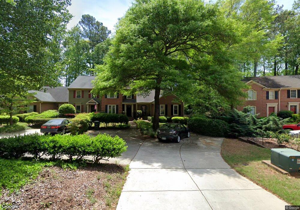
1218 Whitlock Ridge Dr SW Unit 1 Marietta, GA 30064
Northwestern Marietta NeighborhoodEstimated Value: $291,000 - $340,000
3
Beds
3
Baths
1,676
Sq Ft
$193/Sq Ft
Est. Value
About This Home
This home is located at 1218 Whitlock Ridge Dr SW Unit 1, Marietta, GA 30064 and is currently estimated at $323,861, approximately $193 per square foot. 1218 Whitlock Ridge Dr SW Unit 1 is a home located in Cobb County with nearby schools including A.L. Burruss Elementary School, Marietta Sixth Grade Academy, and Marietta Middle School.
Ownership History
Date
Name
Owned For
Owner Type
Purchase Details
Closed on
Dec 5, 2016
Sold by
Susan M
Bought by
Wilson Ginger S and Wilson Susan M
Current Estimated Value
Purchase Details
Closed on
Mar 23, 2006
Sold by
Barnett Carol C
Bought by
Wilson Susan
Purchase Details
Closed on
Jun 25, 1999
Sold by
Jones Robert E and Jones Patricia L
Bought by
Barnett Carol C
Purchase Details
Closed on
Apr 26, 1996
Sold by
Bryan Gloria B
Bought by
Jones Robert E Patricia
Create a Home Valuation Report for This Property
The Home Valuation Report is an in-depth analysis detailing your home's value as well as a comparison with similar homes in the area
Home Values in the Area
Average Home Value in this Area
Purchase History
| Date | Buyer | Sale Price | Title Company |
|---|---|---|---|
| Wilson Ginger S | -- | -- | |
| Wilson Susan | $140,000 | -- | |
| Barnett Carol C | $125,000 | -- | |
| Jones Robert E Patricia | $97,900 | -- |
Source: Public Records
Mortgage History
| Date | Status | Borrower | Loan Amount |
|---|---|---|---|
| Closed | Jones Robert E Patricia | $0 |
Source: Public Records
Tax History Compared to Growth
Tax History
| Year | Tax Paid | Tax Assessment Tax Assessment Total Assessment is a certain percentage of the fair market value that is determined by local assessors to be the total taxable value of land and additions on the property. | Land | Improvement |
|---|---|---|---|---|
| 2025 | $448 | $131,324 | $34,000 | $97,324 |
| 2024 | $448 | $117,292 | $34,000 | $83,292 |
| 2023 | $296 | $117,292 | $34,000 | $83,292 |
| 2022 | $448 | $88,972 | $16,000 | $72,972 |
| 2021 | $459 | $79,692 | $16,000 | $63,692 |
| 2020 | $457 | $69,240 | $14,000 | $55,240 |
| 2019 | $457 | $64,952 | $8,000 | $56,952 |
| 2018 | $457 | $64,952 | $8,000 | $56,952 |
| 2017 | $332 | $58,056 | $8,000 | $50,056 |
| 2016 | $313 | $55,132 | $8,000 | $47,132 |
| 2015 | $307 | $50,400 | $10,000 | $40,400 |
| 2014 | $317 | $50,400 | $0 | $0 |
Source: Public Records
Map
Nearby Homes
- 1077 New Haven Dr SW Unit 12A
- 1141 Whitlock Ave NW
- 1032 Chippendale Trail SW
- 945 Burnt Hickory Cir NW Unit 8
- 805 Manning Way SW
- 927 Burnt Hickory Cir NW Unit 10
- 818 Manning Way SW Unit 1
- 290 Westland Way SW
- 560 Manning Rd SW
- 1156 Grand Oaks Glen NW
- 1211 Cliffpine Ct SW
- 917 Wemberley Ln
- 909 Wemberley Ln
- 984 Wemberley Ln
- 1410 Dallas Cir SW
- 260 Manning Rd SW Unit 110
- 1099 Burnt Hickory Rd NW
- 002 Wakehurst Way
- 201 Wakehurst Way
- 920 Wemberley Ln
- 1216 Whitlock Ridge Dr SW
- 1224 Whitlock Ridge Dr SW
- 1214 Whitlock Ridge Dr SW
- 1214 Whitlock Ridge Dr SW
- 1214 Whitlock Ridge Dr SW Unit 1214
- 1214 Whitlock Ridge Dr SW Unit 1214
- 1212 Whitlock Ridge Dr SW
- 1226 Whitlock Ridge Dr SW Unit B
- 1228 Whitlock Ridge Dr SW
- 1230 Whitlock Ridge Dr SW
- 1150 Whitlock Ave NW
- 1211 Whitlock Ridge Dr SW Unit 1211
- 1211 Whitlock Ridge Dr SW Unit 20
- 1213 Whitlock Ridge Dr SW
- 1215 Whitlock Ridge Dr SW
- 1217 Whitlock Ridge Dr SW
- 1238 Whitlock Ridge Dr SW
- 1219 Whitlock Ridge Dr SW
- 1219 Whitock Ridge
- 1240 Whitlock Ridge Dr SW