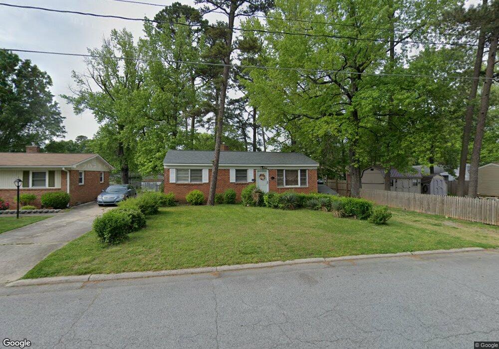
1219 Camden Ave High Point, NC 27260
Greater High Point NeighborhoodEstimated Value: $137,000 - $158,000
3
Beds
1
Bath
975
Sq Ft
$151/Sq Ft
Est. Value
About This Home
This home is located at 1219 Camden Ave, High Point, NC 27260 and is currently estimated at $147,324, approximately $151 per square foot. 1219 Camden Ave is a home located in Guilford County with nearby schools including Montlieu Academy of Technology, Welborn Academy of Science & Technology, and T.W. Andrews High School.
Ownership History
Date
Name
Owned For
Owner Type
Purchase Details
Closed on
Aug 28, 2004
Sold by
Harper Robert Earl and Harper Jenette
Bought by
Barbee Lewis E and Barbee Ellen H
Current Estimated Value
Purchase Details
Closed on
Feb 20, 2002
Sold by
Barbee Ellen H and Barbee Lewis E
Bought by
Harper Moses
Home Financials for this Owner
Home Financials are based on the most recent Mortgage that was taken out on this home.
Original Mortgage
$20,000
Interest Rate
7.02%
Create a Home Valuation Report for This Property
The Home Valuation Report is an in-depth analysis detailing your home's value as well as a comparison with similar homes in the area
Home Values in the Area
Average Home Value in this Area
Purchase History
| Date | Buyer | Sale Price | Title Company |
|---|---|---|---|
| Barbee Lewis E | -- | -- | |
| Harper Moses | $64,500 | -- |
Source: Public Records
Mortgage History
| Date | Status | Borrower | Loan Amount |
|---|---|---|---|
| Previous Owner | Harper Moses | $20,000 | |
| Closed | Harper Moses | $9,377 |
Source: Public Records
Tax History Compared to Growth
Tax History
| Year | Tax Paid | Tax Assessment Tax Assessment Total Assessment is a certain percentage of the fair market value that is determined by local assessors to be the total taxable value of land and additions on the property. | Land | Improvement |
|---|---|---|---|---|
| 2025 | $506 | $73,500 | $14,000 | $59,500 |
| 2024 | $506 | $73,500 | $14,000 | $59,500 |
| 2023 | $506 | $73,500 | $14,000 | $59,500 |
| 2022 | $495 | $73,500 | $14,000 | $59,500 |
| 2021 | $395 | $57,300 | $9,000 | $48,300 |
| 2020 | $395 | $57,300 | $9,000 | $48,300 |
| 2019 | $395 | $57,300 | $0 | $0 |
| 2018 | $393 | $57,300 | $0 | $0 |
| 2017 | $393 | $57,300 | $0 | $0 |
| 2016 | $391 | $55,700 | $0 | $0 |
| 2015 | $393 | $55,700 | $0 | $0 |
| 2014 | $399 | $55,700 | $0 | $0 |
Source: Public Records
Map
Nearby Homes
- 1005 Gordon St
- 1007 Gordon St
- 1606 Boundary Ave
- 1604 Boundary Ave
- 1602 Boundary Ave
- 1508 Boundary Ave
- 1120 Carolina St
- 901 Circle Dr
- 1728 Brooks Ave
- 2507 E Lexington Ave
- 1528 Graves Ave
- 2515 Dallas Ave
- 1109 Terrell Dr
- 1445 Bailey Cir
- 1514 Kingsway Dr
- 1519 Mcguinn Dr
- 1224 S Downing St
- 504 Meredith St
- 208 Underhill St
- 1908 Leonard Ave
- 1217 Camden Ave
- 603 Gordon St
- 1215 Camden Ave
- 601 Gordon St
- 605 Gordon St
- 1214 Dartmouth Ave
- 1212 Dartmouth Ave
- 1213 Camden Ave
- 1218 Camden Ave
- 509 Gordon St
- 1216 Camden Ave
- 607 Gordon St
- 1210 Dartmouth Ave
- 1214 Camden Ave
- 1211 Camden Ave
- 1212 Camden Ave
- 1208 Dartmouth Ave
- 1209 Camden Ave
- 1210 Camden Ave
- 701 Gordon St