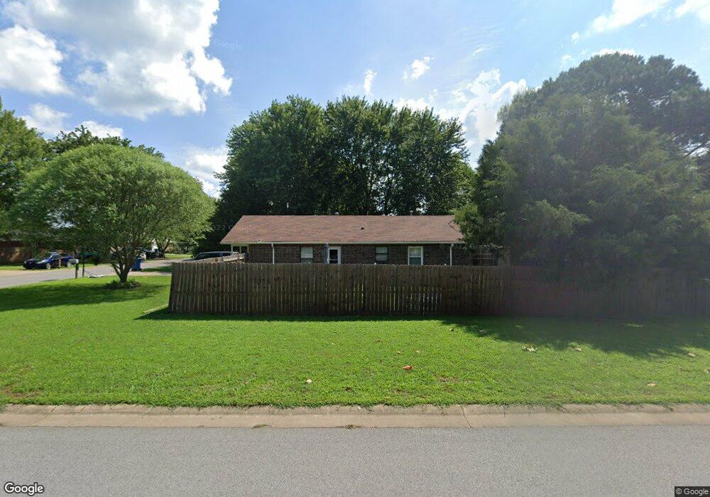
1219 Flint Place Gentry, AR 72734
Estimated Value: $189,184 - $220,000
3
Beds
1
Bath
1,040
Sq Ft
$196/Sq Ft
Est. Value
About This Home
This home is located at 1219 Flint Place, Gentry, AR 72734 and is currently estimated at $204,296, approximately $196 per square foot. 1219 Flint Place is a home located in Benton County with nearby schools including Gentry Primary School, Gentry Intermediate School, and Gentry Middle School.
Ownership History
Date
Name
Owned For
Owner Type
Purchase Details
Closed on
Jan 12, 2011
Sold by
Federal National Mortgage Association
Bought by
Bledsoe Cecil E
Current Estimated Value
Purchase Details
Closed on
Oct 17, 2010
Sold by
Arvest Mortgage Company
Bought by
Federal National Mortgage Association
Purchase Details
Closed on
Oct 15, 2010
Sold by
Hayes William S
Bought by
Arvest Mortgage Company
Purchase Details
Closed on
Nov 15, 2006
Sold by
Hayes Doris
Bought by
Hayes William and Hayes Leola
Purchase Details
Closed on
Jan 19, 1993
Bought by
Hayes
Create a Home Valuation Report for This Property
The Home Valuation Report is an in-depth analysis detailing your home's value as well as a comparison with similar homes in the area
Home Values in the Area
Average Home Value in this Area
Purchase History
| Date | Buyer | Sale Price | Title Company |
|---|---|---|---|
| Bledsoe Cecil E | -- | None Available | |
| Federal National Mortgage Association | -- | None Available | |
| Arvest Mortgage Company | $48,208 | None Available | |
| Hayes William | -- | None Available | |
| Hayes | $8,000 | -- |
Source: Public Records
Tax History Compared to Growth
Tax History
| Year | Tax Paid | Tax Assessment Tax Assessment Total Assessment is a certain percentage of the fair market value that is determined by local assessors to be the total taxable value of land and additions on the property. | Land | Improvement |
|---|---|---|---|---|
| 2025 | $1,219 | $33,430 | $7,000 | $26,430 |
| 2024 | $1,105 | $33,430 | $7,000 | $26,430 |
| 2023 | $1,004 | $21,580 | $5,000 | $16,580 |
| 2022 | $977 | $21,580 | $5,000 | $16,580 |
| 2021 | $893 | $21,580 | $5,000 | $16,580 |
| 2020 | $815 | $13,960 | $1,800 | $12,160 |
| 2019 | $815 | $13,960 | $1,800 | $12,160 |
| 2018 | $815 | $13,960 | $1,800 | $12,160 |
| 2017 | $750 | $13,960 | $1,800 | $12,160 |
| 2016 | $750 | $13,960 | $1,800 | $12,160 |
| 2015 | $646 | $11,680 | $1,800 | $9,880 |
| 2014 | $646 | $11,680 | $1,800 | $9,880 |
Source: Public Records
Map
Nearby Homes
- 300 White Oak St
- 216 White Oak St
- 200 Post Oak Ave
- 108 White Oak St
- 104 White Oak St
- 305 Whitten Ave
- 217 Whitten Ave
- 313 Whitten Ave
- 225 Whitten Ave
- 309 Whitten Ave
- 301 Whitten Ave
- Rc Morgan Plan at Crowder
- RC Kinsley II Plan at Crowder
- RC Baltimore Plan at Crowder
- RC Coleman Plan at Crowder
- RC Carnegie II Plan at Crowder
- RC Glenwood Plan at Crowder
- RC Raleigh Plan at Crowder
- 904 W Main St
- 613 S Smith Ave
- 1193 Flint Place
- 674 Bloomfield St
- 1218 Flint Place
- 694 Bloomfield St
- 1194 Flint Place
- 673 Duckworth St
- 1171 Flint Place
- 675 Bloomfield St
- 591 Bloomfield St
- 693 Duckworth St
- 695 Bloomfield St
- 1172 Flint Place
- 714 Bloomfield St
- 571 Bloomfield St
- 713 Duckworth St
- 569 Duckworth St
- 715 Bloomfield St
- 600 Red Oak St
- 618 Red Oak St
- 572 Red Oak St