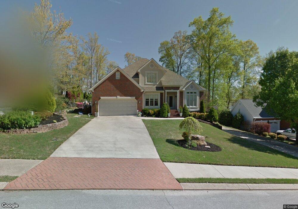
1219 Harbor Point Dr Soddy Daisy, TN 37379
Estimated Value: $566,000 - $689,000
5
Beds
4
Baths
3,319
Sq Ft
$189/Sq Ft
Est. Value
About This Home
This home is located at 1219 Harbor Point Dr, Soddy Daisy, TN 37379 and is currently estimated at $626,018, approximately $188 per square foot. 1219 Harbor Point Dr is a home located in Hamilton County.
Ownership History
Date
Name
Owned For
Owner Type
Purchase Details
Closed on
Jul 6, 2001
Sold by
Colquette Kenneth B and Colquette Golda E
Bought by
Hamblen James Richard and Hamblen Jeannie M
Current Estimated Value
Home Financials for this Owner
Home Financials are based on the most recent Mortgage that was taken out on this home.
Original Mortgage
$211,500
Outstanding Balance
$81,684
Interest Rate
7.17%
Mortgage Type
Purchase Money Mortgage
Estimated Equity
$544,334
Purchase Details
Closed on
May 25, 2000
Sold by
Vanmeter Robert C and Vanmeter Dianna L
Bought by
Colquette Kenneth B and Colquette Golda E
Home Financials for this Owner
Home Financials are based on the most recent Mortgage that was taken out on this home.
Original Mortgage
$175,000
Interest Rate
8.14%
Mortgage Type
Balloon
Purchase Details
Closed on
Sep 30, 1996
Sold by
Cordell J Scotty and Cordell Leann L
Bought by
Vanmeter Robert C and Vanmeter Dianna L
Home Financials for this Owner
Home Financials are based on the most recent Mortgage that was taken out on this home.
Original Mortgage
$173,600
Interest Rate
7.87%
Mortgage Type
Balloon
Create a Home Valuation Report for This Property
The Home Valuation Report is an in-depth analysis detailing your home's value as well as a comparison with similar homes in the area
Home Values in the Area
Average Home Value in this Area
Purchase History
| Date | Buyer | Sale Price | Title Company |
|---|---|---|---|
| Hamblen James Richard | $235,000 | Northgate Title Escrow Inc | |
| Colquette Kenneth B | $224,000 | Legal Title & Escrow Inc | |
| Vanmeter Robert C | $217,000 | Legal Title & Escrow Inc |
Source: Public Records
Mortgage History
| Date | Status | Borrower | Loan Amount |
|---|---|---|---|
| Open | Hamblen James Richard | $211,500 | |
| Previous Owner | Colquette Kenneth B | $175,000 | |
| Previous Owner | Vanmeter Robert C | $173,600 |
Source: Public Records
Tax History Compared to Growth
Tax History
| Year | Tax Paid | Tax Assessment Tax Assessment Total Assessment is a certain percentage of the fair market value that is determined by local assessors to be the total taxable value of land and additions on the property. | Land | Improvement |
|---|---|---|---|---|
| 2024 | $1,977 | $88,375 | $0 | $0 |
| 2023 | $2,972 | $88,375 | $0 | $0 |
| 2022 | $2,972 | $88,375 | $0 | $0 |
| 2021 | $2,972 | $88,375 | $0 | $0 |
| 2020 | $3,184 | $77,100 | $0 | $0 |
| 2019 | $3,184 | $77,100 | $0 | $0 |
| 2018 | $3,184 | $77,100 | $0 | $0 |
| 2017 | $3,184 | $77,100 | $0 | $0 |
| 2016 | $3,167 | $0 | $0 | $0 |
| 2015 | $3,167 | $76,700 | $0 | $0 |
| 2014 | $3,076 | $0 | $0 | $0 |
Source: Public Records
Map
Nearby Homes
- 11312 Hixson Pike
- 11636 Holly Cir
- 11652 Hixson Pike
- 11734 Armstrong Rd
- 1235 Bentley Ln
- 1055 Apollo Dr
- 11570 Armstrong Rd
- 11008 Lovell Rd
- 11213 Dayton Pike
- 11317 Cape View
- 1708 Restful Dr
- 191 Depot St
- 176 Depot St
- 155 Depot St
- 168 Depot St
- 1121 Natural Way
- 11942 Old Dayton Pike
- 345 Ducktown St
- 10627 Jeneva Ln
- 10496 Sovereign Pointe Dr
- 1121 Harbor Point Dr
- 1221 Harbor Point Dr
- 1097 Harbor Point Dr
- 0 Harbor Point Dr
- 1104 Clift Cave Rd
- 1118 Harbor Point Dr
- 1098 Harbor Point Dr
- 1095 Harbor Point Dr
- 1108 Clift Cave Dr
- 1108 Clift Cave Rd
- 1120 Harbor Point Dr
- 1040 Clift Cave Rd
- 1093 Harbor Point Dr
- 1125 Harbor Point Dr
- 1122 Harbor Point Dr
- 1112 Clift Cave Rd
- 1036 Clift Cave Rd
- 1096 Harbor Point Dr
- 1100 Harbor Landing Dr
- 1034 Clift Cave Dr