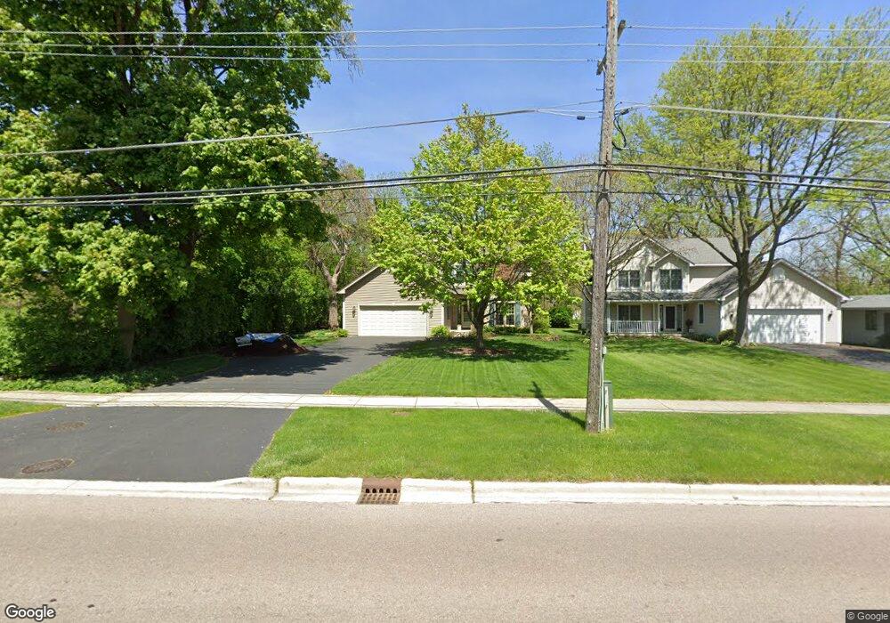
1219 Manchester Rd Wheaton, IL 60187
West Wheaton NeighborhoodEstimated Value: $569,000 - $674,000
--
Bed
1
Bath
2,483
Sq Ft
$257/Sq Ft
Est. Value
About This Home
This home is located at 1219 Manchester Rd, Wheaton, IL 60187 and is currently estimated at $638,112, approximately $256 per square foot. 1219 Manchester Rd is a home located in DuPage County with nearby schools including Clarence E Culver School, Emerson Elementary School, and Monroe Middle School.
Ownership History
Date
Name
Owned For
Owner Type
Purchase Details
Closed on
Apr 22, 2019
Sold by
Bischoff Scott A and Bischoff Mary L
Bought by
The Bischoff Joint Living Trust
Current Estimated Value
Purchase Details
Closed on
Feb 9, 2000
Sold by
Roberts John J
Bought by
Bischoff Scott A and Bischoff Mary L
Home Financials for this Owner
Home Financials are based on the most recent Mortgage that was taken out on this home.
Original Mortgage
$208,400
Outstanding Balance
$68,891
Interest Rate
8.16%
Estimated Equity
$569,221
Create a Home Valuation Report for This Property
The Home Valuation Report is an in-depth analysis detailing your home's value as well as a comparison with similar homes in the area
Home Values in the Area
Average Home Value in this Area
Purchase History
| Date | Buyer | Sale Price | Title Company |
|---|---|---|---|
| The Bischoff Joint Living Trust | -- | Attorney | |
| Bischoff Scott A | $244,000 | Chicago Title Insurance Co |
Source: Public Records
Mortgage History
| Date | Status | Borrower | Loan Amount |
|---|---|---|---|
| Open | Bischoff Scott A | $208,400 |
Source: Public Records
Tax History Compared to Growth
Tax History
| Year | Tax Paid | Tax Assessment Tax Assessment Total Assessment is a certain percentage of the fair market value that is determined by local assessors to be the total taxable value of land and additions on the property. | Land | Improvement |
|---|---|---|---|---|
| 2024 | $11,175 | $189,392 | $38,122 | $151,270 |
| 2023 | $10,700 | $174,330 | $35,090 | $139,240 |
| 2022 | $10,647 | $164,740 | $33,160 | $131,580 |
| 2021 | $10,604 | $160,830 | $32,370 | $128,460 |
| 2020 | $10,568 | $159,330 | $32,070 | $127,260 |
| 2019 | $10,318 | $155,120 | $31,220 | $123,900 |
| 2018 | $10,660 | $158,180 | $29,420 | $128,760 |
| 2017 | $10,490 | $152,340 | $28,330 | $124,010 |
| 2016 | $10,721 | $146,260 | $27,200 | $119,060 |
| 2015 | $10,642 | $139,530 | $25,950 | $113,580 |
| 2014 | $8,638 | $112,530 | $18,500 | $94,030 |
| 2013 | $8,416 | $112,870 | $18,560 | $94,310 |
Source: Public Records
Map
Nearby Homes
- 218 N Woodlawn St
- 119 N Dorchester Ave
- 1321 W Liberty Dr
- 505 S Knollwood Dr
- 1222 Champion Forest Ct
- 200 N Erie St
- 0N042 Nepil Ave
- 0S015 Cottonwood Dr
- 921 & 933 N College Ave
- 0N105 Lot 1 Nepil Ave
- 0N105 Lot 2 Nepil Ave
- 418 W Franklin St
- 100 N Gary Ave Unit 304
- 620 Crest St
- 615 Polo Dr
- 906 W Roosevelt Rd
- 127 N West St
- 1489 Woodcutter Ln Unit A
- 123 N West St
- 26W278 Harrison Ave
- 1213 Manchester Rd
- 1207 Manchester Rd
- 1305 Manchester Rd
- 1305 Manchester Rd
- 1201 Manchester Rd
- 1216 Manchester Rd
- 1212 Manchester Rd
- 1208 Manchester Rd
- 241 N Woodlawn St
- 1119 Manchester Rd
- 1204 Manchester Rd
- 240 N Woodlawn St
- 1118 Manchester Rd
- 1113 Manchester Rd
- 1308 Manchester Rd
- 231 N Woodlawn St
- 1114 Manchester Rd
- 228 N Knollwood Dr
- 1312 Manchester Rd
- 1110 Manchester Rd