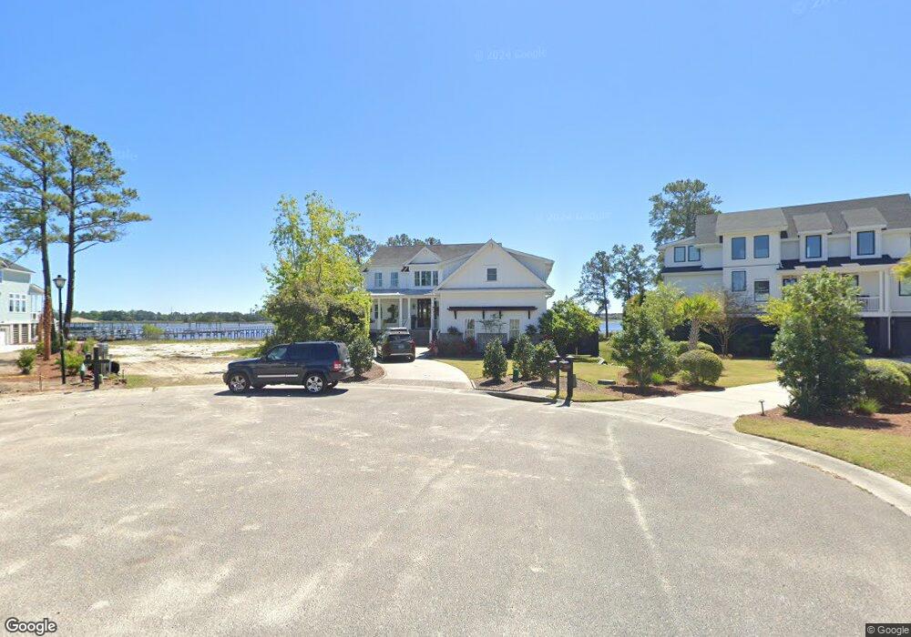
1219 Rivers Reach Dr Cainhoy, SC 29406
Wando NeighborhoodEstimated Value: $1,213,000 - $2,260,564
--
Bed
--
Bath
5,057
Sq Ft
$369/Sq Ft
Est. Value
About This Home
This home is located at 1219 Rivers Reach Dr, Cainhoy, SC 29406 and is currently estimated at $1,863,855, approximately $368 per square foot. 1219 Rivers Reach Dr is a home located in Berkeley County.
Ownership History
Date
Name
Owned For
Owner Type
Purchase Details
Closed on
Nov 3, 2014
Sold by
Wando River Llc
Bought by
Lonneman Kyle and Lonneman Tara
Current Estimated Value
Home Financials for this Owner
Home Financials are based on the most recent Mortgage that was taken out on this home.
Original Mortgage
$934,857
Outstanding Balance
$722,937
Interest Rate
4.26%
Mortgage Type
Construction
Estimated Equity
$1,140,918
Purchase Details
Closed on
Aug 23, 2005
Sold by
River Reach Pointe Llc
Bought by
Wando River Llc
Create a Home Valuation Report for This Property
The Home Valuation Report is an in-depth analysis detailing your home's value as well as a comparison with similar homes in the area
Home Values in the Area
Average Home Value in this Area
Purchase History
| Date | Buyer | Sale Price | Title Company |
|---|---|---|---|
| Lonneman Kyle | $410,000 | -- | |
| Wando River Llc | $425,000 | -- |
Source: Public Records
Mortgage History
| Date | Status | Borrower | Loan Amount |
|---|---|---|---|
| Open | Lonneman Kyle | $934,857 |
Source: Public Records
Tax History Compared to Growth
Tax History
| Year | Tax Paid | Tax Assessment Tax Assessment Total Assessment is a certain percentage of the fair market value that is determined by local assessors to be the total taxable value of land and additions on the property. | Land | Improvement |
|---|---|---|---|---|
| 2025 | $5,385 | $1,492,706 | $618,867 | $873,839 |
| 2024 | $5,385 | $59,709 | $24,755 | $34,954 |
| 2023 | $5,385 | $59,709 | $24,755 | $34,954 |
| 2022 | $5,436 | $51,920 | $20,797 | $31,123 |
| 2021 | $5,601 | $51,920 | $20,797 | $31,123 |
| 2020 | $5,685 | $51,920 | $20,797 | $31,123 |
| 2019 | $5,639 | $51,920 | $20,797 | $31,123 |
| 2018 | $5,091 | $45,148 | $16,200 | $28,948 |
| 2017 | $4,919 | $45,148 | $16,200 | $28,948 |
| 2016 | $7,652 | $45,150 | $16,200 | $28,950 |
| 2015 | $6,441 | $27,420 | $24,300 | $3,120 |
| 2014 | $3,332 | $13,460 | $13,460 | $0 |
| 2013 | -- | $13,460 | $13,460 | $0 |
Source: Public Records
Map
Nearby Homes
- 1216 Rivers Reach Dr
- 1019 Jervey Point Rd
- 141 Wando Reach Rd
- 142 Wando Reach Rd
- 133 Wando Reach Rd
- 1185 Rivers Reach Dr
- 117 Wando Reach Rd
- 213 Ashmont Dr
- 112 Berkshire Dr
- 1436 Water Edge Dr
- 1126 Peninsula Cove Dr
- 237 Nelliefield Creek Dr
- 308 Tidal Rice Ct
- 214 Rice Mill Place
- 1102 Waters Inlet Cir
- 213 Nelliefield Creek Dr
- 537 Spiral Ramp Ct
- 420 Nelliefield Trail
- 1344 Palm Cove Dr
- 1221 Harriman Ln
- 1220 Rivers Reach Dr
- 1220 Rivers Reach Dr
- 1217 Rivers Reach Dr
- 1217 Rivers Reach Dr
- 1218 Rivers Reach Dr
- 1215 Rivers Reach Dr
- 1218 Rivers Reach Dr
- 1216 Rivers Reach Rd
- 1216 Rivers Reach Dr
- 65 Rivers Reach Dr
- 1214 Rivers Reach Dr
- 1213 Rivers Reach Dr
- 1210 Rivers Reach Dr
- 1210 Rivers Reach Dr
- 1211 Rivers Reach Dr
- 1208 Rivers Reach Dr
- 1208 Rivers Reach Dr
- 1209 Rivers Reach Dr
- 1206 Rivers Reach Dr
- 1030 Jervey Point Rd