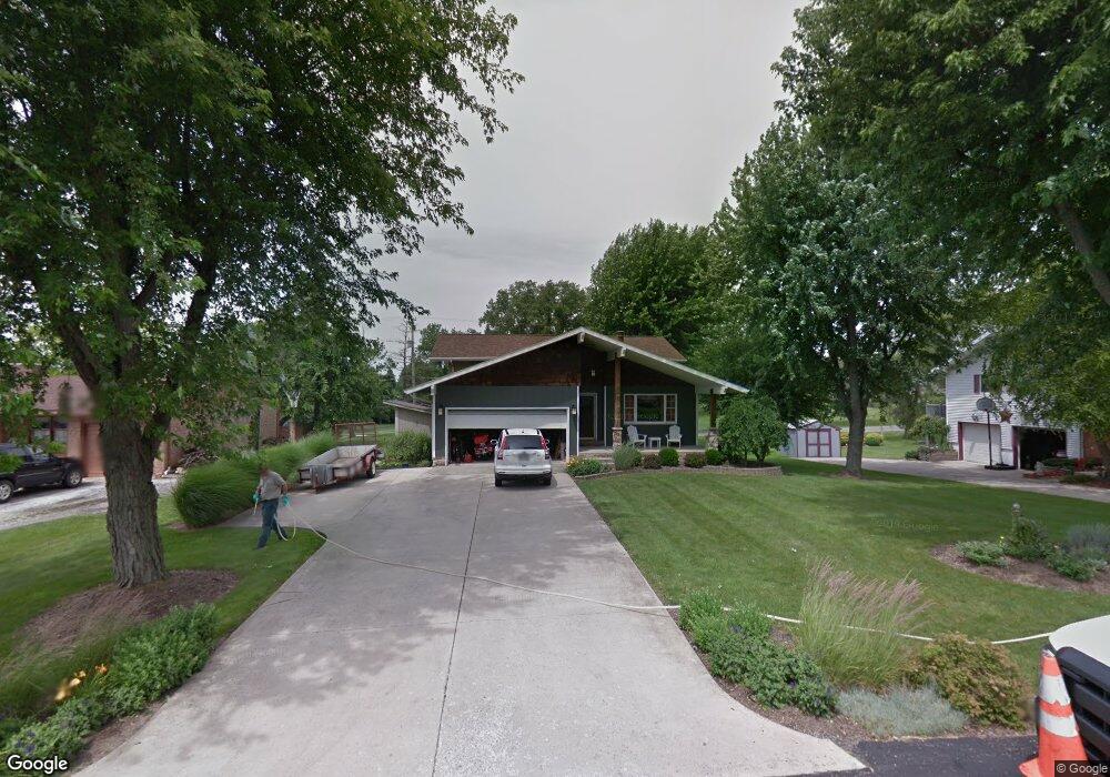
12193 Pamela Dr Kenton, OH 43326
Estimated Value: $266,543 - $335,000
3
Beds
3
Baths
2,165
Sq Ft
$142/Sq Ft
Est. Value
About This Home
This home is located at 12193 Pamela Dr, Kenton, OH 43326 and is currently estimated at $307,886, approximately $142 per square foot. 12193 Pamela Dr is a home located in Hardin County with nearby schools including Kenton Elementary School, Kenton Middle School, and Kenton High School.
Ownership History
Date
Name
Owned For
Owner Type
Purchase Details
Closed on
Feb 28, 2019
Sold by
Harbor Jesse L and Harbor June R
Bought by
Curry Melissa A
Current Estimated Value
Home Financials for this Owner
Home Financials are based on the most recent Mortgage that was taken out on this home.
Original Mortgage
$185,250
Outstanding Balance
$162,866
Interest Rate
4.4%
Mortgage Type
New Conventional
Estimated Equity
$145,020
Purchase Details
Closed on
Jul 21, 2006
Sold by
Stout J Theron and Stout Shana L
Bought by
Harber June R and Harber Jesse L
Home Financials for this Owner
Home Financials are based on the most recent Mortgage that was taken out on this home.
Original Mortgage
$125,600
Interest Rate
6.82%
Mortgage Type
Unknown
Purchase Details
Closed on
Jul 5, 2002
Bought by
Stout Stout J and Stout Shana
Purchase Details
Closed on
Jul 27, 2001
Bought by
Skala Robert G and Skala Patrici
Purchase Details
Closed on
Mar 23, 2001
Bought by
Lucindaco Ltd
Purchase Details
Closed on
Jun 27, 1997
Bought by
Newland Thomas J and Newland Pamel
Create a Home Valuation Report for This Property
The Home Valuation Report is an in-depth analysis detailing your home's value as well as a comparison with similar homes in the area
Home Values in the Area
Average Home Value in this Area
Purchase History
| Date | Buyer | Sale Price | Title Company |
|---|---|---|---|
| Curry Melissa A | $195,000 | None Available | |
| Harber June R | $157,000 | None Available | |
| Stout Stout J | $148,000 | -- | |
| Skala Robert G | $150,000 | -- | |
| Lucindaco Ltd | $155,000 | -- | |
| Newland Thomas J | $128,800 | -- |
Source: Public Records
Mortgage History
| Date | Status | Borrower | Loan Amount |
|---|---|---|---|
| Open | Curry Melissa A | $185,250 | |
| Previous Owner | Harber June R | $125,600 |
Source: Public Records
Tax History Compared to Growth
Tax History
| Year | Tax Paid | Tax Assessment Tax Assessment Total Assessment is a certain percentage of the fair market value that is determined by local assessors to be the total taxable value of land and additions on the property. | Land | Improvement |
|---|---|---|---|---|
| 2024 | $2,858 | $66,490 | $9,920 | $56,570 |
| 2023 | $2,858 | $66,490 | $9,920 | $56,570 |
| 2022 | $2,579 | $55,800 | $4,860 | $50,940 |
| 2021 | $2,589 | $55,800 | $4,860 | $50,940 |
| 2020 | $2,245 | $55,800 | $4,860 | $50,940 |
| 2019 | $1,696 | $44,850 | $4,630 | $40,220 |
| 2018 | $1,724 | $45,570 | $4,630 | $40,940 |
| 2017 | $1,699 | $45,570 | $4,630 | $40,940 |
| 2016 | $1,628 | $45,940 | $4,540 | $41,400 |
| 2015 | $1,602 | $45,940 | $4,540 | $41,400 |
| 2014 | $1,622 | $45,940 | $4,540 | $41,400 |
| 2013 | $1,834 | $49,630 | $4,540 | $45,090 |
Source: Public Records
Map
Nearby Homes
- 11896 Parklane Dr
- 920 Cooper St
- 115 Scioto St
- 1 C Ct
- 79 Broadway St
- 39 Grape St
- 530 E Franklin St
- 510 Decatur St
- 513 E Franklin St
- 508 Decatur St
- 13450 State Route 292
- 509 E Carrol St
- 324 Stone Hedge Ln Unit 324
- 121 S High St
- 104 Oak Ln Unit 15
- 0 N Barron St
- 639 S Main St
- 503 Jennings St
- 727 S Detroit St
- 0 Gilmore St
- 12205 Pamela Dr
- 12173 Pamela Dr
- 12180 Pamela Dr
- 12694 Deborah Dr
- 12160 Pamela Dr
- 12235 Pamela Dr
- 12674 Deborah Dr
- 12270 Pamela Dr
- 12146 Pamela Dr
- 12129 Pamela Dr
- 12257 Pamela Dr
- 12656 Deborah Dr
- 16326 County Road 144
- 12641 Deborah Dr
- 12107 Pamela Dr
- 12306 Pamela Dr
- 12624 Deborah Dr
- 12287 Pamela Dr
- 16362 County Road 144