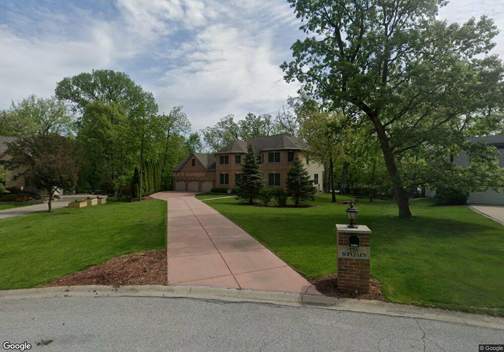
12195 S Williams Ct Crown Point, IN 46307
Estimated Value: $583,000 - $726,000
3
Beds
3
Baths
4,292
Sq Ft
$153/Sq Ft
Est. Value
About This Home
This home is located at 12195 S Williams Ct, Crown Point, IN 46307 and is currently estimated at $657,395, approximately $153 per square foot. 12195 S Williams Ct is a home located in Lake County with nearby schools including Lake Street Elementary School, Robert Taft Middle School, and Crown Point High School.
Ownership History
Date
Name
Owned For
Owner Type
Purchase Details
Closed on
Nov 16, 2022
Sold by
Sopczak Philip
Bought by
Sopczak 2022 Joint Trust
Current Estimated Value
Create a Home Valuation Report for This Property
The Home Valuation Report is an in-depth analysis detailing your home's value as well as a comparison with similar homes in the area
Home Values in the Area
Average Home Value in this Area
Purchase History
| Date | Buyer | Sale Price | Title Company |
|---|---|---|---|
| Sopczak 2022 Joint Trust | -- | -- |
Source: Public Records
Tax History Compared to Growth
Tax History
| Year | Tax Paid | Tax Assessment Tax Assessment Total Assessment is a certain percentage of the fair market value that is determined by local assessors to be the total taxable value of land and additions on the property. | Land | Improvement |
|---|---|---|---|---|
| 2024 | $5,050 | $536,500 | $63,800 | $472,700 |
| 2023 | $4,965 | $506,200 | $63,800 | $442,400 |
| 2022 | $5,314 | $487,500 | $63,800 | $423,700 |
| 2021 | $4,942 | $476,400 | $63,800 | $412,600 |
| 2020 | $5,203 | $475,200 | $63,800 | $411,400 |
| 2019 | $5,110 | $458,600 | $63,800 | $394,800 |
| 2018 | $5,221 | $444,600 | $63,800 | $380,800 |
| 2017 | $5,345 | $449,100 | $63,800 | $385,300 |
| 2016 | $5,406 | $451,200 | $63,800 | $387,400 |
| 2014 | $5,638 | $494,500 | $63,800 | $430,700 |
| 2013 | $5,500 | $483,500 | $63,800 | $419,700 |
Source: Public Records
Map
Nearby Homes
- 4714 W 121st Ave
- 1144 Mary Ellen Dr
- 1156 Donegal Ln
- 1140 Hyde Park
- 3709 W 121st Ave
- 775 Quinlan Ct
- 804 Shannon Dr
- 802 Hayfield Dr
- 12120 Burr St
- 908 Mary Ellen Dr
- 12201 Cedar Lake Rd
- 1575 S Feather Rock Dr
- 11606 Westvalley Dr
- 12812 Whitcomb St
- 12860 Baker Ct
- 11531 Westvalley Dr
- 1002 Gordon Ct
- 12715 Cedar Lake Rd
- 11341 Lakewood St
- The Cottonwood Plan at Golden Meadow
- 12179 S Williams Ct
- 12227 S Williams Ct
- 12188 S Williams Ct
- 12203 White Oak Dr
- 12147 S Williams Ct
- 12121 White Oak Dr
- 4501 W 121st Ave
- 12207 White Oak Dr
- 12152 S Williams Ct
- 12243 S Williams Ct
- 12211 White Oak Dr
- 12129 White Oak Dr
- 4557 W 121st Ave
- 4710 W 122nd Place
- 12125 White Oak Dr
- 12215 White Oak Dr
- 12131 S Williams Ct
- 12136 S Williams Ct
- 4607 W 121st Ave
- 4313 W 121st Ave