Estimated Value: $1,791,313 - $2,498,000
3
Beds
4
Baths
2,120
Sq Ft
$1,026/Sq Ft
Est. Value
About This Home
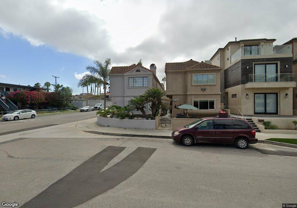
This home is located at 122 12th St, Huntington Beach, CA 92648 and is currently estimated at $2,174,078, approximately $1,025 per square foot. 122 12th St is a home located in Orange County with nearby schools including Agnes L. Smith Elementary, Ethel Dwyer Middle, and Huntington Beach High School.
Ownership History
Date
Name
Owned For
Owner Type
Purchase Details
Closed on
Apr 1, 2003
Sold by
Singh Cynthia
Bought by
Singh Cynthia and Cynthia Singh Revocable Trust
Current Estimated Value
Purchase Details
Closed on
Oct 10, 2002
Sold by
Singh Manmohan
Bought by
Singh Cynthia
Home Financials for this Owner
Home Financials are based on the most recent Mortgage that was taken out on this home.
Original Mortgage
$275,000
Outstanding Balance
$114,701
Interest Rate
6.09%
Estimated Equity
$2,059,377
Purchase Details
Closed on
Mar 17, 1994
Sold by
Boland David C and Boland Patricia E
Bought by
Singh Manmohan and Singh Cynthia
Home Financials for this Owner
Home Financials are based on the most recent Mortgage that was taken out on this home.
Original Mortgage
$315,000
Interest Rate
7%
Create a Home Valuation Report for This Property
The Home Valuation Report is an in-depth analysis detailing your home's value as well as a comparison with similar homes in the area
Home Values in the Area
Average Home Value in this Area
Purchase History
| Date | Buyer | Sale Price | Title Company |
|---|---|---|---|
| Singh Cynthia | -- | -- | |
| Singh Cynthia | -- | Lawyers Title Company | |
| Singh Manmohan | $350,000 | Title Land Company |
Source: Public Records
Mortgage History
| Date | Status | Borrower | Loan Amount |
|---|---|---|---|
| Open | Singh Cynthia | $275,000 | |
| Closed | Singh Manmohan | $315,000 |
Source: Public Records
Tax History Compared to Growth
Tax History
| Year | Tax Paid | Tax Assessment Tax Assessment Total Assessment is a certain percentage of the fair market value that is determined by local assessors to be the total taxable value of land and additions on the property. | Land | Improvement |
|---|---|---|---|---|
| 2025 | $6,822 | $594,882 | $366,601 | $228,281 |
| 2024 | $6,822 | $583,218 | $359,413 | $223,805 |
| 2023 | $6,669 | $571,783 | $352,366 | $219,417 |
| 2022 | $6,494 | $560,572 | $345,457 | $215,115 |
| 2021 | $6,375 | $549,581 | $338,683 | $210,898 |
| 2020 | $6,333 | $543,946 | $335,210 | $208,736 |
| 2019 | $6,259 | $533,281 | $328,637 | $204,644 |
| 2018 | $6,163 | $522,825 | $322,193 | $200,632 |
| 2017 | $6,081 | $512,574 | $315,875 | $196,699 |
| 2016 | $5,814 | $502,524 | $309,681 | $192,843 |
| 2015 | $5,758 | $494,976 | $305,029 | $189,947 |
| 2014 | $5,638 | $485,281 | $299,054 | $186,227 |
Source: Public Records
Map
Nearby Homes
- 116 11th St
- 1102 Pacific Coast Hwy Unit Lot 4
- 221 10th St
- 1111 Olive Ave Unit A & B
- 1200 Pacific Coast Hwy Unit 102
- 1200 Pacific Coast Hwy
- 1200 Pacific Coast Hwy Unit 214
- 228 12th St Unit 1113 Olive Av
- 309 8th St
- 711 Pacific Coast Hwy Unit 303
- 711 Pacific Coast Hwy Unit 330
- 711 Pacific Coast Hwy Unit 206
- 427 10th St
- 319 14th St Unit B
- 1516 Pacific Coast Hwy Unit 101
- 517 Walnut Ave
- 413 14th St Unit D
- 416 15th St
- 526 12th St
- 521 12th St
- 120 12th St
- 116 12th St
- 118 12th St
- 114 12th St
- 112 12th St
- 1101 Walnut Ave
- 113 11th St
- 111 11th St
- 201 11th St
- 203 11th St
- 201 12th St
- 205 11th St
- 210 12th St
- 1120 Pacific Coast Hwy
- 1116 Pacific Coast Hwy
- 1116 Pacific Coast Hwy Unit A
- 1112 Pacific Coast Hwy
- 1110 Pacific Coast Hwy
- 207 11th St
- 212 12th St