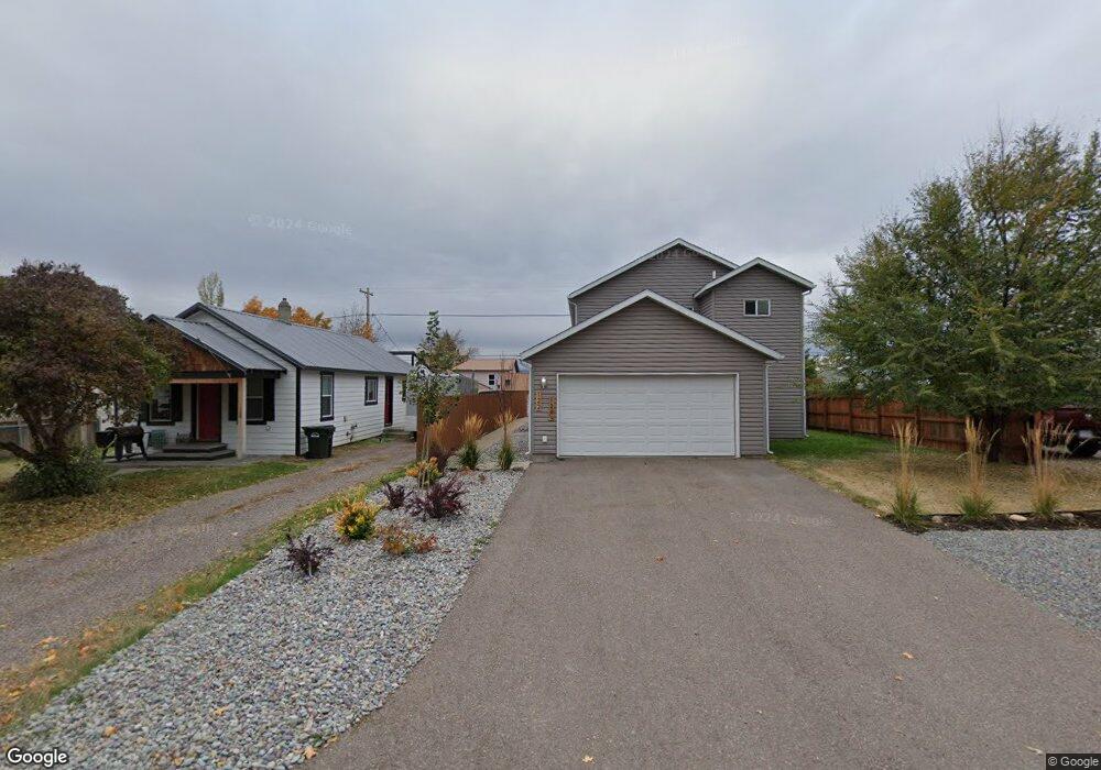
122 3rd Ave W Unit 124 1/2 Columbia Falls, MT 59912
Estimated Value: $464,000 - $517,000
6
Beds
2
Baths
1,166
Sq Ft
$422/Sq Ft
Est. Value
About This Home
This home is located at 122 3rd Ave W Unit 124 1/2, Columbia Falls, MT 59912 and is currently estimated at $492,091, approximately $422 per square foot. 122 3rd Ave W Unit 124 1/2 is a home located in Flathead County with nearby schools including Glacier Gateway Elementary School, Columbia Falls Junior High School (7-8), and Columbia Falls High School.
Ownership History
Date
Name
Owned For
Owner Type
Purchase Details
Closed on
Dec 30, 2022
Sold by
Bertalot Dusty J
Bought by
Glacier Rental Properties Llc
Current Estimated Value
Purchase Details
Closed on
Dec 23, 2021
Sold by
Tade Ronald and Tade Norma Jean
Bought by
Bertalot Dusty J and Bertalot Lissa R
Home Financials for this Owner
Home Financials are based on the most recent Mortgage that was taken out on this home.
Original Mortgage
$321,750
Interest Rate
3.11%
Mortgage Type
New Conventional
Purchase Details
Closed on
Apr 5, 2012
Sold by
Provident Financial Inc
Bought by
Tade Ronald and Tade Norma Jean
Purchase Details
Closed on
Feb 22, 2012
Sold by
Selders Myrl L
Bought by
Provident Financial Inc
Create a Home Valuation Report for This Property
The Home Valuation Report is an in-depth analysis detailing your home's value as well as a comparison with similar homes in the area
Home Values in the Area
Average Home Value in this Area
Purchase History
| Date | Buyer | Sale Price | Title Company |
|---|---|---|---|
| Glacier Rental Properties Llc | -- | -- | |
| Bertalot Dusty J | -- | Insured Titles | |
| Tade Ronald | -- | First American Title Company | |
| Provident Financial Inc | -- | None Available |
Source: Public Records
Mortgage History
| Date | Status | Borrower | Loan Amount |
|---|---|---|---|
| Previous Owner | Bertalot Dusty J | $321,750 |
Source: Public Records
Tax History Compared to Growth
Tax History
| Year | Tax Paid | Tax Assessment Tax Assessment Total Assessment is a certain percentage of the fair market value that is determined by local assessors to be the total taxable value of land and additions on the property. | Land | Improvement |
|---|---|---|---|---|
| 2025 | $2,583 | $533,500 | $0 | $0 |
| 2024 | $3,022 | $429,100 | $0 | $0 |
| 2023 | $3,184 | $429,100 | $0 | $0 |
| 2022 | $2,919 | $273,200 | $0 | $0 |
| 2021 | $2,992 | $273,200 | $0 | $0 |
| 2020 | $2,467 | $203,200 | $0 | $0 |
| 2019 | $2,350 | $203,200 | $0 | $0 |
| 2018 | $2,263 | $187,200 | $0 | $0 |
| 2017 | $2,003 | $187,200 | $0 | $0 |
| 2016 | $20 | $167,100 | $0 | $0 |
| 2015 | $1,993 | $167,100 | $0 | $0 |
| 2014 | $2,174 | $111,035 | $0 | $0 |
Source: Public Records
Map
Nearby Homes
- 221 2nd Ave W
- 540 Nucleus Ave Unit 304
- 540 Nucleus Ave Unit 306
- 324 1st Ave E
- 519 Nucleus Ave Unit Suite 303
- 12 Mitchell Way
- 354 3rd Ave E
- 307 5th St E
- 409 1st Street East N
- 929 9th St W
- 812 4th Ave E
- 830 11th St W
- 1020 3rd Ave E
- 2225 Tamarack Ln
- 9 Cedar Pointe Loop
- 875 River Ave
- 1408 11th St W
- 1201 14th Ave W
- 1605 & 1629 4th Ave W
- 521 Evening Star Ln