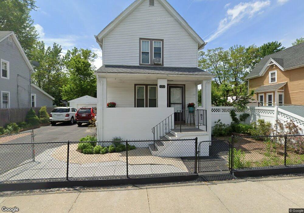
122 Andrew St Springfield, MA 01109
Bay NeighborhoodEstimated Value: $210,000 - $261,000
3
Beds
2
Baths
1,292
Sq Ft
$183/Sq Ft
Est. Value
About This Home
This home is located at 122 Andrew St, Springfield, MA 01109 and is currently estimated at $235,939, approximately $182 per square foot. 122 Andrew St is a home located in Hampden County with nearby schools including Rebecca M Johnson School, John F. Kennedy Academy, and Springfield High School of Science and Technology.
Ownership History
Date
Name
Owned For
Owner Type
Purchase Details
Closed on
Apr 13, 1995
Sold by
Schreiber Karl E and Fraro Daniel A
Bought by
Fox John and Fox Elaine
Current Estimated Value
Home Financials for this Owner
Home Financials are based on the most recent Mortgage that was taken out on this home.
Original Mortgage
$41,500
Interest Rate
8.49%
Mortgage Type
Purchase Money Mortgage
Create a Home Valuation Report for This Property
The Home Valuation Report is an in-depth analysis detailing your home's value as well as a comparison with similar homes in the area
Home Values in the Area
Average Home Value in this Area
Purchase History
| Date | Buyer | Sale Price | Title Company |
|---|---|---|---|
| Fox John | $45,000 | -- |
Source: Public Records
Mortgage History
| Date | Status | Borrower | Loan Amount |
|---|---|---|---|
| Closed | Fox John | $41,500 |
Source: Public Records
Tax History Compared to Growth
Tax History
| Year | Tax Paid | Tax Assessment Tax Assessment Total Assessment is a certain percentage of the fair market value that is determined by local assessors to be the total taxable value of land and additions on the property. | Land | Improvement |
|---|---|---|---|---|
| 2025 | $2,104 | $134,200 | $31,100 | $103,100 |
| 2024 | $1,829 | $113,900 | $31,100 | $82,800 |
| 2023 | $1,819 | $106,700 | $28,300 | $78,400 |
| 2022 | $1,965 | $104,400 | $26,400 | $78,000 |
| 2021 | $1,884 | $99,700 | $24,000 | $75,700 |
| 2020 | $1,724 | $88,300 | $24,000 | $64,300 |
| 2019 | $1,785 | $90,700 | $24,000 | $66,700 |
| 2018 | $1,669 | $84,800 | $24,000 | $60,800 |
| 2017 | $1,451 | $73,800 | $15,000 | $58,800 |
| 2016 | $1,459 | $74,200 | $15,000 | $59,200 |
| 2015 | $1,347 | $68,500 | $15,000 | $53,500 |
Source: Public Records
Map
Nearby Homes
- 81 Hayden Ave
- 93 Dawes St
- 163 Marion St
- 90 Cambridge St
- 52-56 Andrew St
- 65 Montrose St
- 62 Kenyon St
- 15 Kenyon St
- 32 Clifford St
- 50-52 Maynard St
- 18 Sycamore St
- 58 Willard Ave
- 146 Bay St
- 19 Westford Ave
- 22-24 Westminster St
- 107 Dartmouth St
- 107 Thompson St
- 115 Thompson St
- 123 Bay St
- 288 Saint James Ave
- 126 Andrew St
- 116 Andrew St
- 114 Andrew St
- 119 Andrew St
- 123 - 125 Andrew St
- 125 Andrew St
- 111 Andrew St Unit 113
- 100 Andrew St Unit 100
- 98-100 Andrew St
- 98 Andrew St Unit 100
- 99 Andrew St
- 104 Dawes St Unit 106
- 94-96 Andrew St
- 94-96 Andrew St Unit 2
- 94-96 Andrew St Unit 1
- 94 Andrew St Unit 96
- 98 Dawes St
- 117 Dawes St
- 18 Burr St
- 75 Mcknight St