M
Seller's Agent in 2026
Matthew Mandeville
eXp Realty LLC
(401) 787-3757
3 in this area
137 Total Sales
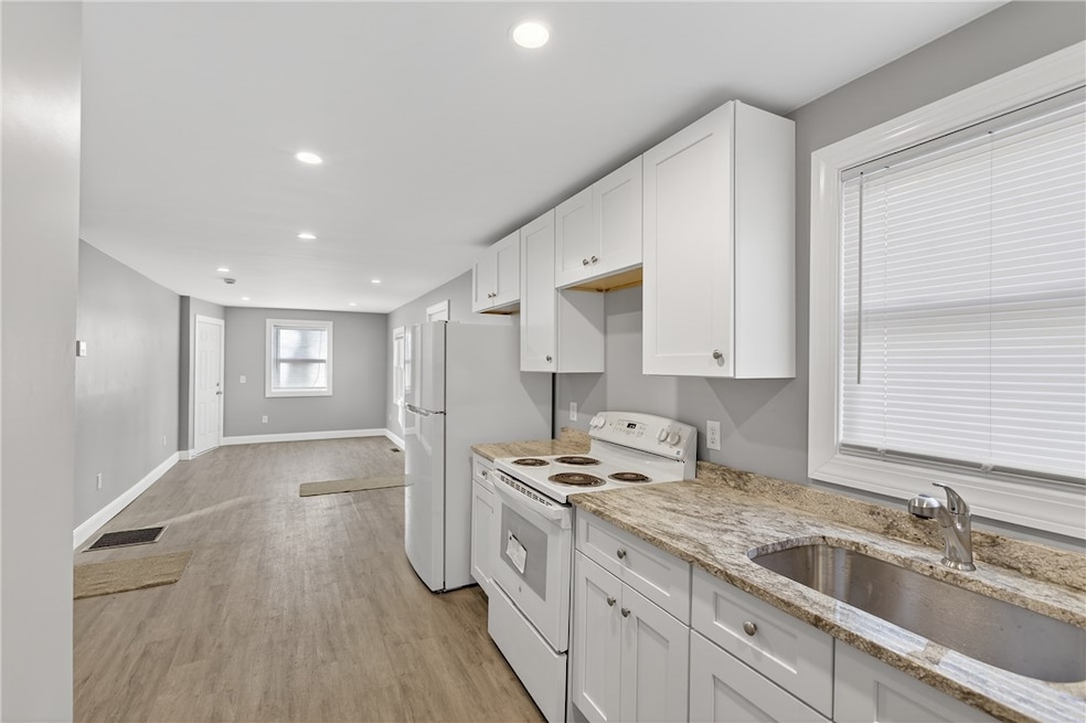
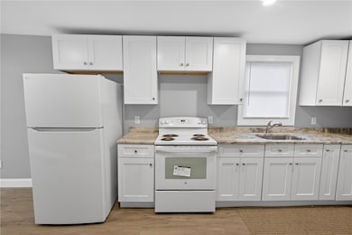
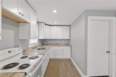
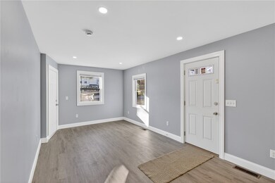
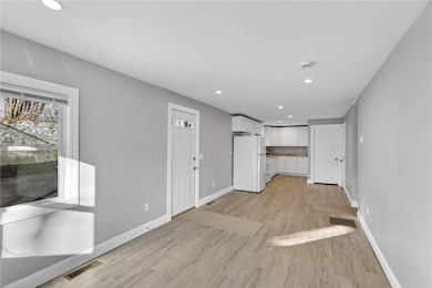
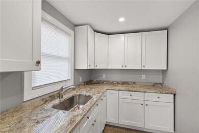
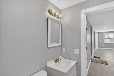
Welcome to 122 Brookside Ave in West Warwick a fully renovated, top-to-bottom rebuilt 3-family that delivers modern living, strong rental potential, and true long-term peace of mind. This impressive property features two spacious 2-bedroom units and one beautifully updated 1-bedroom unit, each finished with brand-new vinyl flooring, fully renovated kitchens with new cabinetry and countertops, and sleek, modern bathrooms. Every major component has been replaced, including all-new central air and central heat for each unit, three new hot water tanks, new vinyl siding, and updated mechanicals throughout, giving the next owner the rare benefit of a true turn-key investment. Even better, the home comes with three lead certificates, offering huge value, compliance, and security for owners and tenants alike. The exterior is just as impressive, featuring a hard-to-find 4-car attached garage that opens the door for additional rental income or storage opportunities, along with plenty of off-street parking. With every inch of this property thoughtfully renovated and built for durability, 122 Brookside Ave stands out as one of the strongest multifamily opportunities in West Warwick, perfect for owner-occupants or investors seeking a low-maintenance, cash-flowing asset. Schedule a tour today and experience 122 Brookside Ave for yourself!
Last Agent to Sell the Property
eXp Realty LLC License #RES.0047223 Listed on: 12/05/2025

| Date | Type | Sale Price | Title Company |
|---|---|---|---|
| Warranty Deed | $640,000 | -- | |
| Warranty Deed | $640,000 | -- | |
| Quit Claim Deed | -- | -- | |
| Quit Claim Deed | -- | -- | |
| Warranty Deed | $240,000 | None Available | |
| Warranty Deed | $240,000 | None Available | |
| Warranty Deed | $240,000 | None Available | |
| Warranty Deed | $240,000 | None Available | |
| Deed | $183,000 | -- | |
| Deed | $183,000 | -- |
| Date | Status | Loan Amount | Loan Type |
|---|---|---|---|
| Open | $480,000 | New Conventional | |
| Closed | $480,000 | New Conventional | |
| Previous Owner | $504,000 | Purchase Money Mortgage | |
| Previous Owner | $430,000 | Purchase Money Mortgage |
| Date | Event | Price | List to Sale | Price per Sq Ft |
|---|---|---|---|---|
| 01/16/2026 01/16/26 | Sold | $640,000 | -5.2% | $320 / Sq Ft |
| 12/30/2025 12/30/25 | Pending | -- | -- | -- |
| 12/05/2025 12/05/25 | For Sale | $675,000 | -- | $338 / Sq Ft |
| Year | Tax Paid | Tax Assessment Tax Assessment Total Assessment is a certain percentage of the fair market value that is determined by local assessors to be the total taxable value of land and additions on the property. | Land | Improvement |
|---|---|---|---|---|
| 2025 | $5,781 | $378,100 | $83,800 | $294,300 |
| 2024 | $4,188 | $204,600 | $53,200 | $151,400 |
| 2023 | $4,106 | $204,600 | $53,200 | $151,400 |
| 2022 | $4,041 | $204,600 | $53,200 | $151,400 |
| 2021 | $5,494 | $183,800 | $43,700 | $140,100 |
| 2020 | $5,494 | $183,800 | $43,700 | $140,100 |
| 2019 | $5,389 | $183,800 | $43,700 | $140,100 |
| 2018 | $5,496 | $140,200 | $41,100 | $99,100 |
| 2017 | $5,321 | $140,200 | $41,100 | $99,100 |
| 2016 | $5,225 | $140,200 | $41,100 | $99,100 |
| 2015 | $4,677 | $125,500 | $41,100 | $84,400 |
| 2014 | $4,574 | $125,500 | $41,100 | $84,400 |
M
Seller's Agent in 2026
Matthew Mandeville
eXp Realty LLC
(401) 787-3757
3 in this area
137 Total Sales
Buyer's Agent in 2026
Benjamin R. Frink
eXp Realty LLC
(401) 200-4884
1 in this area
11 Total Sales
Source: State-Wide MLS
MLS Number: 1401299
APN: WWAR-000006-000043-000000
Disclaimer: Certain information contained herein is derived from information provided by parties other than Homes.com. All information provided is deemed reliable, but is not guaranteed to be accurate and should be independently verified.
![]() IDX information is provided exclusively for personal, non-commercial use, and may not be used for any purpose other than to identify prospective properties consumers may be interested in purchasing. Information is deemed reliable but not guaranteed.
IDX information is provided exclusively for personal, non-commercial use, and may not be used for any purpose other than to identify prospective properties consumers may be interested in purchasing. Information is deemed reliable but not guaranteed.
Copyright © 2026 State-Wide MLS, Inc. All rights reserved.
Ask me questions while you tour the home.