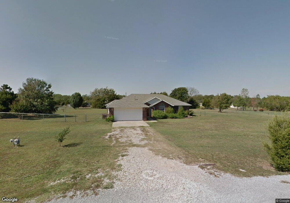
122 Camaron Dr Shawnee, OK 74804
Estimated Value: $264,646 - $292,000
3
Beds
2
Baths
1,946
Sq Ft
$142/Sq Ft
Est. Value
About This Home
This home is located at 122 Camaron Dr, Shawnee, OK 74804 and is currently estimated at $276,912, approximately $142 per square foot. 122 Camaron Dr is a home located in Pottawatomie County.
Ownership History
Date
Name
Owned For
Owner Type
Purchase Details
Closed on
Dec 27, 2018
Sold by
Shepard David
Bought by
Creacy Tammy J and Creacy Jason
Current Estimated Value
Home Financials for this Owner
Home Financials are based on the most recent Mortgage that was taken out on this home.
Original Mortgage
$153,174
Outstanding Balance
$136,288
Interest Rate
5.5%
Mortgage Type
FHA
Estimated Equity
$140,624
Purchase Details
Closed on
Jun 18, 2018
Sold by
Shepard Elizabeth
Bought by
Shepard David
Purchase Details
Closed on
Mar 9, 2018
Sold by
Shepard David
Bought by
Shepard David and Shepard Elizabeth
Purchase Details
Closed on
Apr 13, 2017
Sold by
Shepard David
Bought by
Shepard David and Dhepad Elizabeth
Purchase Details
Closed on
Jun 5, 2000
Sold by
King Alan and King Connie
Bought by
Wallace Kathy
Purchase Details
Closed on
Mar 10, 1999
Sold by
Snider Clint and Snider Betty
Bought by
King Alan and King Connie
Create a Home Valuation Report for This Property
The Home Valuation Report is an in-depth analysis detailing your home's value as well as a comparison with similar homes in the area
Purchase History
| Date | Buyer | Sale Price | Title Company |
|---|---|---|---|
| Creacy Tammy J | $156,000 | Choice Title Insurance | |
| Shepard David | -- | None Available | |
| Shepard David | -- | None Available | |
| Shepard David | -- | None Available | |
| Wallace Kathy | $105,000 | -- | |
| King Alan | $83,000 | -- |
Source: Public Records
Mortgage History
| Date | Status | Borrower | Loan Amount |
|---|---|---|---|
| Open | Creacy Tammy J | $153,174 |
Source: Public Records
Tax History
| Year | Tax Paid | Tax Assessment Tax Assessment Total Assessment is a certain percentage of the fair market value that is determined by local assessors to be the total taxable value of land and additions on the property. | Land | Improvement |
|---|---|---|---|---|
| 2025 | $2,108 | $18,846 | $1,200 | $17,646 |
| 2024 | $2,060 | $17,949 | $1,200 | $16,749 |
| 2023 | $2,060 | $17,949 | $1,200 | $16,749 |
| 2022 | $2,035 | $17,949 | $1,200 | $16,749 |
| 2021 | $2,097 | $17,949 | $1,200 | $16,749 |
| 2020 | $2,155 | $18,172 | $1,200 | $16,972 |
| 2019 | $2,192 | $18,619 | $1,200 | $17,419 |
| 2018 | $2,163 | $20,004 | $1,200 | $18,804 |
| 2017 | $2,102 | $19,421 | $1,200 | $18,221 |
| 2016 | $1,681 | $18,855 | $1,200 | $17,655 |
| 2015 | $1,626 | $18,306 | $1,200 | $17,106 |
| 2014 | $1,576 | $17,773 | $1,200 | $16,573 |
Source: Public Records
Map
Nearby Homes
- 110 Cuyler Dr
- 0 Mockingbird Ln
- 213 Hope Ave
- 219 Hope Ave
- 7110 Brangus Rd
- 43289 Garrett's Lake Rd
- 43249 Garrett's Lake Rd
- 5707 Earl Dr
- 5604 Gemini
- 42829 Garrett's Lake Rd
- 42773 Garrett's Lake Rd
- 5505 Capricorn
- 8888 Arthur Rd
- 7777 Arthur Rd
- 42904 Westech Rd Unit 42904 + 42906
- 23 Lake Ln
- 17 Rustic Oak Dr
- 43304 Belle Brook Cir
- 43147 Prairie Ranch Rd
- 43153 Prairie Ranch Rd
- 114 Camaron Dr
- 115 Camaron Dr
- 113 Camaron Dr
- 116 Camaron Dr
- 112 Camaron Dr
- 111 Camaron Dr
- 118 Camaron Dr
- 106 Cuyler Dr
- 117 Camaron Dr
- 112 Cuyler Dr
- 110 Camaron Dr
- 115 Castle Rock Ln
- 109 Camaron Dr
- 114 Cuyler Dr
- 120 Camaron Dr
- 119 Camaron Dr
- 108 Cuyler Dr
- 109 Castle Rock Ln
- 0 Castle Rock Ln
- 109 Cuyler Dr
Your Personal Tour Guide
Ask me questions while you tour the home.