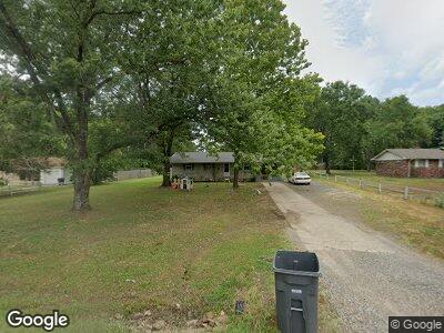
122 Carter Dr Searcy, AR 72143
Estimated Value: $116,000 - $137,000
--
Bed
1
Bath
1,248
Sq Ft
$97/Sq Ft
Est. Value
About This Home
This home is located at 122 Carter Dr, Searcy, AR 72143 and is currently estimated at $121,286, approximately $97 per square foot. 122 Carter Dr is a home located in White County with nearby schools including Westside Elementary School, Southwest Middle School, and Ahlf Junior High School.
Ownership History
Date
Name
Owned For
Owner Type
Purchase Details
Closed on
Jul 9, 2014
Sold by
Pope Ariel C and Pope Lisa
Bought by
Andras Rocky and Sheldon Wendy
Current Estimated Value
Home Financials for this Owner
Home Financials are based on the most recent Mortgage that was taken out on this home.
Original Mortgage
$62,000
Outstanding Balance
$48,212
Interest Rate
4.18%
Mortgage Type
New Conventional
Estimated Equity
$75,018
Purchase Details
Closed on
Aug 1, 1983
Bought by
Pope James A and Pope Marion
Create a Home Valuation Report for This Property
The Home Valuation Report is an in-depth analysis detailing your home's value as well as a comparison with similar homes in the area
Home Values in the Area
Average Home Value in this Area
Purchase History
| Date | Buyer | Sale Price | Title Company |
|---|---|---|---|
| Andras Rocky | $62,000 | Dalco Closing & Title | |
| Pope James A | $28,000 | -- |
Source: Public Records
Mortgage History
| Date | Status | Borrower | Loan Amount |
|---|---|---|---|
| Open | Andras Rocky | $62,000 |
Source: Public Records
Tax History Compared to Growth
Tax History
| Year | Tax Paid | Tax Assessment Tax Assessment Total Assessment is a certain percentage of the fair market value that is determined by local assessors to be the total taxable value of land and additions on the property. | Land | Improvement |
|---|---|---|---|---|
| 2024 | $426 | $10,710 | $1,170 | $9,540 |
| 2023 | $408 | $10,710 | $1,170 | $9,540 |
| 2022 | $15 | $10,710 | $1,170 | $9,540 |
| 2021 | $373 | $10,710 | $1,170 | $9,540 |
| 2020 | $355 | $8,250 | $350 | $7,900 |
| 2019 | $355 | $8,250 | $350 | $7,900 |
| 2018 | $5 | $8,250 | $350 | $7,900 |
| 2017 | $355 | $8,250 | $350 | $7,900 |
| 2016 | $355 | $8,250 | $350 | $7,900 |
| 2015 | $354 | $8,230 | $1,200 | $7,030 |
| 2014 | $354 | $8,230 | $1,200 | $7,030 |
Source: Public Records
Map
Nearby Homes
- 2624 Dominion Dr
- 2620 Dominion Dr
- 2612 Dominion Dr
- 3117 Stonehenge Dr
- 3206 Saddlebrook Dr
- 505 Wycliffe Dr
- 604 Samuel Loyce Dr
- 614 Adamson Dr
- 906 Abby Ln
- 921 Kelburn
- 82 Country Club Cir
- 112 Ranchette Village Rd
- 904 Brisbane
- 2723 Dominion Dr
- 2705 Dominion Dr
- 921 Brisbane
- 915 Brisbane
- 911 Brisbane
- 907 Brisbane
- 104 Courtney Cove
- 122 Carter Dr
- 122 Carter Dr
- 124 Carter Dr
- 124 Carter Dr
- 120 Carter Dr
- 125 Carter Dr
- 5952 Highway 13
- 114 Carter Dr
- 121 Carter Dr
- 127 Carter Dr
- 0 Carter Dr
- 115 Carter Dr
- 129 Carter Dr
- 134 Carter Dr
- 104 Carter Dr
- 111 Carter Dr
- 133 Carter Dr
- 0 Honeyhill Rd (Hwy 13) Unit 19023214
- 108 Brookhaven Rd
- 104 Brookhaven Rd