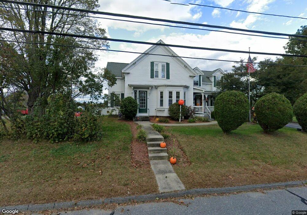
122 Clinton Rd Sterling, MA 01564
Estimated Value: $535,000 - $629,000
2
Beds
2
Baths
2,419
Sq Ft
$247/Sq Ft
Est. Value
About This Home
This home is located at 122 Clinton Rd, Sterling, MA 01564 and is currently estimated at $596,750, approximately $246 per square foot. 122 Clinton Rd is a home located in Worcester County with nearby schools including Wachusett Regional High School and South Lancaster Academy.
Ownership History
Date
Name
Owned For
Owner Type
Purchase Details
Closed on
May 10, 2021
Sold by
Lowe Charles Kevin Est
Bought by
Lowe Christine A
Current Estimated Value
Purchase Details
Closed on
Dec 31, 1976
Bought by
Lowe Chas Kevin
Create a Home Valuation Report for This Property
The Home Valuation Report is an in-depth analysis detailing your home's value as well as a comparison with similar homes in the area
Home Values in the Area
Average Home Value in this Area
Purchase History
| Date | Buyer | Sale Price | Title Company |
|---|---|---|---|
| Lowe Christine A | -- | None Available | |
| Lowe Chas Kevin | -- | -- |
Source: Public Records
Mortgage History
| Date | Status | Borrower | Loan Amount |
|---|---|---|---|
| Previous Owner | Lowe Chas Kevin | $22,000 | |
| Previous Owner | Lowe Chas Kevin | $25,000 | |
| Previous Owner | Lowe Chas Kevin | $58,000 | |
| Previous Owner | Lowe Chas Kevin | $32,941 |
Source: Public Records
Tax History Compared to Growth
Tax History
| Year | Tax Paid | Tax Assessment Tax Assessment Total Assessment is a certain percentage of the fair market value that is determined by local assessors to be the total taxable value of land and additions on the property. | Land | Improvement |
|---|---|---|---|---|
| 2025 | $6,431 | $499,300 | $144,300 | $355,000 |
| 2024 | $5,990 | $450,000 | $144,100 | $305,900 |
| 2023 | $6,025 | $421,300 | $146,400 | $274,900 |
| 2022 | $5,453 | $357,600 | $125,900 | $231,700 |
| 2021 | $5,612 | $339,700 | $123,500 | $216,200 |
| 2020 | $5,262 | $313,000 | $120,900 | $192,100 |
| 2019 | $5,050 | $292,400 | $120,900 | $171,500 |
| 2018 | $5,043 | $287,500 | $119,400 | $168,100 |
| 2017 | $4,773 | $264,700 | $114,700 | $150,000 |
| 2016 | $4,641 | $253,200 | $114,600 | $138,600 |
| 2015 | $4,125 | $238,600 | $120,200 | $118,400 |
| 2014 | $4,039 | $238,600 | $120,200 | $118,400 |
Source: Public Records
Map
Nearby Homes
- 96 Clinton Rd
- 28 Sandy Ridge Rd
- 0 Brockelman Rd Unit 73424117
- 121 &125 Flanagan Hill Rd
- 2 Stuart Rd
- 4 Redstone Hill Rd
- 6 Ashton Ln
- 45 Meetinghouse Hill Rd
- 41 Meetinghouse Hill Rd
- 25 North Row
- 5 Leo's Way Unit 1
- 7 Leo's Way Unit 1
- 45 Kendall Hill Rd
- 54 S Meadow Rd
- 765 Brockelman Road Lot C
- 271 Sterling St
- 765 Brockelman Rd
- 5 Pine Woods Ln
- 17 Taft Rd
- 25 N Row Rd
- 124 Clinton Rd
- 125 Clinton Rd
- 116 Clinton Rd
- 9 Albright Rd
- 126 Clinton Rd
- 2 Albright Rd
- 11 Albright Rd
- 110 Clinton Rd
- 115 Clinton Rd
- 4 Albright Rd
- 108 Clinton Rd
- 8 Albright Rd
- 106 Clinton Rd
- 111 Clinton Rd Unit 111
- 109 Clinton Rd Unit 1
- 109 Clinton Rd
- 111 Clinton Rd
- 141 Clinton Rd
- 202 Pratts Junction Rd
- 6 Albright Rd