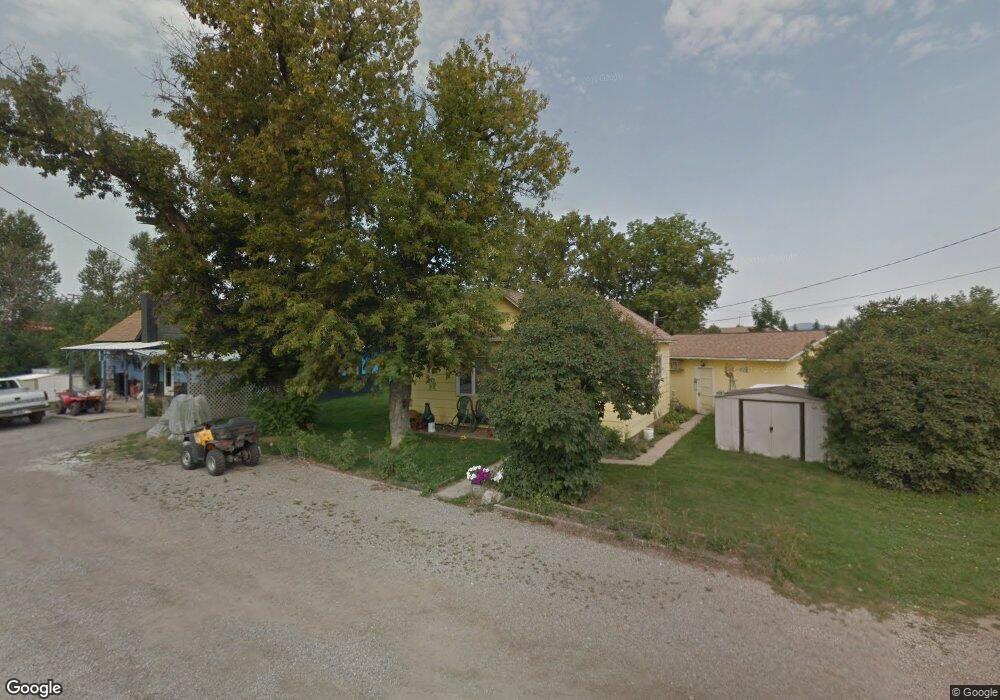
122 E Corcoran St Lewistown, MT 59457
Estimated Value: $147,000 - $228,000
2
Beds
1
Bath
924
Sq Ft
$185/Sq Ft
Est. Value
About This Home
This home is located at 122 E Corcoran St, Lewistown, MT 59457 and is currently estimated at $171,224, approximately $185 per square foot. 122 E Corcoran St is a home located in Fergus County with nearby schools including Fergus High School.
Ownership History
Date
Name
Owned For
Owner Type
Purchase Details
Closed on
Nov 24, 2025
Sold by
Lamb Shaun E and Lamb Cristi A
Bought by
Ddt Rentals Llc
Current Estimated Value
Home Financials for this Owner
Home Financials are based on the most recent Mortgage that was taken out on this home.
Original Mortgage
$383,607
Outstanding Balance
$383,607
Interest Rate
5.53%
Mortgage Type
Credit Line Revolving
Estimated Equity
-$212,383
Purchase Details
Closed on
Feb 1, 2022
Sold by
Kriesel Bonnie L
Bought by
Lamb Shaun E and Lamb Cristi A
Purchase Details
Closed on
Oct 22, 2018
Bought by
Kriesel Bonnie L
Home Financials for this Owner
Home Financials are based on the most recent Mortgage that was taken out on this home.
Original Mortgage
$106,400
Interest Rate
4.5%
Mortgage Type
FHA
Create a Home Valuation Report for This Property
The Home Valuation Report is an in-depth analysis detailing your home's value as well as a comparison with similar homes in the area
Home Values in the Area
Average Home Value in this Area
Purchase History
| Date | Buyer | Sale Price | Title Company |
|---|---|---|---|
| Ddt Rentals Llc | -- | Flying S Title And Escrow | |
| Lamb Shaun E | -- | New Title Company Name | |
| Kriesel Bonnie L | -- | -- |
Source: Public Records
Mortgage History
| Date | Status | Borrower | Loan Amount |
|---|---|---|---|
| Open | Ddt Rentals Llc | $383,607 | |
| Previous Owner | Kriesel Bonnie L | $106,400 |
Source: Public Records
Tax History Compared to Growth
Tax History
| Year | Tax Paid | Tax Assessment Tax Assessment Total Assessment is a certain percentage of the fair market value that is determined by local assessors to be the total taxable value of land and additions on the property. | Land | Improvement |
|---|---|---|---|---|
| 2025 | $1,333 | $147,900 | $0 | $0 |
| 2024 | $1,535 | $112,900 | $0 | $0 |
| 2023 | $1,520 | $111,000 | $0 | $0 |
| 2022 | $1,206 | $65,685 | $0 | $0 |
| 2021 | $759 | $65,685 | $0 | $0 |
| 2020 | $1,073 | $61,310 | $0 | $0 |
| 2019 | $1,067 | $61,310 | $0 | $0 |
| 2018 | $811 | $57,900 | $0 | $0 |
| 2017 | $653 | $57,900 | $0 | $0 |
| 2016 | $789 | $57,700 | $0 | $0 |
| 2015 | $642 | $57,700 | $0 | $0 |
| 2014 | $597 | $30,104 | $0 | $0 |
Source: Public Records
Map
Nearby Homes
- 514 2nd Ave N
- 316 W Corcoran St
- 313 W Idaho St
- 318 W Evelyn St
- 628 Mountain View Dr
- 632 Mountain View Dr
- 412 W Huron St
- 701 E Montana St
- 307 E Janeaux St
- 210 S High St
- 1014 Mountain View Dr
- 624 W Broadway St
- 115 7th Ave N
- TBD Truck Bypass
- 35 acres Truck Bypass
- NHN Truck Bypass
- 401 7th Ave S
- 105 Hillcrest Dr
- 506 Brassey St
- 1011 W Broadway St
- 118 E Corcoran St
- 714 N Dawes St
- 121 E Corcoran St
- 623 1st Ave N
- 115 E Corcoran St
- 615 N Dawes St
- 117 E Corcoran St
- 205 E Corcoran St
- 802 N Dawes St
- 112 E Crowley Ave
- 803 N Dawes St
- 117 Us Highway 191
- 813 N Dawes St
- 15 Us Highway 191
- 607 N Dawes St
- 505 N Dawes St
- 815 N Dawes St
- 112 W Evelyn St
- 105 E Montana St
- 602 N High St