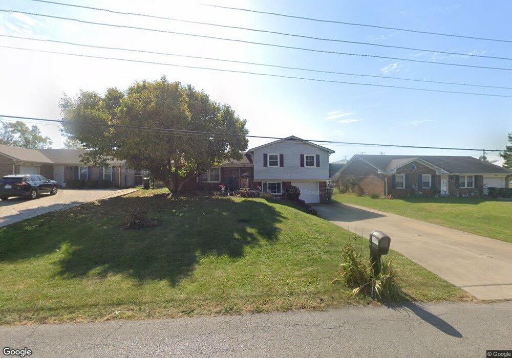
122 E Showalter Dr Georgetown, KY 40324
Mount Vernon NeighborhoodEstimated Value: $243,000 - $311,000
3
Beds
1
Bath
1,404
Sq Ft
$186/Sq Ft
Est. Value
About This Home
This home is located at 122 E Showalter Dr, Georgetown, KY 40324 and is currently estimated at $261,763, approximately $186 per square foot. 122 E Showalter Dr is a home located in Scott County with nearby schools including Southern Elementary School, Georgetown Middle School, and Scott County High School.
Ownership History
Date
Name
Owned For
Owner Type
Purchase Details
Closed on
Dec 4, 2020
Sold by
Barber Antonio and Barber Katelyn
Bought by
Roberts Jacob and Roberts Ruth Casey
Current Estimated Value
Home Financials for this Owner
Home Financials are based on the most recent Mortgage that was taken out on this home.
Original Mortgage
$193,939
Outstanding Balance
$171,393
Interest Rate
2.8%
Mortgage Type
New Conventional
Estimated Equity
$90,370
Create a Home Valuation Report for This Property
The Home Valuation Report is an in-depth analysis detailing your home's value as well as a comparison with similar homes in the area
Home Values in the Area
Average Home Value in this Area
Purchase History
| Date | Buyer | Sale Price | Title Company |
|---|---|---|---|
| Roberts Jacob | $188,000 | Title Suppliers |
Source: Public Records
Mortgage History
| Date | Status | Borrower | Loan Amount |
|---|---|---|---|
| Open | Roberts Jacob | $193,939 |
Source: Public Records
Tax History
| Year | Tax Paid | Tax Assessment Tax Assessment Total Assessment is a certain percentage of the fair market value that is determined by local assessors to be the total taxable value of land and additions on the property. | Land | Improvement |
|---|---|---|---|---|
| 2025 | $2,138 | $240,000 | $0 | $0 |
| 2024 | $1,725 | $191,800 | $0 | $0 |
| 2023 | $1,676 | $184,800 | $32,000 | $152,800 |
| 2022 | $1,440 | $169,400 | $25,000 | $144,400 |
| 2021 | $1,441 | $153,000 | $25,000 | $128,000 |
| 2020 | $1,203 | $140,000 | $25,000 | $115,000 |
| 2019 | $1,173 | $134,400 | $0 | $0 |
| 2018 | $1,055 | $121,564 | $0 | $0 |
| 2017 | $1,060 | $121,564 | $0 | $0 |
| 2016 | $933 | $115,900 | $0 | $0 |
| 2015 | $927 | $115,900 | $0 | $0 |
| 2014 | $961 | $115,948 | $0 | $0 |
| 2011 | $72 | $115,948 | $0 | $0 |
Source: Public Records
Map
Nearby Homes
- 139 E Showalter Dr
- 104 Bronte Place
- 305 Yorktown Ct
- 107 Oconner Ct
- 1336 Dorchester Dr
- 1117 Pawnee Trail
- 1026 Parkside Dr
- 206 Hiawatha Trail
- 199 Hawthorne Dr
- 106 Ransom Trace
- 115 Victor Place
- 633 Military St
- 113 Walden Cove Unit 3I
- 103 Crescent Way
- 101 Crescent Way
- 107 Crescent Way
- 129 Compass Trail
- 109 Crescent Way
- 124 Compass Trail
- 128 Compass Trail
- 124 E Showalter Dr
- 120 E Showalter Dr
- 100 Market Path
- 126 E Showalter Dr
- 128 E Showalter Dr
- 121 E Showalter Dr
- 123 E Showalter Dr
- 119 E Showalter Dr
- 111 Potomac Ct
- 125 E Showalter Dr
- 117 E Showalter Dr
- 109 Potomac Ct
- 127 E Showalter Dr
- 130 E Showalter Dr
- 115 E Showalter Dr
- 129 E Showalter Dr
- 113 Potomac Ct
- 132 E Showalter Dr
- 107 Potomac Ct
- 113 E Showalter Dr
Your Personal Tour Guide
Ask me questions while you tour the home.