Estimated Value: $236,000 - $281,000
4
Beds
2
Baths
2,056
Sq Ft
$123/Sq Ft
Est. Value
About This Home
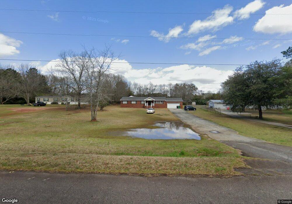
This home is located at 122 Fox Run Dr, Perry, GA 31069 and is currently estimated at $252,557, approximately $122 per square foot. 122 Fox Run Dr is a home located in Houston County with nearby schools including Langston Road Elementary School, Mossy Creek Middle School, and Perry High School.
Ownership History
Date
Name
Owned For
Owner Type
Purchase Details
Closed on
Feb 25, 2019
Sold by
Jackson Robert
Bought by
Jackson Jacqueline
Current Estimated Value
Purchase Details
Closed on
Jan 5, 2010
Sold by
Bender Daniel R
Bought by
State Bank & Trust Company
Purchase Details
Closed on
Nov 2, 1990
Sold by
Richardson Ruby Lee
Bought by
Jackson Robert and Jackson Jacqueline
Purchase Details
Closed on
Jun 9, 1986
Sold by
Phillips Vernon L
Bought by
Richardson Ruby Lee
Purchase Details
Closed on
Nov 30, 1984
Sold by
Broome Stanley D
Bought by
Phillips Vernon L
Purchase Details
Closed on
Apr 3, 1984
Bought by
Broome Stanley D
Create a Home Valuation Report for This Property
The Home Valuation Report is an in-depth analysis detailing your home's value as well as a comparison with similar homes in the area
Home Values in the Area
Average Home Value in this Area
Purchase History
| Date | Buyer | Sale Price | Title Company |
|---|---|---|---|
| Jackson Jacqueline | -- | None Available | |
| State Bank & Trust Company | $42,400 | None Available | |
| Jackson Robert | -- | -- | |
| Richardson Ruby Lee | -- | -- | |
| Phillips Vernon L | -- | -- | |
| Broome Stanley D | -- | -- |
Source: Public Records
Tax History Compared to Growth
Tax History
| Year | Tax Paid | Tax Assessment Tax Assessment Total Assessment is a certain percentage of the fair market value that is determined by local assessors to be the total taxable value of land and additions on the property. | Land | Improvement |
|---|---|---|---|---|
| 2024 | $1,245 | $54,040 | $8,160 | $45,880 |
| 2023 | $1,054 | $45,600 | $8,160 | $37,440 |
| 2022 | $970 | $42,120 | $8,160 | $33,960 |
| 2021 | $894 | $38,800 | $8,160 | $30,640 |
| 2020 | $871 | $37,680 | $8,160 | $29,520 |
| 2019 | $871 | $37,680 | $8,160 | $29,520 |
| 2018 | $871 | $37,680 | $8,160 | $29,520 |
| 2017 | $872 | $37,680 | $8,160 | $29,520 |
| 2016 | $873 | $37,680 | $8,160 | $29,520 |
| 2015 | $875 | $37,680 | $8,160 | $29,520 |
| 2014 | -- | $37,680 | $8,160 | $29,520 |
| 2013 | -- | $37,680 | $8,160 | $29,520 |
Source: Public Records
Map
Nearby Homes
- 204 Chimney Rock Rd
- 124 Lake Lillian Dr
- 309 Bermuda Ridge
- 502 Arons Ct
- 2360 U S 41
- 0 Hwy 41 & Langston Rd Unit M170042
- 161 Overton Dr
- 149 MacK Thompson Road Common
- 220 Overton Dr
- Savannah Plan at Bankstone Landing
- Newport Plan at Bankstone Landing
- Delaware Plan at Bankstone Landing
- 0 MacK Thompson Rd Unit 253661
- 150 MacK Thompson Rd
- 219 Overton Dr
- 0 Langston Rd Unit 16828609
- 103 Breakwater Way
- 107 Breakwater Way
- 111 Breakwater Way
- 118 Bramblewood Way